Classroom Materials
The following lists educational resources such as lesson plans and fun activities about New Jersey’s geology for teachers, students of all ages, or anyone in remote learning. These resources are available for purchase or free download as indicated in the below.
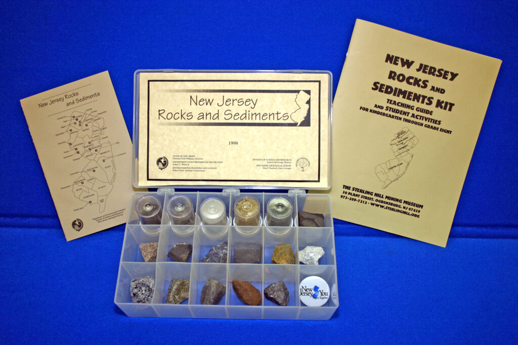
The NJ Rocks and Sediments Kit consists of seventeen representative New Jersey rock and sediment samples. Representative samples include 2 igneous rocks (diabase and basalt), 4 metamorphic rocks (slate, quartzite, marble, and gneiss), 4 sedimentary rocks (shale, sandstone, limestone, and dolomite), 5 sediments (peat, clay, glass sand, lime sand, and greensand), and 2 ores (ironstone and magnetite). Rock samples average 1-1/2 x 1-1/2 inches. Sediments are in plastic containers 1-1/2 x 1-1/2 inches. This kit also includes a 20 page booklet which describes samples, gives definitions of major rock types, provides a geologic time scale and lists many New Jersey museums, mineral and fossil collecting clubs, and other sources of information for teachers, students, and parents. Also provides a page-size color geologic map of the state (8-1/2 x 11 inch map). A New Jersey Rocks and Sediments Kit Teaching Guide that includes student activities for Kindergarten through Grade Eight from the Sterling Hill Mine Museum are also available.
![]() The following virtual field trips utilize Google Earth Pro as a tool to teach students about some New Jersey provinces. Trip downloads include .kmz files and activities based on the virtual tours:
The following virtual field trips utilize Google Earth Pro as a tool to teach students about some New Jersey provinces. Trip downloads include .kmz files and activities based on the virtual tours:
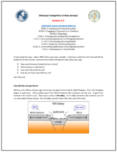 Dinosaur Foot Prints (Grades K-5 and Grades 6-8)
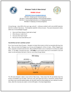
A long, long time ago – about 200 million years ago, actually – a dinosaur walked in soft mud and left its footprints in New Jersey! Someone found these footprints only a few years ago.
• How could dinosaur footprints last so long?
• What dinosaur made them?
• How were the prints found?
• How do we know how old they are?
This Earth Science lesson plan answers these questions and is for use in grades K-5 and grades 6-8.
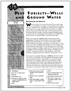 Deep Subjects – Wells and Ground Water (Grades 3-6)
Ground water is the primary drinking water source for half of the state’s population. A system of more than 100 aquifers are scattered throughout New Jersey, covering 7,500 miles. Aquifer recharge areas are locations where rainwater and other precipitation seep into the earth’s surface to enter an aquifer. Currently, groundwater recharge areas of the state’s major aquifers are being identified by the New Jersey Geological and Water Survey. In order to sustain groundwater supplies, these areas should not be paved over without providing mitigation, and pollution should be prevented or minimized.
Developed by the New England Interstate Water Pollution Control Commission, this Earth Science lesson plan includes New Jersey-specific content information for use in grades 3-6.
 Where Does Water Run Off After School? (Grades 6-12)
Geology is very important in making wise land use and management decisions. For example, the groundwater recharge areas of the state’s major aquifers are currently being identified by the New Jersey Geological and Water Survey. In order to sustain ground water supplies, these areas should not be paved over without providing mitigation, and pollution should be prevented or minimized.
Co-Sponsored by the Western Regional Environmental Education Council, Inc. and the Wester Association of Fish and Wildlife Agencies, this Earth Science lesson plan includes New Jersey-specific content information for use in grades 6-12.
 Not-So-Boring Geology (Grades 9-12)
Geologists have a choice of methods to use when they want to see what is underground. Borehole geophysical logging is the process of viewing, collecting, analyzing, and interpreting the data from boreholes. Borehole geophysics is the study of geologic (rock) and hydrologic (water) information of the shallow earth. Boreholes provide a way to view rock, water, and other materials, as well as physically obtain samples.
There are numerous tools that scientists can use to obtain information from boreholes. In this exercise, students will learn about different kinds of tools used in borehole geophysical logging, what they do, and what information they provide. Then students will “read” real geophysical logs and put together what they have learned by answering some questions.
This Earth Science lesson plan is for use in grades 9-12.
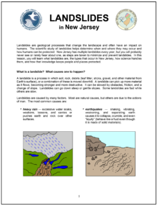 Landslides in New Jersey (Grades 9-12)
Landslides are geological processes that change the landscape and often have an impact on humans. The scientific study of landslides helps determine when and where they may occur and how humans can be protected. New Jersey has multiple landslides every year, but you will probably never see or rarely hear about one, as steps are taken to minimize and prevent landslides. In this lesson, students will learn what landslides are, the types that occur in New Jersey, how science handles them, and how that knowledge keeps people and places protected.
This Earth Science lesson plan includes New Jersey-specific information for use in grades 9-12.
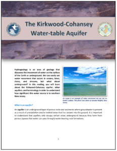 The Kirkwood-Cohansey Water-table Aquifer (Grades 9-12)
Hydrogeology is an area of geology that discusses the movement of water on the surface of the Earth or underground. We can easily see water movement that occurs in oceans, lakes, rivers, and streams, but what about underground? In this reading, students will learn about the Kirkwood-Cohansey aquifer, other aquifers, and terminology in order to understand how significant this water source is to southern New Jersey.
This Earth Science lesson plan includes New Jersey-specific information for use in grades 9-12.
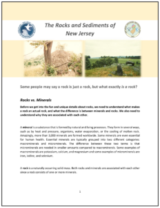 The Rocks and Sediments of New Jersey (Grades 9-12)
Some people may say a rock is just a rock, but what exactly is a rock? This Earth Science lesson plan teaches the difference between rocks vs. minerals, discusses the three main rock types, and talks about specific rocks and sediments that can be found in New Jersey.
This earth science lesson plan was developed for grades 9-12.
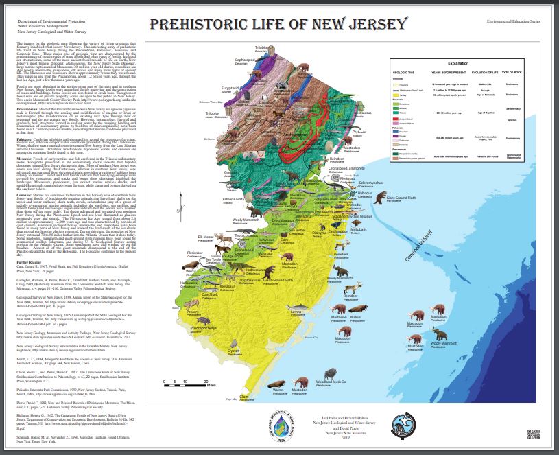
This map illustrates a variety of living creatures that formerly inhabited what is now New Jersey. This interesting array of prehistoric life lived in New Jersey during the Precambrian, Paleozoic, Mesozoic and Cenozoic Eras. These major eras of geologic time are characterized by the predominance of certain types of trace fossils and other types of fossils. Included are stromatolites, some of the most ancient fossil records of life on Earth, New Jersey’s most famous dinosaur, Hadrosaurus, the New Jersey State Dinosaur, large marine reptiles called Mosasaurs, 30-million-year-old sharks, crocodiles, Ice Age woolly mammoths, mastodons, elk moose and many more types of ancient life. The likenesses and fossils are shown approximately where they were found. They range in age from the Precambrian, about 1.2 billion years ago, through the last Ice Age, just a few thousand years ago.
This 2012 map is authored by Pallis, Ted, Dalton, Richard, and Parris, David and is at an approximate scale of 1:507,000. A power point presentation based on this map is available.
A hard copy of this map can be purchased for $10.