
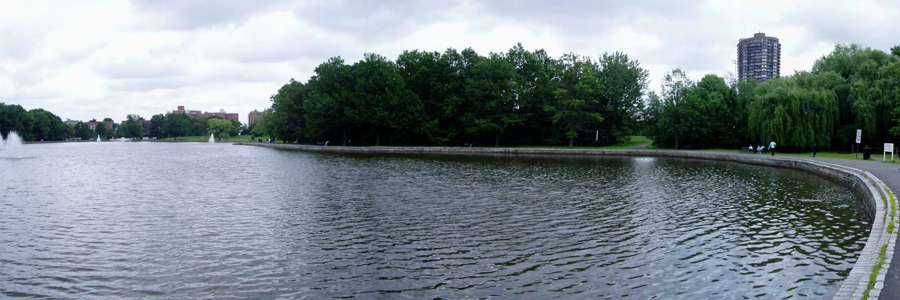
Lake Monitoring
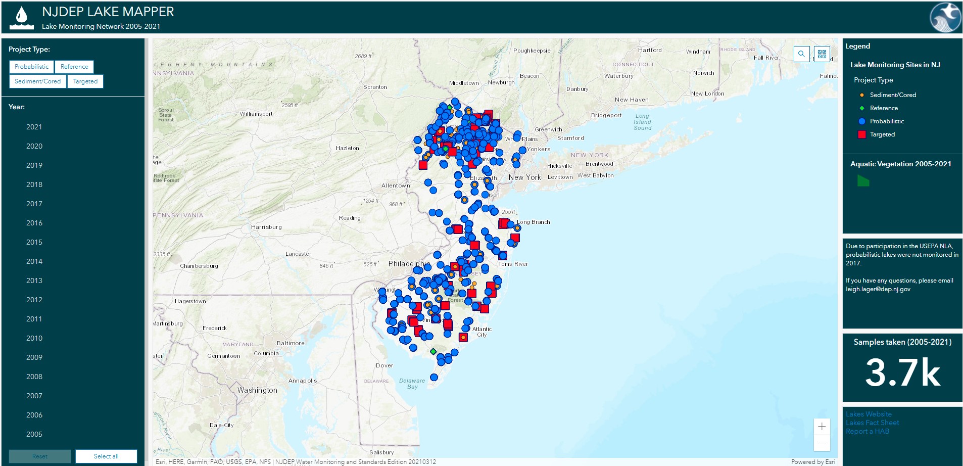
BFBM’s Lake Mapper! The Lake Mapper shows all lakes monitored along with water quality data (as available) and other lake-specific information. If you have any feedback on this interactive mapping application, please email leigh.lager@dep.nj.gov
In 2005, the Bureau reinstituted its ambient Lake Monitoring Network to provide the water quality data necessary to assess the ecological health of the State’s lentic water resource. This program currently includes regionally targeted, statewide reference, and randomly selected lakes(statistical design) from the State’s 1700 lakes and ponds. The water quality measurements conducted at each lake includes parameters such as dissolved oxygen, pH, nutrients, and chlorophyll a. Data assists New Jersey in determining the status and trends in lake water quality needed to meet NJDEP’s Clean Water Act requirements and our Total Maximum Daily Load (TMDL) related water quality assessments.
The lake Monitoring Network addresses the deficiencies cited in the 1999 USEPA’s Office of Inspector General’s Audit Report, needs of the watershed management program and provides data for the Integrated Water Quality Assessment Report {305(b)/303(d)}. This approach comports with the guidance provided in USEPA’s publication “Elements of a State Water Monitoring and Assessment Program” (March 2003), which requires that states develop and implement long-term strategies that include monitoring of all State waterbody types including lakes.
The Bureau of Freshwater and Biological Monitoring performs ambient lake monitoring in addition to Harmful Algal Bloom (HAB) sampling. For other lake inquiries, see below:
- Swimming Beaches – Please contact the health department of the municipality or county where the beach is located. If swimming beach is in a state park, please contact the state park directly.
- Aquatic Pesticide Permitting – Please contact the Bureau of Pesticide Compliance and Enforcement at 609-984-6513
- Dams – Please contact the Bureau of Dam Safety & Flood Control at 609-984-0859
- Lake Lowering Permits – Please contact the Division of Fish and Wildlife, Bureau of Freshwater Fisheries at 908-236-2118
- Lake Dredging & Restoration – Please contact the Office of Engineering and Construction at 609-292-9236
- Lakes Stormwater Management Grants – Please contact the Division of Watershed & Land Management at 609-777-0454
Below is a list of the Lake Monitoring Networks administered by the Bureau of Freshwater & Biological Monitoring. Click on each program to learn more.
Statewide Statistical Survey
 In 2015, New Jersey employed a statewide statistical survey that enabled the use of a randomly selected portion of NJ lakes to extrapolate the overall conditions of lakes in NJ. This data is collected to evaluate the trophic state of selected lakes and assess the ecological health of the State's lentic water resources. Lakes are monitored to develop baseline, status and trend information for New Jersey lakes.

 To achieve a comprehensive dataset, the survey lakes are sampled 4 times per year for 2 years from March through November. In addition to providing a statewide statistical estimate of NJ lake conditions, the data allows for the eventual assessment of each individual lake sampled for use in the integrated water quality assessment required under Sections 303(d) and 305(b) of the federal Clean Water Act. Each year, a new set of 12 or 13 lakes (alternating) are monitored. After 8 years, 50 lakes provide data for a statewide assessment of lakes. Lakes are monitored at several in-lake monitoring stations for a variety of physical and chemical parameters, as listed below.
-
- Field parameters are analyzed immediately on-site and include dissolved oxygen, temperature, pH, conductivity, chlorophyll a, phycocyanin and turbidity
-
- General and nutrient laboratory parameters (e.g. Alkalinity, Phosphorus, Chlorophyll a)
-
- Secchi depth, habitat assessment, bathymetry mapping (where feasible)
-
- Harmful algal bloom screening
Regional Monitoring
 In 2014, DEP employed a rotating regional approach to integrated water quality assessment required under Sections 303(d) and 305(b) of the federal Clean Water Act. Through this approach, the Bureau of Environmental Analysis, Restoration and Standards produces a robust assessment of environmental conditions affecting water quality in each water region. This Regional Comprehensive Assessment incorporates one of five water regions (Atlantic Coastal, Lower Delaware, Northwest, Raritan and Northeast) during each Integrated Report cycle. The rotating basin approach results in a comprehensive assessment of the entire state every 10 years. This approach encourages development of measures to restore, maintain and enhance water quality uses that maximize effectiveness and efficiency in achieving positive environmental outcomes that are tailored to the unique circumstances of each region. The Lake Regional Monitoring Network was established in 2015 to support this approach.

Beginning in 2024, monitoring will be conducted in the Lower Delaware Water Region for a period of 2 years.
 To achieve a comprehensive dataset, the targeted lakes are sampled 4 times per year for 2 years from March through November. This sampling allows for characterization of each lake and contributes to the integrated water quality assessment required under Sections 303(d) and 305(b) of the federal Clean Water Act. Sampling regions are then rotated resulting in a complete assessment of the entire State every 10 years. Lakes are monitored at several in-lake monitoring stations for a variety of physical and chemical parameters, as listed below.
- Field parameters are analyzed immediately on-site and include dissolved oxygen, temperature, pH, conductivity, chlorophyll a, phycocyanin and turbidity
- General and nutrient laboratory parameters (e.g. Alkalinity, Phosphorus, Chlorophyll a)
- Secchi depth, habitat assessment, bathymetry mapping (where feasible)
- Harmful algal bloom screening
Reference Monitoring
 Reference lake data documents baseline information on minimally-impacted lake water quality, ecological integrity, and the trophic state
of lakes within each ecoregion. Reference lakes are monitored every year and can be used to measure variations and trends resulting from climate change and land use. Data is also compared to disturbed lakes within the same ecoregion to gauge the degree of impairment. Reference data also serves to inform criteria development, specifically nutrients, to determine criteria that are attainable, appropriate for the ecoregion and adequate to control nutrient enrichment.
Reference lake data documents baseline information on minimally-impacted lake water quality, ecological integrity, and the trophic state
of lakes within each ecoregion. Reference lakes are monitored every year and can be used to measure variations and trends resulting from climate change and land use. Data is also compared to disturbed lakes within the same ecoregion to gauge the degree of impairment. Reference data also serves to inform criteria development, specifically nutrients, to determine criteria that are attainable, appropriate for the ecoregion and adequate to control nutrient enrichment.
In 2015, 8 lakes were selected for the Reference Lake network. These lakes have been monitored at varying frequencies each year through 2019. In 2020, no sampling was performed. Beginning in 2021, these lakes were sampled once between July and August to capture peak growing season. In 2024, Deer Park Pond was eliminated from the network due to multiple access issues. A minimum of one monitoring event during this timeframe will be performed annually.
 Beginning in 2021, monitoring for this network is conducted once during the growing season between July and August. The lakes are monitored at multiple in-lake monitoring stations for a variety of physical and chemical parameters, as listed below.
-
- Field parameters are analyzed immediately on-site and include dissolved oxygen, temperature, pH, conductivity, chlorophyll a, phycocyanin and turbidity
-
- General and nutrient laboratory parameters (e.g. Alkalinity, Phosphorus, Chlorophyll a)
-
- Secchi depth, habitat assessment, bathymetry mapping (where feasible)
-
- Harmful algal bloom screening
Lake Regional Monitoring Network

BFBM worked with the EPA in the Mid-Atlantic Region to establish a Regional Monitoring Network (RMN). Data collected from Lake RMN sites records conditions at high quality sites and tracks changes over time. This data provides important information on whether benchmarks are shifting over time and whether these changes are associated with changing thermal and hydrologic conditions. RMN data from high quality sites can also be used for the Clean Water Act Section 305(b) assessments as well as 303(d) Program.
Click the above map for sampling locations
The NJ Reference Lake Monitoring Network was selected to serve as the Lake Regional Monitoring Network sites. These waterbodies, shorelines and watersheds are protected by NJDEP State Parks and Forests, Fish and Wildlife and/or conservation non-profit-managed lands so there is low potential for future disturbance.
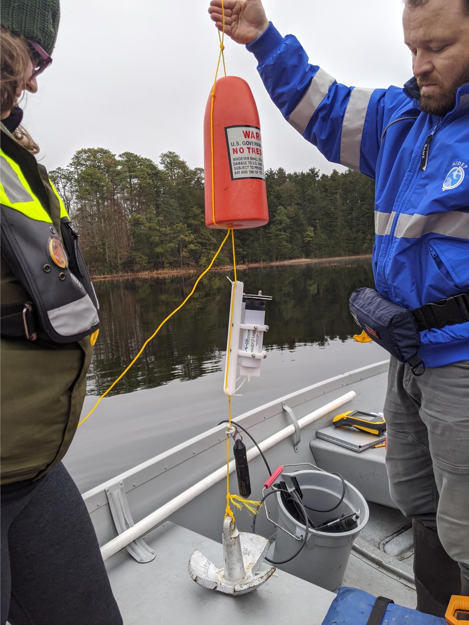
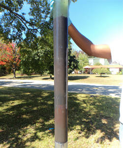
Continuous monitoring of air/water temperature/pressure, dissolved oxygen (DO) and water level measurements are collected at Hands Millpond, Mashipacong Pond and Mount Misery Lake, as resources permit. Water temperature is the highest priority parameter, followed by DO, then water level. These sensors are being deployed year-round or seasonally, depending on the type of installation and logistical constraints. Water sensors are installed on a vertical profile sensor array. The arrays are assembled by installing sensors, at fixed depths, on a line that is vertically suspended by a buoy and attached to the lake bottom using an anchor system.
Continuous monitoring data will be published to the NJDEP DWM&S Continuous Data Monitoring Program, as resources permit.
In addition, BFBM and the State Park Service partnered with the Lake Observations by Citizen Scientist and Satellites (LOCSS) project to easily measure lake level. Staff gauges were installed by LOCSS project personnel at select Lake RMN sites to understand how the quantity of water in lakes is changing. This provides BFBM with accurate lake level measurements while onsite and allowing citizen scientist to assist with data collection.
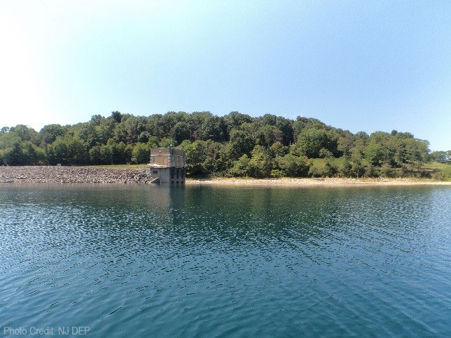
Round Valley Reservoir Monitoring
Project Objectives:
- Annual monitoring at Round Valley Reservoir was initiated in 2001.
- Monitoring at the Round Valley Reservoir is conducted to fulfill the statutory requirements included in Assembly Bill No. A2793 amending R.S. 58:4-1, which was passed by the New Jersey Legislature on May 4th 2001. In it, the statute states,
"... the Commissioner of Environmental Protection shall provide for the continuous monitoring of the impacts associated with releasing water from the Round Valley reservoir for the purpose of sustaining water recreational activities at the Spruce Run reservoir."
- The BFBM’s sampling efforts at the reservoir aim to monitor potential water quality effects, in particular nutrients, that the release of Round Valley water may have on the Spruce Run Reservoir.

Click the above map and choose the
Other Networks/Projects tab
Project Design:
The current monitoring design for this project includes five sampling locations within Round Valley Reservoir and one sampling location on South Branch Raritan River upstream of New Jersey Water Supply Authority’s intake pond.

Sampling Frequency and Parameters:
- Samples are collected once per year, during the summer, at all six in-reservoir stations as well as the intake pond (if New Jersey Water Supply Authority begins pumping water into Round Valley Reservoir).
- Parameters for Round Valley sampling include field parameters which are analyzed on-site (e.g., dissolved oxygen, pH) and conventional/nutrient parameters (e.g., phosphorus, total suspended solids). Click the button below for a complete list of parameters.
- Additional samples are collected as needed or as conditions warrant (e.g. additional, pumping, drought).
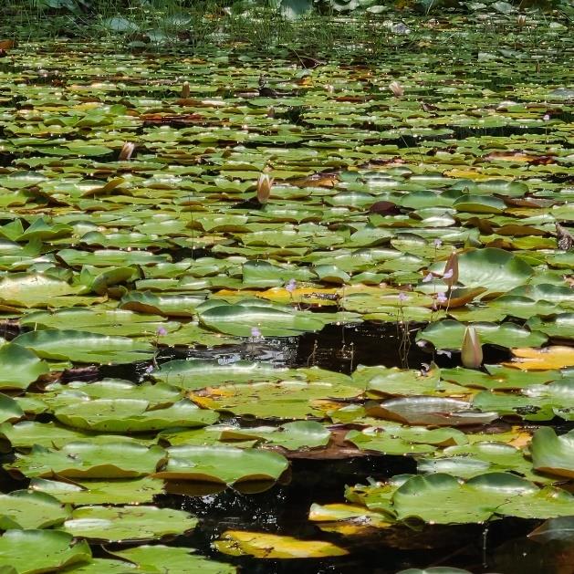
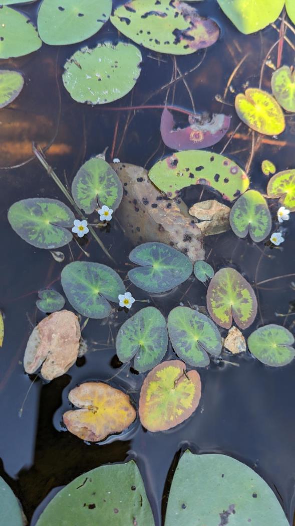
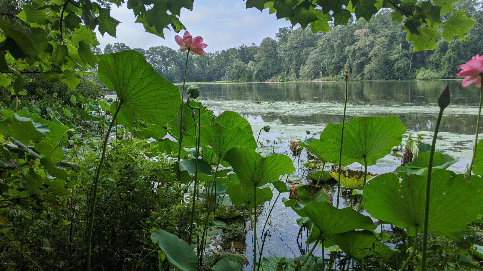
Aquatic Vegetation Surveys
Project Objectives:
The project aims to gather baseline data on the aquatic macrophyte community, focusing on the distribution, occurrence, and trends over time to better understand their impact on New Jersey's aquatic ecosystems. It seeks to support the Aquatic Invasive Species (AIS) Management Plan by sharing information on invasive species with the NJ Aquatic Invasive Species Coordinator. Additionally, the project will document any rare, threatened, endangered, or nonnative species to help protect water resources and species at risk. This information will aid in future mitigation and restoration planning, may be used in the future to evaluate the effectiveness of invasive plant control methods, and enhance the Lake Monitoring Network by providing detailed data on aquatic vegetation acreage.
Network:
Great Gorge Lake, Watchu Pond, Green Turtle Lake, Silver Lake, Mount Misery Lake, Hands Mill Pond and Mashipacong Lake were selected due to their previous and current monitoring as part the NJ Reference Lake Monitoring Network. These waterbodies, shorelines and watersheds are protected by NJDEP State Parks and Forests, Fish and Wildlife and/or conservation non-profit-managed lands so there is low potential for future disturbance.
Sampling:
Aquatic plant abundances are evaluated using a modified hand-rake with the adapted point-intercept method from the US Army Corps of Engineers. These aquatic vegetation surveys offer a snapshot of the species present at a specific time. Conducted annually from the end of July to the end of September, the surveys aim to capture the complete growth of the aquatic plant assemblage, which is most abundant during this period.
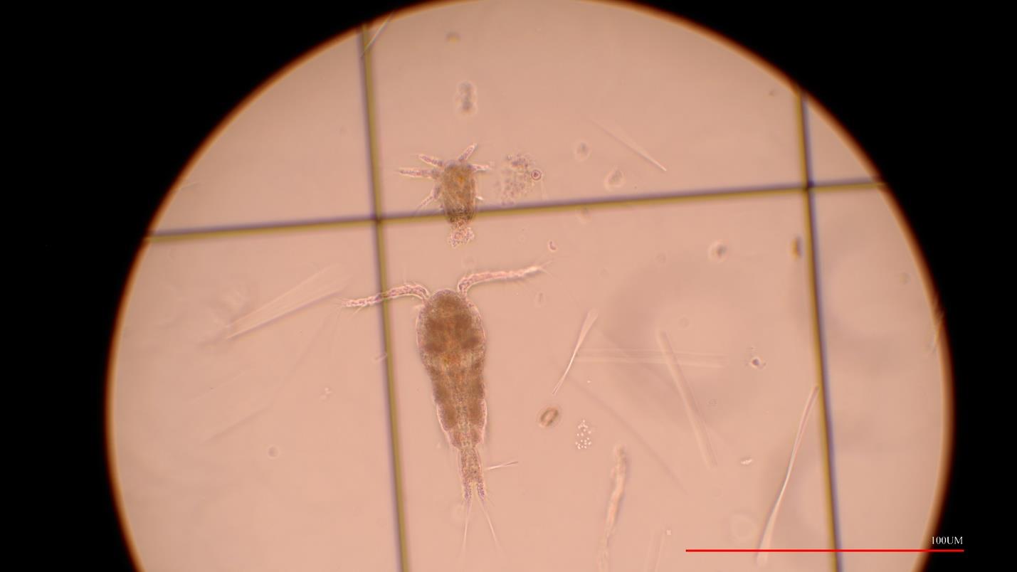
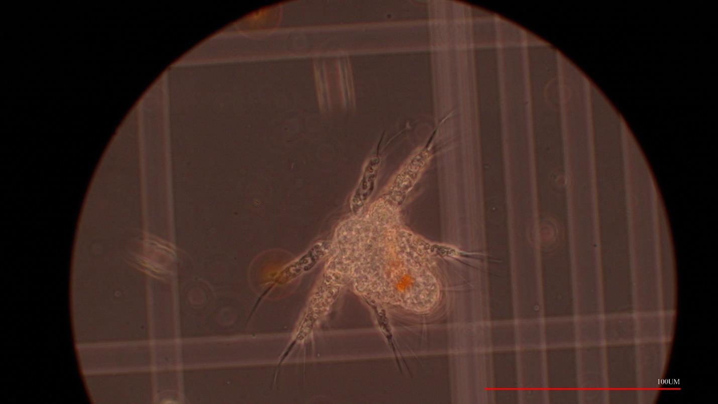
Zooplankton Monitoring
Objective:
The objective of the project is to enhance the Lake Monitoring Network Program by integrating research-driven monitoring focused on the zooplankton community, which has been a missing component since the program's inception in 2005. By identifying and enumerating zooplankton assemblages, the project aims to characterize their composition and abundance across a specified list of lakes. Establishing a baseline of spatial and seasonal patterns will help identify changes or trends in the zooplankton community, providing crucial insight into trophic interactions and ecosystem health. This baseline data will support future evaluations, model applications, and analyses of how zooplankton relates to water quality and responds to environmental changes, offering a more comprehensive understanding of freshwater ecosystems.
Network:
Ancora Pond, Stephen Lake, Delaware Lake, East Brunswick Comm. Park Lake, Eagle Lake, Weequahic Lake, Gropp Lake, Almonesson Lake, Silver Lake, Mt Misery Lake, Great George Lake, Hands Mill Pond, Mashipacong Pond, Watchu Pond, Green Turtle Lake, Terrace Pond, Surprise Lake and Quick Pond.
Sampling:
Utilizing the National Lakes Assessment (NLA) zooplankton protocols to collect samples across NJ. Samples are preserved in the field and brought back to BFBM’s laboratory for further identification and enumeration of assemblages.
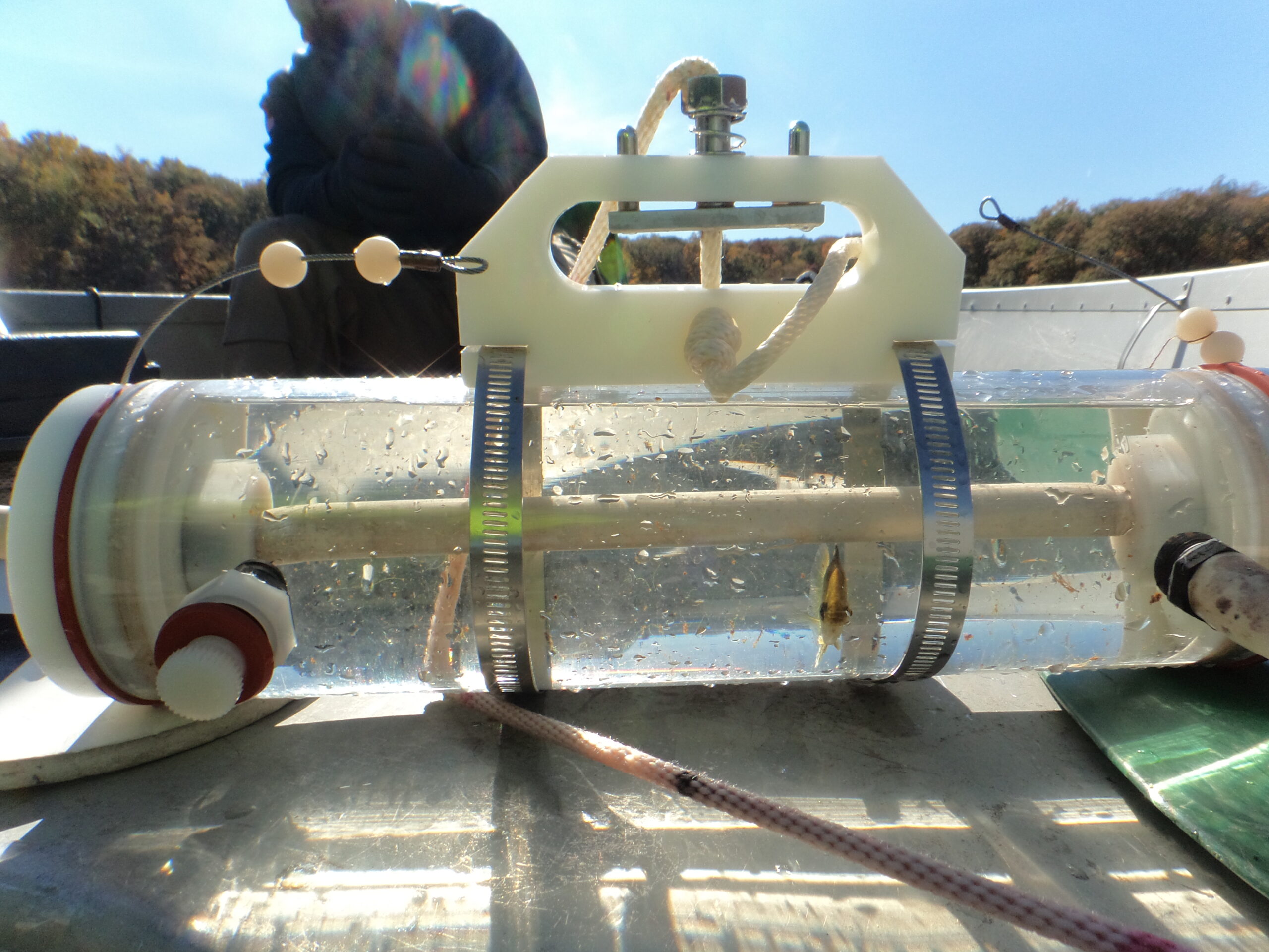
To properly characterize the chemical and physical parameters of a lake, multiple stations that account for the morphometry of the lake and incoming streams are established. Once a station is established, water chemistry and physical parameters of the water column are measured. Depending on the total depth, water is collected via horizontal sampler for laboratory analysis. Two types of samples are collected:
(1) total (non-filtered) samples that contain suspended materials from the water column. Certain constituents can adhere to or be transported by suspended sediment and/or particulates.(2) dissolved (filtered) samples are samples that have had particulates removed. Dissolved components tend to be more biologically available and mobile and thus are more susceptible to uptake by fish and other aquatic organisms.
The physical habitat (PHab) characterization method was utilized by the USEPA as part of the National Lakes Assessment (NLA). BFBM employed this method beginning in 2013 as supplemental data to support assessments of lake water quality. The PHab survey estimates, measures and observes various conditions in the littoral and riparian habitat along lake shorelines. PHab surveys were performed through 2021 and will continue as needed and resources allow.
More information can be found on the U.S. EPA website (https://www.epa.gov/national-aquatic-resource-surveys/nla).
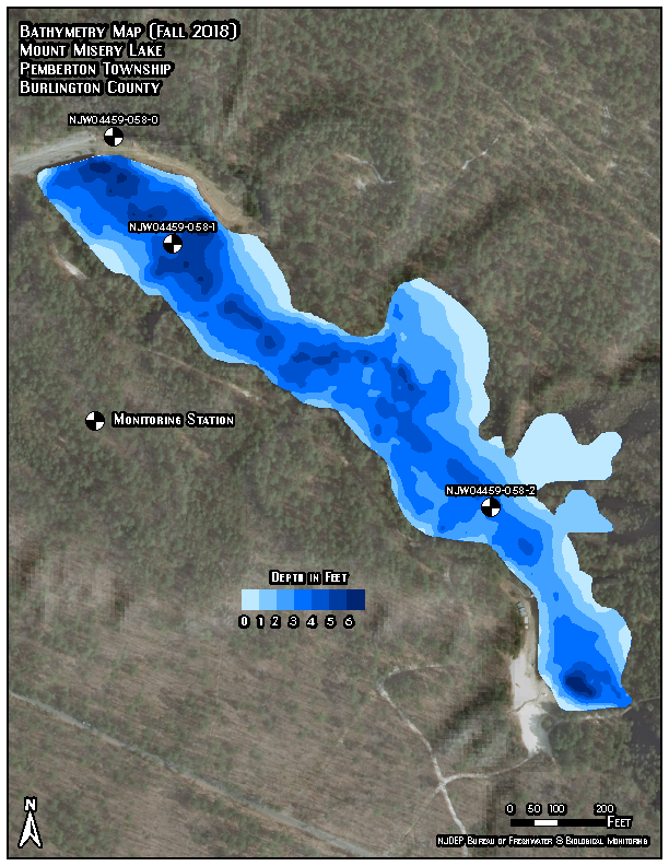
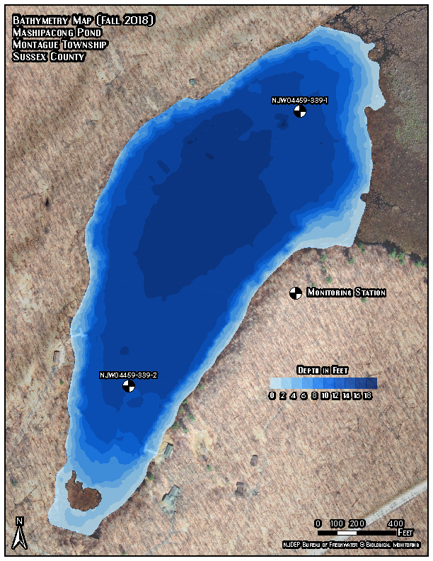
Bathymetric surveying produces a detailed map of a waterbody’s depth and subsurface contours. This data can be used to calculate waterbody volume and coupled with other data to find the residence time of lake waters. These data aid in the development of water quality standards and Total Maximum Daily Loads (TMDLs). It can also aid in the management of aquatic vegetation, Harmful Algal Blooms (HABs), fisheries and water safety plans.
BFBM personnel use sonar equipped fish finders to log depths linked to GPS data. Lakes are traversed using predetermined transects to ensure accurate coverage of the entire lake. The data logs are then uploaded to a cloud-based software for processing. The resulting data is translated into detailed bathymetric maps of waterbodies throughout the State.
|
|
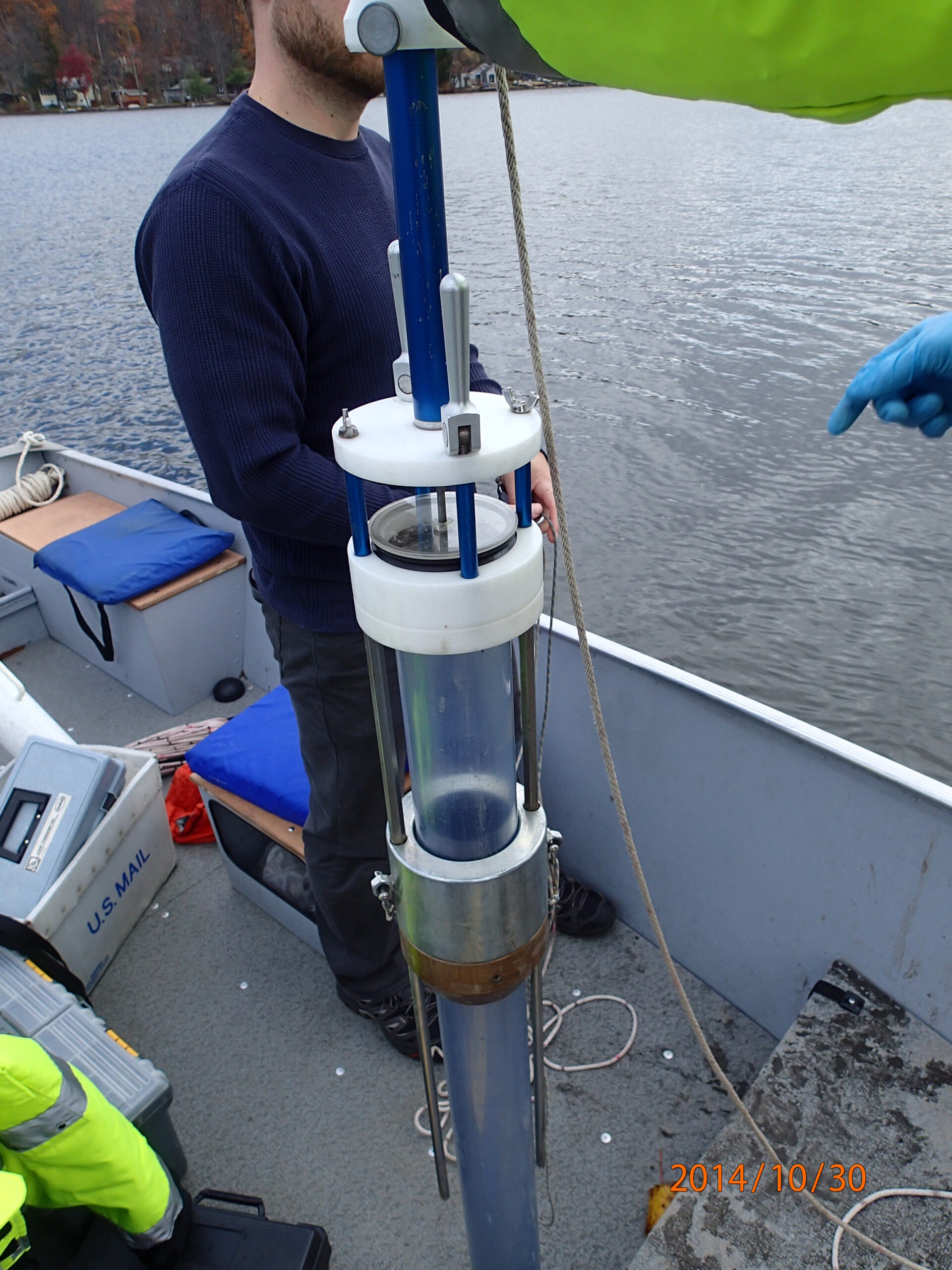
BFBM personnel have cored the sediment of many lakes throughout the State. Core samples can be used for a variety of purposes. These include diatom assemblage identification, nutrient/eutrophication status and analysis for pollutants. A maps of these lakes can be viewed using the Lake Mapper button below. Many of these sediment samples have been prepped by the Academy of Natural Sciences of Drexel University.
|
 |

|
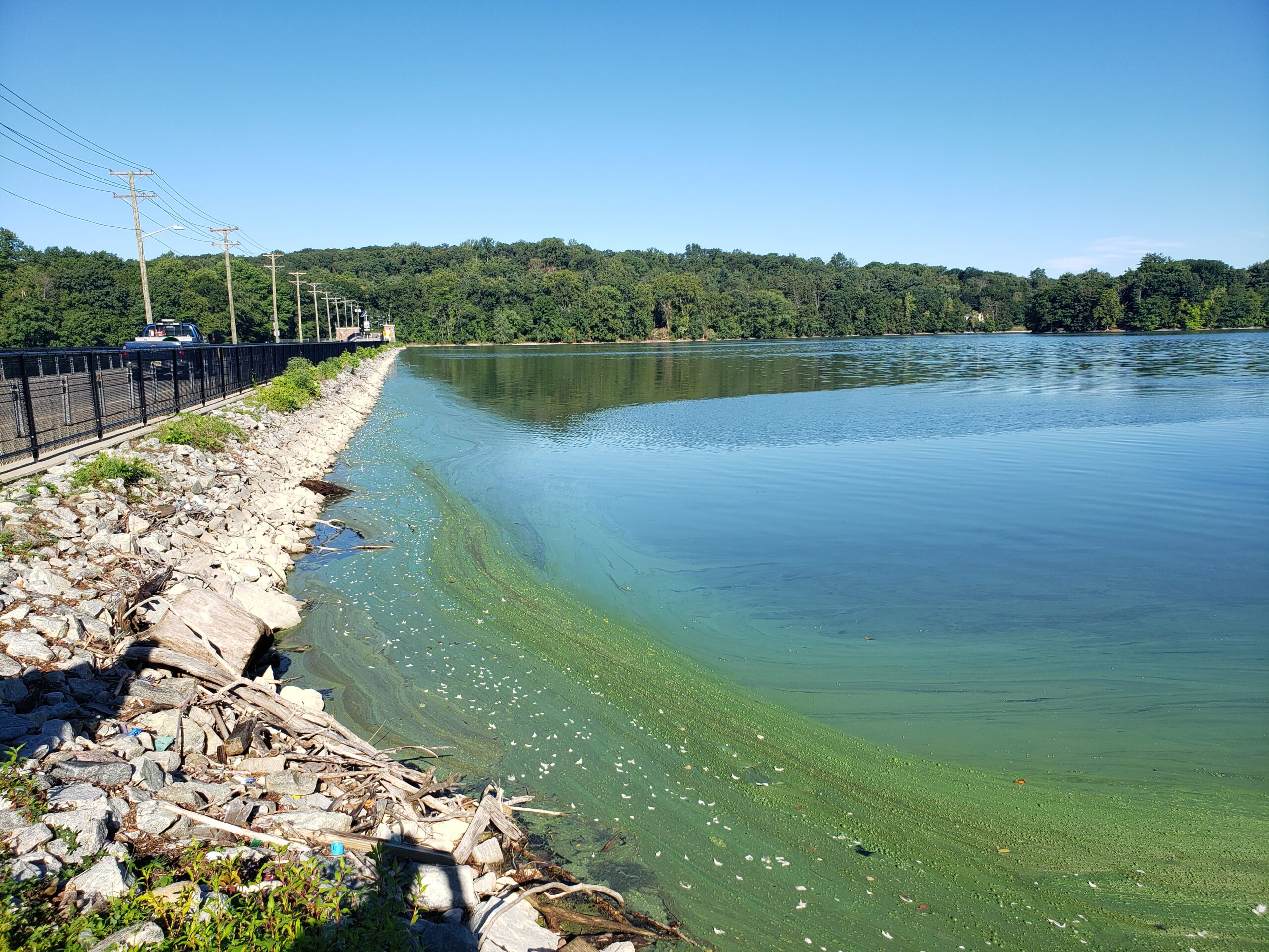
Harmful algal blooms have become increasingly prevalent in freshwater waterbodies throughout the State. Under certain conditions, a cyanobacteria population can rapidly increase in density, forming a bloom which can potentially produce toxins, called cyanotoxins. These cyanobacteria blooms are known as harmful algal blooms (HABs). HABs can be found on the surface or throughout the water column. BFBM can detect and collect surface and subsurface HABs. Using a phycocyanin probe and a horizontal sampler, BFBM can measure the entire water column for the presence or absence of PC. For more information please visit the Department's HAB page.

|
 |
For every sampling event within a lake, on-site measurements of physical and chemical parameters are taken throughout the water column. Many parameters such as pH and dissolved oxygen need to be measured on site since they are affected by water temperature and other factors.
BFBM is certified by the Office of Quality Assurance (certified lab ID # 11896) for the following parameters during field work for this project: temperature, pH, conductance, dissolved oxygen (DO), turbidity, chlorophyll, and microcystins.
Daily calibrations of meters help ensure both precision and accuracy of these field readings. Standards of known concentrations are used to calibrate and perform checks on meters before each sampling event.
Parameters measured by BFBM staff
Measures dissolved oxygen concentration and percent saturation as well as barometric pressure and water temperature. Since dissolved oxygen is inversely related to temperature, it is important to measure water temperature and barometric pressure concurrently. Adequate dissolved oxygen is essential for a healthy aquatic biological community. Low dissolved oxygen levels may be an indicator of excessive biological activity related to the decomposition of organic material, but also may be a natural condition related to certain types of waterbodies.
Measured on a scale of 0 to 14, this probe measures the pH of a lake, whether it is acidic (values less than 7) or basic/alkaline (values greater than 7). The acidity of New Jersey lakes can vary greatly depending on the underlying geology. For example, lakes in and near the Pine Barrens are naturally acidic (typically with pH of 3.5 to 5.5); a byproduct of the sandy acidic soil in the region, while most lakes in northern New Jersey are more alkaline (pH of 6.5 – 8.5) due to the local geology and soils found there. The pH value affects aquatic life directly (certain fish and other aquatic life cannot survive in waterbodies with pH values which are too low or too high) and the availability of certain chemicals and nutrients.
Measures specific conductance, which is the ability of water to conduct electrical current. Specific conductance is based on the relative number of ions dissolved in water. High conductivity can indicate high concentrations of ions, some of which are detrimental to aquatic life.
Measured on a scale of 0 – 400 µg/L. This probe measures the amount of chlorophyll a (green pigment found in plants) and the amount of Phycocyanin (blue pigment found in cyanobacteria). There is an increasing presence of HABs (Harmful Algal Blooms) in New Jersey’s waters. HABs can be dangerous to humans and animals. More information on HABs and the Department’s HAB strategy can be found at: Division HAB page.
Measures the clarity of the water, which is related to the ability of light to penetrate. The more light scattered by sediments and other materials in the water, the higher the turbidity. Higher turbidity results in a decreased opportunity for photosynthesis and lower dissolved oxygen levels. High turbidity in a lake can indicate issues with runoff and erosion, which results in increased sedimentation. Too much sedimentation can destroy habitat for aquatic life by burying important spawning areas or smothering biological communities.
In accordance with the Clean Water Act, network data is used to assess attainment of the water body’s intended uses in the New Jersey Integrated Water Quality Assessment Report (305(b) and 303(d).
A list of New Jersey surface water quality standards and sediment/soil remediation standards can be found at http://www.nj.gov/dep/standards/
National Databases
 Water Quality Portal
Data from the lake monitoring programs can be retrieved from the national Water Quality Portal(WQP). The Water Quality Portal is a collaborative effort between the EPA, USGS and the National Water Monitoring Council with the goal of integrating water quality data from multiple databases. It brings together physical, chemical and biological water quality data from 900 federal, state and local agencies, all, into one location.
More information on this initiative, including a step-by-step guide on how to download data, can be found on the Water Quality Portal’s webpage.
Reports
Lake Reports
Ambient Lake Monitoring Network Reports
From 2005 through 2009, NJDEP monitored 200 randomly selected lakes for the Ambient Lake Monitoring Network.
The network was designed to provide unbiased, statewide, statistically valid estimates for assessing lake water quality. 40 lakes per year were sampled up to 3 times per year for chemical and physical parameters. Reports for each year are available on the BFBM Publications page.
Historic Lake Reports
BFBM formed an informal partnership with Rutgers University Libraries to digitize historic water quality data with the New Jersey Environmental Digital Library (NJEDL). BFBM warehoused over 200 (229 as of FEB 2021) historic lake reports for the NJEDL. In hardcopy form, the distribution and research of these reports was limited. Digitization of these reports by NJEDL assures simple, effective access that make all resources readily available to anyone interested in any aspect of New Jersey environmental issues.
All historic lake reports are available through the Rutgers Environmental Digital Library. View a list of reports submitted by BFBM .
Networks

Duration/Time Period: 2005-2009
Objective: In 2005, NJDEP renewed an ambient lake monitoring network designed to provide unbiased statewide statistically valid estimates for assessing lake water quality. This program involved the monitoring of 200 randomly selected lakes from 869 fresh water, non-tidal, named lakes. 40 lakes per year were sampled up to 3 times per year for chemical and physical parameters.
Duration/Time Period: 2010-2014
Objective: 196 of the original 200 lakes selected for Round 1 were monitored again for Round 2. The data provided info for another statewide assessment of lakes.
The network was redesigned in 2015 and renamed the Statewide Statistical Network.

Time Period: 2015-2016
10 lakes from Lower Delaware Water Region lakes were monitored for the Regional Comprehensive Assessment Method Integrated Report cycle. These lakes were monitored 3 times each year for chemical and physical parameters.
Time Period: 2017-2018
10 lakes from the Upper Delaware Water Region were monitored for the Regional Comprehensive Assessment Method Integrated Report cycle. These lakes were monitored 3 times each year for chemical and physical parameters.
Time Period: 2019
10 lakes from the Northeast Water Region were monitored for the Regional Comprehensive Assessment Method Integrated Report cycle. These lakes were monitored 4 times for chemical and physical parameters.

Time Period: 2020-2021
13 lakes from the Atlantic Water Region were monitored for the Regional Comprehensive Assessment Method Integrated Report cycle. These lakes were monitored 2 times in 2020 (due to Covid-19 Pandemic) and 5 times in 2021 for chemical and physical parameters.

Time Period: 2022-2023
10 lakes from the Raritan Water Region were monitored for the Regional Comprehensive Assessment Method Integrated Report cycle. These lakes were monitored 8 times over two years (4x per year) for chemical and physical parameters.
Projects
Duration/Time Period: Ongoing
Objective: This project was initiated in 2017 at three lakes: Deal Lake, Manasquan Reservoir, and Union Lake. The primary goal of this project is to develop a customized algorithm that can reliably detect and estimate phycocyanin concentrations in freshwaters through wavelength reflectance signatures. This algorithm will not be used for regulatory purposes. It will be utilized as a screening tool to detect relative increases and decreases in phycocyanin pigment concentrations. BFBM and Bureau of Marine Water Monitoring (BMWM) will work together to develop this customized algorithm by leveraging a similar process implemented by BMWM used for chlorophyll detection. By doing this, the BFBM will enhance their detection and response protocol for Harmful Algal Blooms (HABs) to better protect public and ecological health.
Duration/Time Period: 2013-2014
Objective: 80 Probabilistic lakes were monitored for the presence of harmful algal blooms between June and September each year. This data was used to determine the occurrence, extent, and exposure risk of microcystin toxins in lakes statewide. In addition, the monitoring provided enough samples for BFBM to develop the capability to analyze these toxins using the ELISA method.
Duration/Time Period: 2015-2016
Objective: This pilot was designed to address limitations in routine monitoring of harmful algal blooms and develop strategies for actions and response. In partnership with Rutgers Cooperative Extension of Burlington and Camden Counties, lakes with recurring blooms were targeted to develop monitoring designs that best assessed recreational risk. Hopkins Pond and Smithville Lake were sampled weekly, August through September, for chemical and physical parameters along with a visual assessment.
Duration/Time Period: 2015-2016
Objective: This pilot was designed to develop a cost-effective means for lake stewards to screen for harmful algal bloom risks. In partnership with NJDEP State Park Service, state park staff monitored swimming lakes weekly, August through September, for harmful algal blooms. This screening included strip test and visual assessments which could alert BFBM to sample for toxin analysis as well as chemical and physical parameters.
Duration/Time Period:2007, 2012, 2017, 2022
Objective: The U.S. EPA National Lakes Assessment (NLA) is a statistical survey of the condition of our nation’s lakes, ponds, and reservoirs. U.S. EPA designed it to provide data on the extent of lakes that support healthy biological condition and recreation, estimate how widespread major stressors are, that impact lake quality and provide insight into whether lakes nationwide are getting cleaner.
11 lakes throughout New Jersey were selected for the NLA. These lakes were monitored once for a wide range of biological, chemical and physical parameters. More info can be found on the U.S. EPA National Aquatic Resource Survey NLA webpage (https://www.epa.gov/national-aquatic-resource-surveys/nla).