Program Areas
New Jersey Geological & Water Survey staff work in various program areas. These program areas are explained below:
Bureau of Water Resources and Geoscience

The following is a list of agencies that the New Jersey Geological and Water Survey provides assistance to:
Local Government and Public
 The Survey provides geotechnical expertise to the public sector on a variety of issues, including water supply, geologic hazards, environmental resource planning, and earth science education. Every DEP permit involving groundwater or landuse (NJPDES, ISRA, water diversion, solid waste, etc.) requires geologic and hydrologic data from the Survey databases, maps or publications. This is a function that has been performed for the public for over 100 years. The Survey also is considered an objective neutral party for dispute resolution.
Executive Branch
 As the state geological survey, the Survey is expected to provide assistance to other departments. Presently, assistance is provided to DOT and the Attorney General on non-DEP related matters. Although DEP receives the Survey appropriation, legislative intent was for the Survey to serve the entire Executive Branch.
NJDEP Site Remediation Program
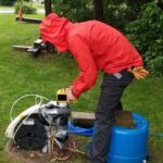
![]() The Survey analyzes and performs hydrogeologic work at pollution sites when needed, and reviews consultant reports with regard to both geology and hydrogeology. The Survey has encouraged the use of geophysics to characterize sites to minimize the need for expensive borings and wells. Pre-remedial investigations by the Survey help reduce site-remediation costs and allow the DEP to streamline the remediation-contract process. The Survey also provides quality assurance for compliance documents that include hydrogeologic and geophysical methods. In addition, the State Geologist provides advice to and is, by law, a member of the New Jersey Site Remediation Professional Licensing Board.
The Survey analyzes and performs hydrogeologic work at pollution sites when needed, and reviews consultant reports with regard to both geology and hydrogeology. The Survey has encouraged the use of geophysics to characterize sites to minimize the need for expensive borings and wells. Pre-remedial investigations by the Survey help reduce site-remediation costs and allow the DEP to streamline the remediation-contract process. The Survey also provides quality assurance for compliance documents that include hydrogeologic and geophysical methods. In addition, the State Geologist provides advice to and is, by law, a member of the New Jersey Site Remediation Professional Licensing Board.
Delaware River Basin Commission
 Survey staff provides assistance and technical expertise to NJDEP management and the public on Delaware River water supply. This is done in order to protect NJ’s withdrawals from the river for potable supply. Other issues that arise involve development impacts (such as pipelines) and ecological issues (such as upstream withdrawals that may affect salinity). In addition, the State Geologist provides advice to and is an alternate representative for NJDEP to the Delaware River Basin Commission.
New Jersey Water Supply Authority
 The New Jersey Water Supply Authority was the created by the New Jersey Water Supply Act in 1981. This authority seeks to maintain a dependable supply of water to central New Jersey residents, and preserve and enhance source water quality and quantity through planning, preservation, and assessment and rehabilitation of critical watershed parcels. Members consist of the NJDEP Commissioner and six public members that represent the agricultural community, industrial water users, residential water users, private watershed associations, public finance and water resource management and distribution. The State Geologist serves as an alternate board member for the Commissioner in representing New Jersey’s interest in water supply.
The Survey maintains the state’s boundary with Delaware, Pennsylvania and New York, as required of the DEP by NJSA 52:29-2. The Tidal Benchmark Network of New Jersey has approximately 1200 tidal benchmarks along the coast to measure effects of sea level and shore changes and settle riparian rights disputes.
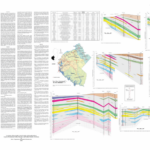
In 2009, the Survey joined the Midwest Regional Carbon Sequestration Partnership (MRCSP) to investigate the broad class of technologies for capturing and permanently sequestering, or storing, carbon dioxide (CO2) to help stabilize atmospheric levels of carbon dioxide. The Survey studied geologic sequestration that involves capturing and permanently storing CO2 in deep underground formations such as saline (saltwater) reservoirs. With funding from the USDOE and the USGS, the Survey conducted preliminary characterization of geological sequestration potential in the state and adjacent offshore region including the continental shelf and slope. The objectives of the research were to 1) provide a preliminary characterization of potential reservoirs and confining units in the state and adjacent offshore region including the continental shelf and slope; and 2) identify geologic data and analysis needed to achieve a more detailed characterization in the future.
The NJGWS has been participating in the US Geological Survey (USGS) National Data Preservation Program Grant since 2008. The Data Preservation Grant, administered by the USGS, provides opportunities to state geological surveys to preserve critical geologic information, much of it related to sites that are no longer accessible due to development. The NJGWS uses its grant funding to preserve our most at-risk data. Preservation activities include inventorying, scanning, and archiving aerial photographs, digital borehole geophysical logs, rock cores, sediment cores, geologists field maps and notes, historic geologic photographs, mine maps, mining records, soil logs, soil samples, and unpublished geological data. Preserved NJGWS data can be found at New Jersey Geological and Water Survey – ScienceBase-Catalog.
The following is a list New Jersey Geological and Water Survey program areas pertaining to environmental hazards:
Landslides
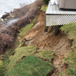 The Survey maintains a database of Landslides in New Jersey and updates the database as new landslides occur. This information is used by The NJ State Police, Office of Emergency Management as well as federal, state, county, local government officials and consultants to assist them in hazard mitigation planning. New Jersey Landslides can damage homes, utilities, cover roads, highways and railroad tracks. Landslides can be responsible human injury and death, as well as millions of dollars in damages.
Earthquakes
New Jersey has experienced many small earthquakes in the past. The N.J. State Police, Office of Emergency Management, has been working with the Survey to enter Earthquake Epicenters of New Jersey, soil liquefaction and landslide susceptibility on GIS and identify high hazard areas under a Federal (FEMA) grant. Earthquake Loss Estimation Study for New Jersey. Assistance also is provided to DOT to identify highway bridges that may pose a hazard if damaged by an earthquake. Predicting Earthquake damage in New Jersey. Check out the 4/5/2024 NJ Earthquake page!
Miscellaneous Geologic Hazards
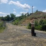
 Local government and the private sector depends on the Survey to assist with subsidence, sinkholes (karst Features in New Jersey), proposed pipelines, excavations, including Quarries, Sand and Gravel in New Jersey and unique groundwater problems. The Survey geochemists provide assessments of soil, groundwater and bedrock chemistry. Current projects include evaluation of Arsenic in New Jersey Ground Water and contamination in groundwaters of the Northern New Jersey. Studies show the elevated Arsenic is naturally occurring. The Survey also is working with Office of Safety Compliance, Mine Safety Unit, as well as the NJ State Police, Office of Emergency Management on a FEMA grant to assess the collapse of abandoned iron mines(Abandoned Mines of New Jersey) in northern New Jersey. Map Archive of New Jersey’s Abandoned Mines.
![]() In 1992 the New Jersey Legislature appropriated funds for the “Completion of Water Resources Geographic Information Systems” (PL 1991, Chapter 346). Since that date the Survey has been generating and compiling geoscience data needed for water resources evaluation and placing this data in a GIS. Our databases consist of GIS coverages that are built and maintained using state-of-the-art GIS software and other relational database files. Completed data are organized into a comprehensive system called Digital Geodata Series that includes subdirectories for base maps, geology, geophysics, and water. Please refer to Digital Geodata Series for more information on database content and the means for obtaining custom products.
In 1992 the New Jersey Legislature appropriated funds for the “Completion of Water Resources Geographic Information Systems” (PL 1991, Chapter 346). Since that date the Survey has been generating and compiling geoscience data needed for water resources evaluation and placing this data in a GIS. Our databases consist of GIS coverages that are built and maintained using state-of-the-art GIS software and other relational database files. Completed data are organized into a comprehensive system called Digital Geodata Series that includes subdirectories for base maps, geology, geophysics, and water. Please refer to Digital Geodata Series for more information on database content and the means for obtaining custom products.
The Survey received over $200,000 from the US Department of Energy (DOE), under the American Recovery and Reinvestment Act (ARRA), to investigate geothermal resources in this state as a relevant resource for heating and cooling applications. The project was conducted over a three-year period and provided information to aid industry in the identification, development and implementation of geothermal heating and cooling projects. All New Jersey data is available at the National Geothermal Data System.
New Jersey Geological and Water Survey performs the following types of mapping:
Aquifer
 The Survey develops and publishes county-wide aquifer maps for depicting important coastal aquifers on a more regional and holistic scale. Completed aquifer maps covering Monmouth, Ocean and Cape May counties are available for downloading or purchasing. Burlington County and Atlantic County aquifer maps are being compiled and will be available soon.
Brownfield Historic Fill
The “Brownfield and Contaminated Site Remediation Act” (N.J.S.A. 58:10B-1 et seq.) requires the Department to map regions where large areas of historic fill exist and to make this information available to the public. The Survey prepared maps showing areas of historic fill covering more than five acres. For the purposes of these maps, historic fill is non-indigenous material placed to raise the topographic elevation of a location. No representation is made as to the composition or contamination of the fill. These maps are not intended to be used at a parcel-scale. Any local evaluation of historic fill must be conducted by appropriate governmental agencies.
Geologic
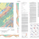 The Survey maps surficial and bedrock geology throughout the state with a long-term goal of complete coverage at 1:24,000 scale. Mapping is partially funded by the National Cooperative Mapping Program known as STATEMAP, a component of the National Geologic Mapping Act. Geologic maps provide basic data to address natural resource or environmental issues. Government regulators and the public use these maps and reports for making environmental decisions and conducting scientific research. Published Geologic Maps are available for purchase through Maps and Publications or as free downloads in Adobe PDF™ format. Some geologic data are available digitally in GIS format as Digital Geodata Series.
Offshore Sand Resources
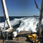 For over two decades, the Survey has played a critical role in discovering, delineating and characterizing offshore sand resources needed for past, present and future Beach Replenishment projects. NJGWS has worked with the NJDEP Division of Engineering and Construction to aid the US Army Corp of Engineers in their continuing investigation of New Jersey’s offshore sand resources. NJGWS personnel plan and execute offshore seismic data collection cruises. Staff collects upwards of 300 nautical miles of data needed to accurately define three dimensional volumes of offshore sand bodies. Follow up sand vibracoring programs designed by NJGWS allow for a more accurate sand shoal characterization. Recently, Superstorm Sandy has directed a spotlight on the State’s need for material to rebuild and enhance the resiliency of the New Jersey coastline. As time progress, accurate calculation of offshore sand volumes and characterization of sand quality is growing more important in planning future Beach Replenishment. The work being completed for offshore sand resources also aids in mapping the geology off the coast of New Jersey which can be used for other offshore projects such as wind farms.
Subsurface
 The Survey geophysicists assist the Survey mapping geologists by providing remotely-sensed subsurface information (Geophysics and Subsurface Investigations). This greatly increases the value of geologic maps by providing 3-dimensional information (cross sections). This is especially important where buried valley aquifers only occupy a narrow part of a river valley, but supply groundwater to an entire region (for example, Passaic Valley). The Survey provides support to the U.S. Geological Survey to help establish the subsurface geologic framework.
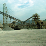 New Jersey has a long history of mining (Abandoned Mines in New Jersey) and a $250,000,000 Mineral Industry of New Jersey. Current mining activities (Quarries in New Jersey) include the quarrying of stone and the mining of sand and gravel. Analyses are performed to find new mineral resources e.g. the location and abundance of offshore sand and gravel for beach-replenishment projects in conjunction with the U.S. Mineral Management Services.
Geochemical
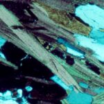 The Survey provides geochemistry support to programs within and outside the NJDEP, often times on high profile studies. On-going work includes: (1) Providing laboratory assistance to field staff by identifying minerals/rocks, describing core and grab samples, pottery shard mineralogical analyses, etc.; (2) Conducting research and characterization of ‘metallic’ microtekites (which are a result of extraterrestrial impactors) that have been recently discovered in NJ by NJGWS staff. Goal is to possibly provide information on the type of impactor; (3) Review and comment on site-assessment reports from other NJDEP programs; (4) Investigating the geochemical implications of CAMP (Central Atlantic Magmatic Province) which includes the Palisades sill, Watchung basalt/diabase, etc.; (5) to Assist the public in identifying their sample as a possible meteorite.
Geophysical
Near Surface Geophysics
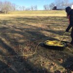 The New Jersey Geological and Water Survey employs several different geophysical techniques to investigate small-scale features in the shallow subsurface. These features may include studies of shallow structures for engineering site investigation, exploring for groundwater, narrow mine shafts or other forms of buried cavities, the mapping of archeological remains, and locating buried pipes or cables. In general, the depth of investigation is less than 100 m. Tools used in this work electrical resistivity, electromagnetic methods, ground penetrating radar, and seismic reflection and refraction. Which method is considered on a site by site basis and depends on the expected depth of the target, the material of target, and local site conditions. Using geophysics in the early stages of any project saves time and money, and reduces danger and liability.
Borehole Logging
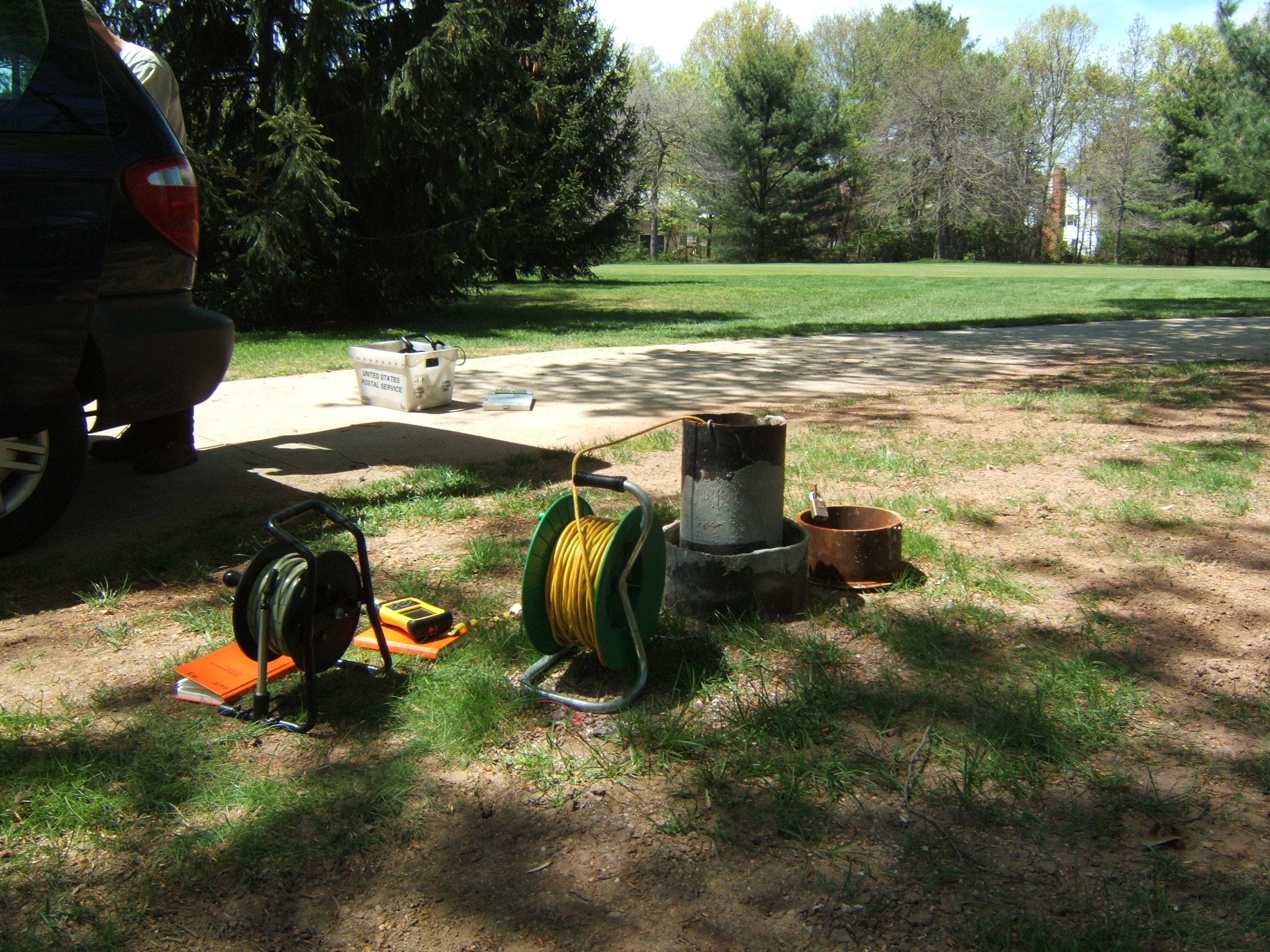
 Borehole geophysical logging consists of lowering probes into a well to collect geologic and hydrologic information. Currently, NJGWS has an Optical Televiewer, Acoustic Televiewer, Gamma, Fluid Conductivity, Spontaneous Potential, Caliper, Resistivity, Electromagnetic Induction, and Single Point Resistance tools. Geophysical logs produced from these tools can be used to provide information on rock lithology, fractures, rock integrity, structure, permeability, water quality, and water-bearing zones. Logging is integral to gaining a better understanding of subsurface conditions for groundwater investigations, environmental studies, determining local geology.
The following is a list New Jersey Geological and Water Survey program areas pertaining to New Jersey’s surface and groundwater:
Ambient Groundwater Quality Network
 The AGWQMN is comprised of 150 water-table monitoring wells that provides information about land-use-related non-point source contaminant effects on shallow-groundwater quality in the State. The goals of the network are to assess: (1) the status of the groundwater, (2) land use impacts on shallow groundwater, (3) groundwater quality trends, and (4) identify emerging groundwater quality concerns. The network wells are spatial distributed throughout the State, and fifty wells are sampled on a 3-year cycle. To date four complete sampling cycles have been completed. New Jersey’s Ambient Ground Water Quality Network Data from the AGWQMN is available through the NJGWS and reports are generated by the NJGWS. The network data is also entered into the USGS database NWIS, the National Water Quality Portal, and is available through various DEP platforms and reports. The AGWQMN was one of the first participating networks included in the National Ground Water Monitoring Network, and to date remains a part of the National network.
Aquifer Recharge
The Survey has published a methodology to map Groundwater Recharge areas of New Jersey and Aquifer-Recharge Potential for New Jersey on a watershed basis using Geographic Information Systems (GIS).
CDC/NJDOH Private Well Water Study
In coordination with NJ Department of Health and NJDEP Division of Science and Research, the NJGWS serves as outreach and testing coordinator as part of a NJDOH grant from the Center for Disease Control and Prevention. The testing is performed on private wells for geogenic (naturally occuring) compounds.
Drought Monitoring
 As part of the department’s on-going drought monitoring activities, the Survey maintains and updates real-time drinking-water-supply indicators for precipitation, confined and unconfined groundwater, streamflow and reservoirs, found in New Jersey Drought Information. These indicators as used to monitor hydrologic conditions for NJ’s six drought regions and proactively inform division drought management responsibilities.
Groundwater Quality Investigations
 The Survey performs various groundwater quality investigations. These investigations include assisting Municipalities and Counties on subsurface pollution investigations, public outreach to private well owners on geogenic compounds and research studies on emerging contaminates. Our subsurface investigations program includes drilling, borehole-logging, near-surface geophysics, hydrologists, geochemists, and research scientists. The Survey has and continues to work in coordination with other DEP programs, State agencies, and Federal partners on groundwater quality investigations through Joint Funding Agreements, MOA’s and/or Grants from the Center of Disease Control, EPA, and USGS.
Surface Water Supply
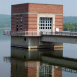
 The Survey analyzes and reviews reports submitted in support of surface water diversion applications for water allocations. River and reservoir models are used to evaluate requests and determine the safe yield (Safe Yield Guidance Manual) and reliability of the sources. Alternative operating plans are evaluated to ensure that they meet the water supply needs of the state.
Watershed Characterization and Assessment
A vital aspect of the NJDEP watershed characterization and management initiative is assessing the status of the state’s groundwater resources. This requires knowing the geologic and hydrologic properties of a watershed. The Survey contributes essential information for the characterization process including the location, extent, and productivity of aquifers, the distribution and rates of groundwater recharge, data on groundwater quality, and the amount of groundwater discharge to surface streams (base flow).
Groundwater Supply
 The Survey analyzes and reviews hydrogeologic reports submitted in support of water supply diversion applications for the Water Allocations. The Survey also provides input to Well Permitting on the drilling, abandonment and sealing of wells penetrating multiple aquifers. The Survey maintains and updates geologic and hydrologic databases (New Jersey Geological and Water Survey Hydro Database) used by Water Supply and DEP permit applicants. In addition, the Survey conducts regional water resource assessments and regional groundwater models required by the 1981 Water Bond Act. The Survey also provides geologic & hydrologic information to the regulated community for locating high capacity industrial and municipal wells. The Survey is responsible for the NJDEP/USGS Groundwater-Monitoring Network and drought networks (New Jersey Water-Supply Drought Indicators).
Water Supply Planning and Data
The Survey maintains the division’s comprehensive water withdrawal, transfer and discharge database (New Jersey Transfer Model Withdrawal, Use and Return Data Summaries). The database contains detailed location, watershed, aquifer/stream and related attributes for use in water resource evaluations and modeling. The data are used by the Delaware River Basin Commission, the NJ Highlands Council and pre-approved federal, local and academic groups. The dataset was used as the basis of the state’s Water Supply Plan. The Survey develops and maintains many of the water availability methods to determine ecologically based surface water and unconfined aquifer and confined aquifer water availability thresholds. The Survey develops and analyzes water use projections and population and potable water demands studies. New Jersey Water Withdrawal Data Summary Viewer. Visit the Water Supply Plan webpage!
Well Head Protection Area (WHPA) Delineation
As part of the Source Water Assessment Program (SWAP), the Survey has calculated the well head protection area for public community (Well Head Protection for Public Community Water Supply Wells in New Jersey) and public non-community (Well Head Protection for Public Non-Community Water Supply Wells in New Jersey) water supply wells. Well head protection areas are calculated in accordance with the Guidelines for Delineation of Well Head Protection Areas New Jersey. The well head protection areas provide a critical component of the source water assessment and protection activities as well as the basis for focusing efforts of the state’s groundwater protection strategy.
Bureau of Water Allocation and Well Permitting

The Water Allocation Permitting Section manages the water resources of the State to ensure adequate supply and quality of the State’s water supply resources for water users that have the capability to divert more than 100,000 gallons of water per day. Type of water uses include public water supply, industrial processing and cooling, irrigation, sand and gravel operations, remediation, power generation, agriculture, aquaculture and horticulture, construction related dewatering and other water uses. The Section manages approximately 1500 non-agricultural water users and about 1000 agricultural diverters. Routine activities include reservoir storage monitoring, aquifer test reviews, complaints of interference with wells going dry or reduced yield/declining stream and/or pond levels and agricultural outreach. This section also manages two Areas of Critical Water Supply Concern and various water supply deficit areas where new diversions are limited.
The Well Permitting Section manages well construction and maintenance, sealing of abandoned wells, and establishes requirements and standards for the Permitting, Construction and Decommissioning of Wells, the Licensing of Well Drillers and Pump Installers, and the activities and responsibilities of the New Jersey State Well Drillers and Pump Installers Examining and Advisory Board. The section maintains records for over one million wells. Approximately 20,000 new permits to drill wells are issued and tracked per year. Once a well is constructed, the driller is required to submit a well record document which is the as-built description of the well. Well drillers also submit a well abandonment report whenever a well has been decommissioned. There are about 600 licensed well drillers and 200 licensed pump installers in New Jersey; only properly licensed individuals are permitted to install, service and decommission wells and pumps. The Subsurface and Percolating Water Act establishes the State Well Drillers and Pump Installers Examining and Advisory Board, whose members provide advice to the Department on exam questions, license status and technical issues. All meetings of the Board are open to the public. Well permits are issued for various types of wells including residential, public supply, industrial, remediation, dewatering, geothermal, and monitoring.