April 5 2024, the largest earthquake in over 241 years
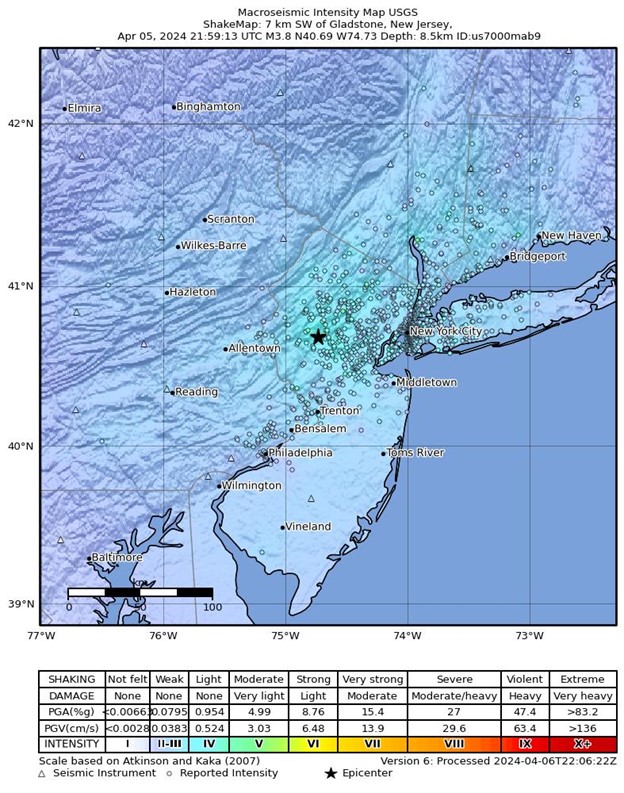
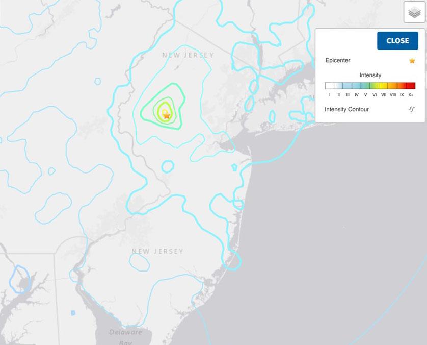
At approximately 10:23 am on Friday April 5, New Jersey experienced a magnitude 4.8 earthquake, the first of this magnitude in over two centuries. The earthquake occurred about three miles below ground, near Oldwick in Tewksbury Township, Hunterdon County. Within minutes of the event, data from seismic monitoring networks were reporting location, magnitude, and depth information to the Department. The initial quake was followed by over seventy aftershocks, with one coming in at a magnitude of 3.8 and an additional ten at 2.0 or higher with more still occurring.
Where did the earthquake and its aftershocks occur?
The Earthquake Event map shows the reported epicenters of the April 5 earthquake and the multiple aftershocks that occurred since then. It also includes the location of mapped faults. Seismologists are still working to identify which fault the 4.8 earthquake occurred on. The bar chart shows the magnitude and timing of the April 5 earthquake and its many aftershocks.
Why did the earthquake happen?
In New Jersey and elsewhere, earthquakes usually occur when slowly accumulated strain within the earth’s crust is suddenly released along a fault. The energy from this movement travels as seismic waves along the ground surface and within the earth. The arrival of this released energy is felt as an earthquake.
Where are the fault lines in NJ?
Geologists at the New Jersey Geological and Water Survey and elsewhere have mapped the bedrock geology and its associated fault lines. Faults are located within the consolidated or hard rock geologic formations so are mapped in the northern half of the state. The largest are typically found on the border of the older Paleozoic units (i.e. the NJ Highlands region) and the younger Mesozoic units (i.e. the Newark basin region). The inset map below shows the location of the major fault lines which run from the NJ-NY border in upper Passaic County south-southwest through Morris County and then turn westerly in Morris, Hunterdon, and Warren Counties.
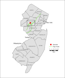
New Jersey 2024 Earthquake Epicenter and Major Faults inset map
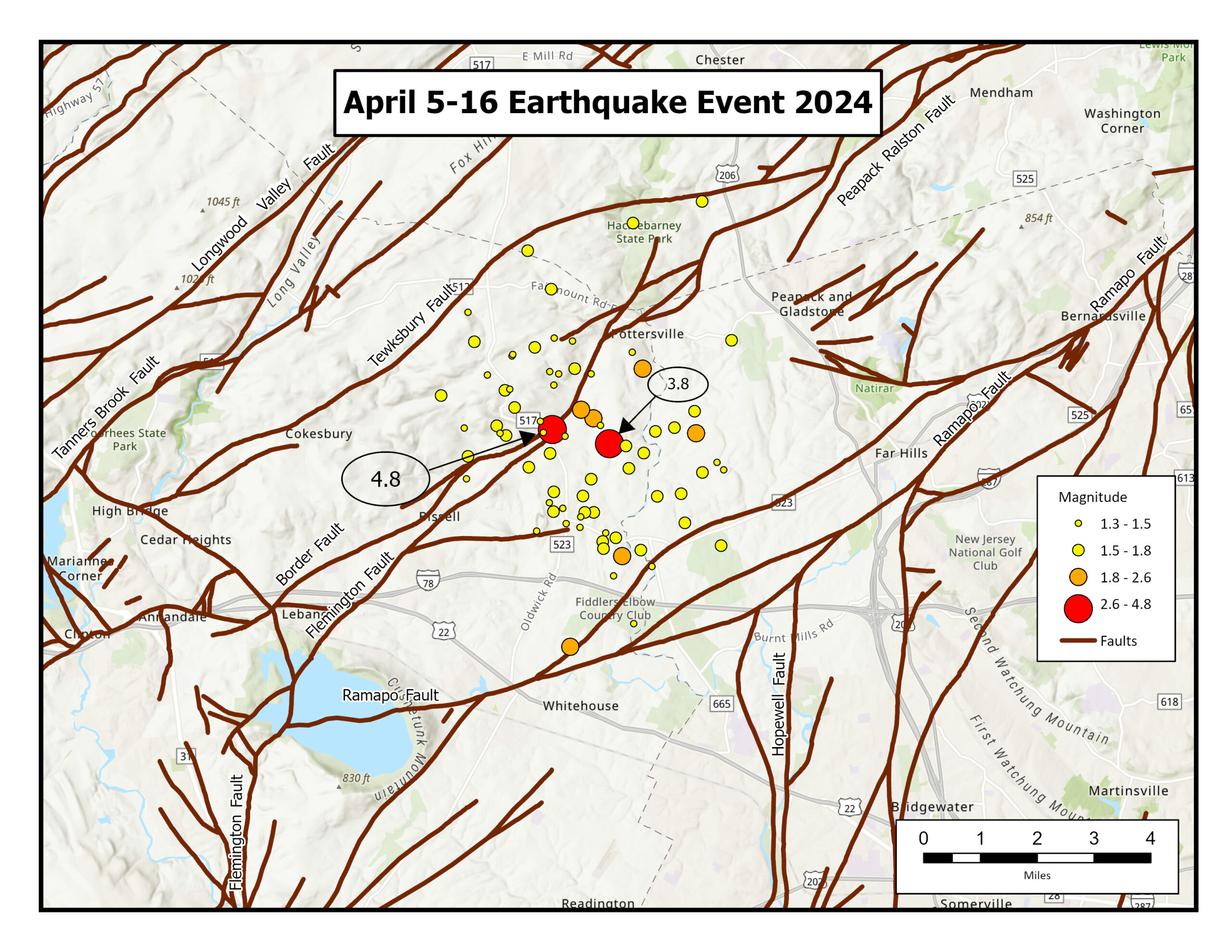 April 5-16 2024 Earthquake Event map
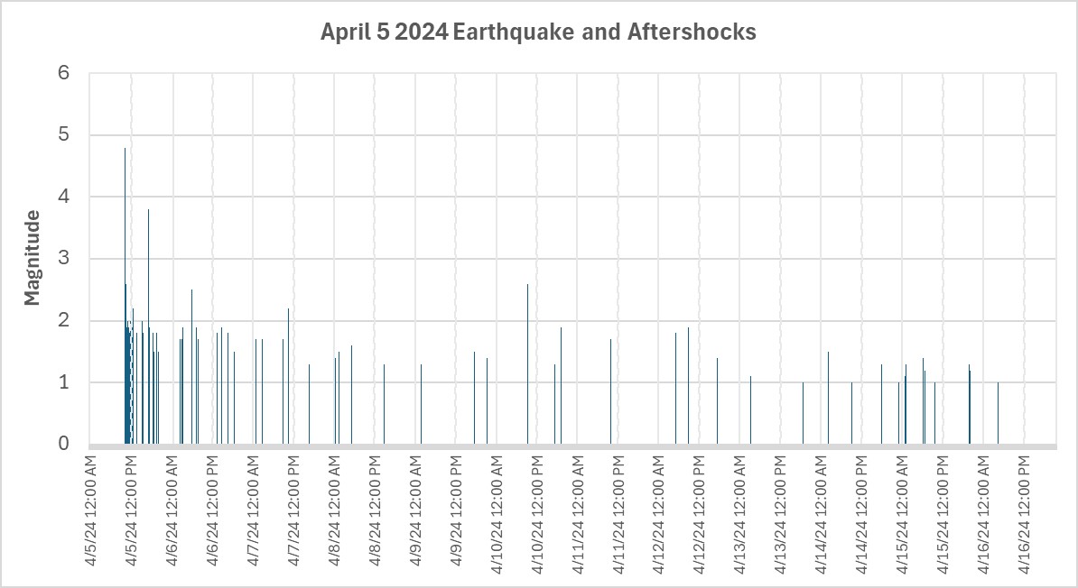 Magnitudes and times of earthquakes beginning April 5, 2024.
 Did you Feel it map. The April 5,2024, Tewksbury, NJ earthquake was felt from Quebec to Georgia and into the Midwest US. Source United States Geological Survey accessed April 16, 2024
 Epicenter GIS feature layer map: United States Geological Survey, accessed April 16, 2024 USGS Earthquake Hazards Program
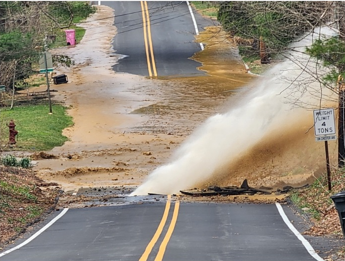
In Randolph, New Jersey, a water main break occurred on Pleasant Hill Road, believed to be caused by the recent 4.8-magnitude earthquake. The break resulted in significant water flooding the street. Emergency steps were taken by the water department and the water main break was repaired and is currently operational. Photo Edward Eberhard Jr. and Mendham-Chester Patch.com.