DGS96-1 Glacial Sediments of New Jersey
Abstract
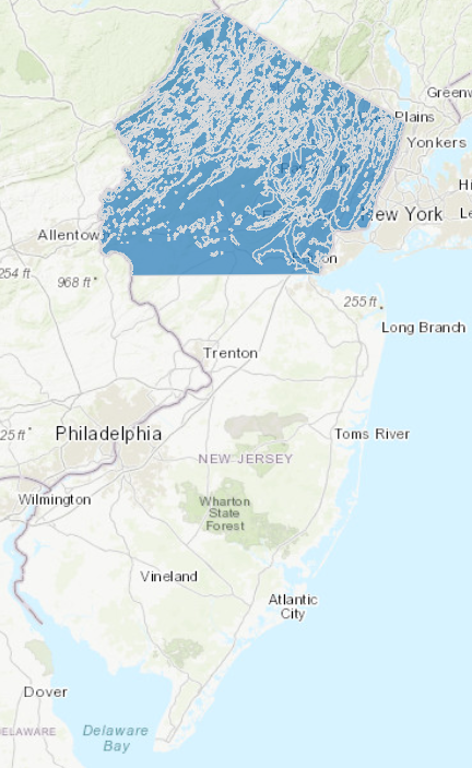
This layer is derived from the 2002 revision of N.J. Geological Survey Open-File Map OFM-3, originally released in 1990. There will be future revisions of the map before publication, so the information is subject to change. Open File Map 3 is at a scale of 1:100,000. Enlargement of the layer to more detailed scales will result in registration errors. Open-File Map 3 also contains explanatory information that is not provided here, including descriptions of materials, hydrogeologic characteristics of the map units, and block diagrams of typical valley-fill aquifer systems. OFM 3 also has a topographic base and an inset map showing the location of principal glacial aquifers in New Jersey. Glacial sediments are mapped in the northern part of New Jersey covering parts of the Valley and Ridge, Highlands, and Piedmont physiographic provinces. The area includes about the upper one-third of the State. All coverages were either scanned or digitized from base-positive mylar separates of Open-File Map No. 3. The sediment and thickness coverages were first optically scanned and subsequently edited in ARC/INFO using a digitizer. The lines in the sediment coverage that were duplicated in this layer were selected from the completed sediment layer and put into this layer. Other lines that were unique to this coverage were then digitized from the mylar separate from Open-File Map No. 3. Please refer to the OFM 3 map for more information: https://nj.gov/dep/njgws/pricelst/ofmap/ofm3.pdf
The Thickness of Glacial Sediments in New Jersey layer is a Geographic Information Systems (GIS) geodatabase layer compiled from NJGS Open-File Map No. 3, Hydrogeologic Character and Thickness of the Glacial Sediment of New Jersey, 1990 (revised 2002). The layer details the map distribution, thickness, and types of Quaternary glacial sediment in northern New Jersey at the 1:100,000 scale. The GIS data are compiled in NAD83 State-Plane-Coordinate feet using an optical scanner, raster-to-vector conversion software, and a digitizer.
Download the compressed (zip) files containing ESRI shape files and metadata for each of the following: