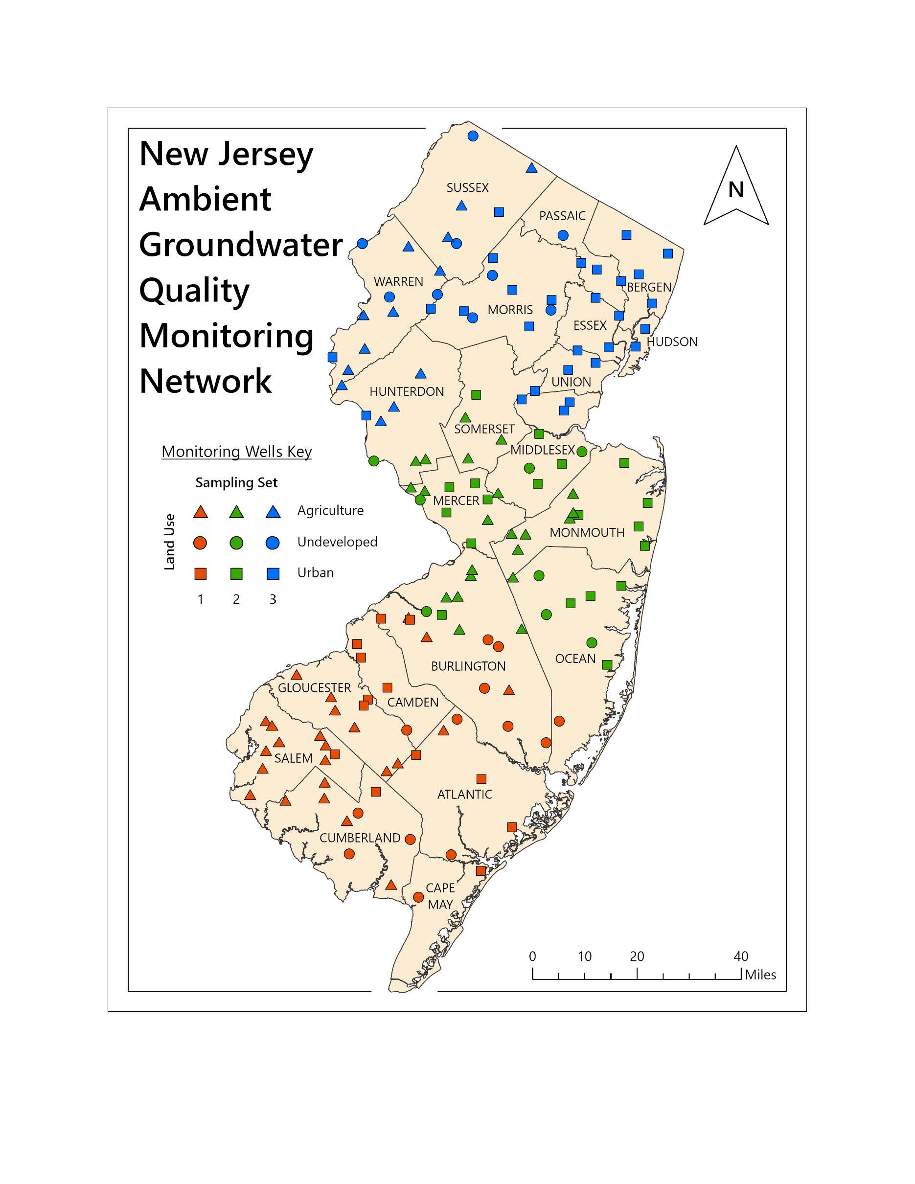
DGS05-2 New Jersey Ambient Groundwater Quality Monitoring Network, 2020-2022
Updated (3/6/2025)
Abstract
The New Jersey Ambient Groundwater Quality Monitoring Network (AGWQMN) is a cooperative program between the New Jersey Department of Environmental Protection (NJDEP) and the United States Geological Survey (USGS). The goals of the current network are to determine the status and trends of shallow groundwater quality as a function of land use related to non-point source pollution in New Jersey. This network consists of 150 monitoring wells screened at the water table. Thirty of these wells were sampled per year on a 5-year cycle from 1999-2013. Beginning with the 4th sampling cycle in 2014, the sampling frequency was changed to once every 3 years (3-year cycle). The New Jersey Geological and Water Survey (NJGWS) manages the network design, well installation, well maintenance, data interpretation, reporting, and a portion of the well sampling. The NJDEP Bureau of Fresh Water and Biological Monitoring and the United States Geological Survey collect the remaining groundwater samples and the USGS National Water Quality Laboratory in Denver, Colorado or their contracted laboratories analyzes them. Chemical and physical parameters analyzed at each well include major ions, trace elements (metals), gross-alpha particle activity (radionuclides), volatile organic compounds, nutrients, pesticides, and field parameters such as pH, specific conductance, dissolved oxygen, water temperature and alkalinity.
This update (2024) includes the groundwater quality results from the 6th sampling cycle (2020-2022) of the New Jersey Ambient Groundwater Quality Monitoring Network. Groundwater quality data from the Ambient Groundwater Quality Monitoring Network is collected to increase understanding of water quality as it relates to the geologic character of various aquifers and non-point source impacts from land use. Layers containing the 2020-2022 groundwater quality results for major ions, metals, nutrients, radionuclides, pesticides, and volatile organic compounds are linked below.
Click the link below to open corresponding layer file.
Ambient Groundwater Major Ions
Ambient Groundwater Metals
Ambient Groundwater Nutrients
Ambient Groundwater Radionuclides
Ambient Groundwater Pesticides
