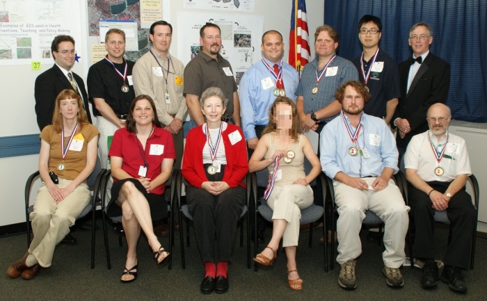
21st ANNUAL NJDEP GIS MAPPING CONTEST WINNERS
2008 MAPPING CONTEST AWARDS
June 05, 2008
|
Category |
Winner |
Map Title |
Thumbnail |
|
BEST |
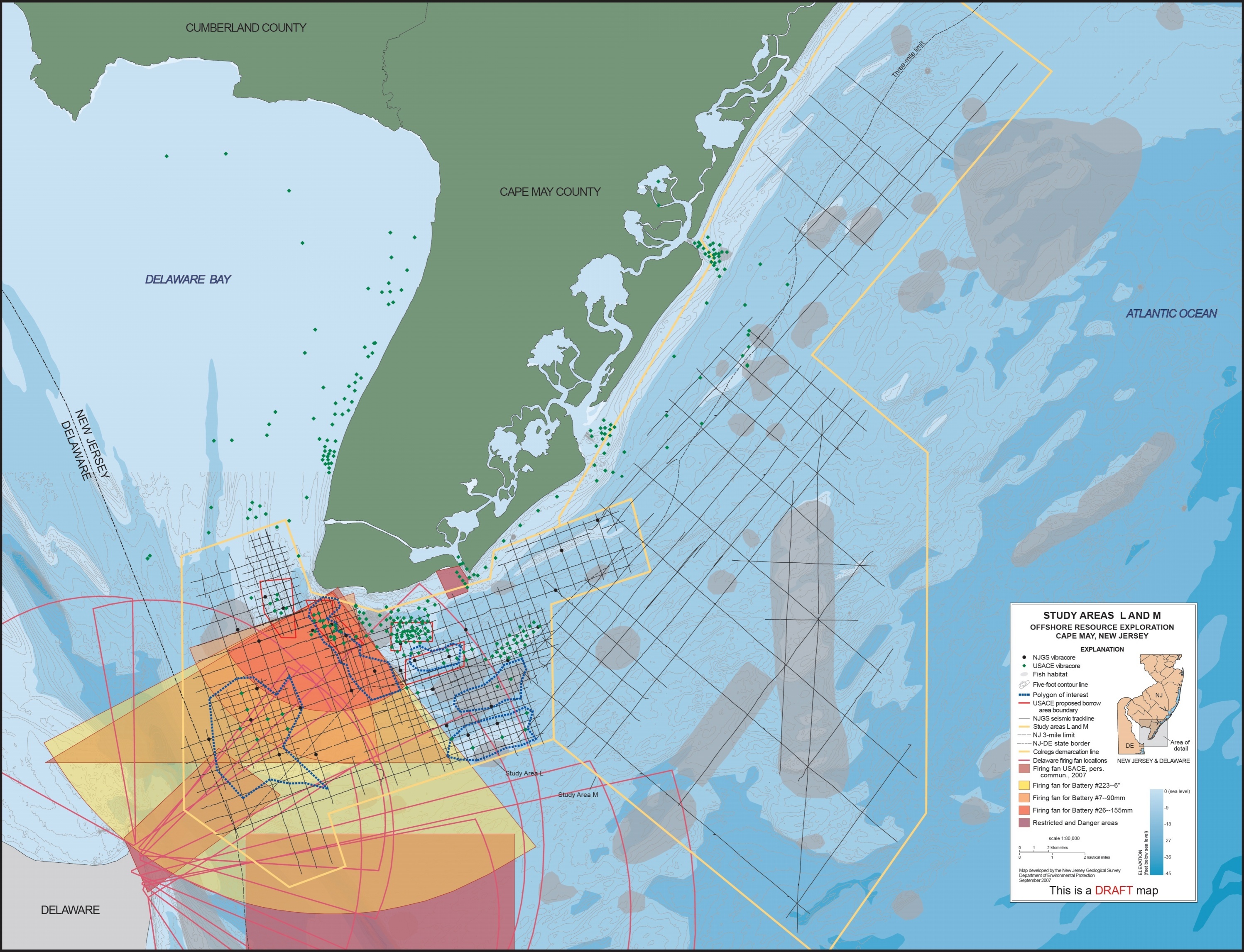
1st Zehdreh Allen-Lafayette |
UpnArms: Searching for Beach Replenishment Sand Offshore Cape May, NJ |
|
|
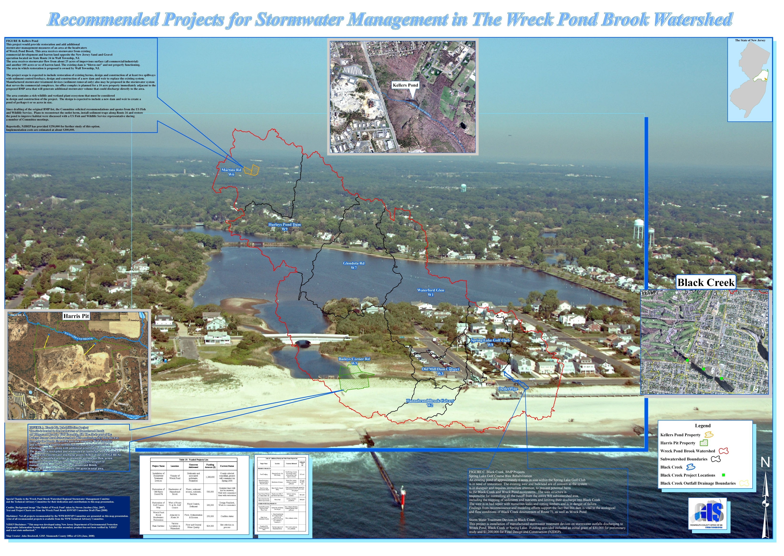
2nd John Brockwell |
Recommended Projects for Stormwater Management in the Wreck Pond Brook Watershed |
|
|
|
BEST |
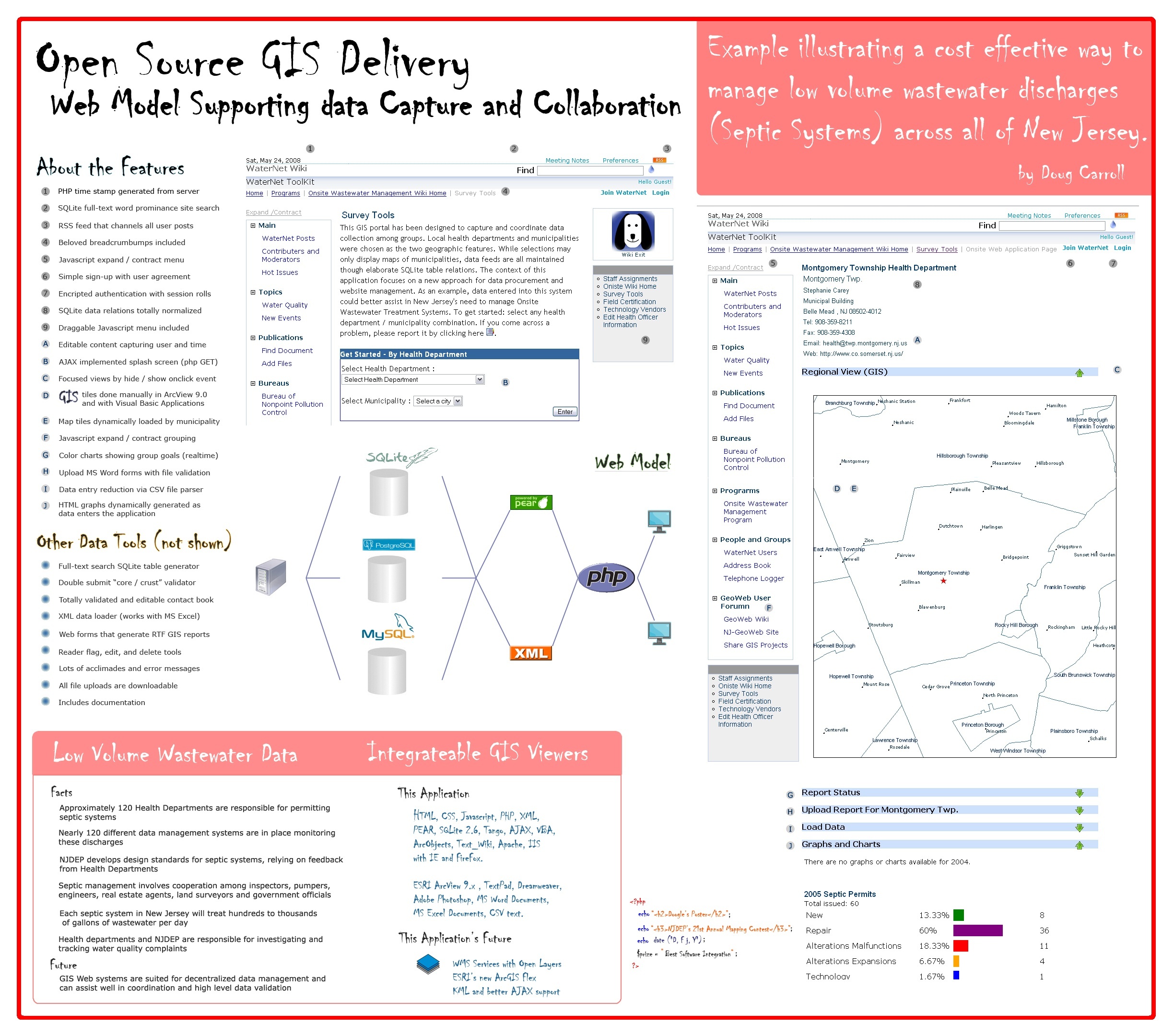
1st Doug Carroll |
Open Source GIS Delivery – Web Model Supporting Data Capture and Collaboration |
|
|
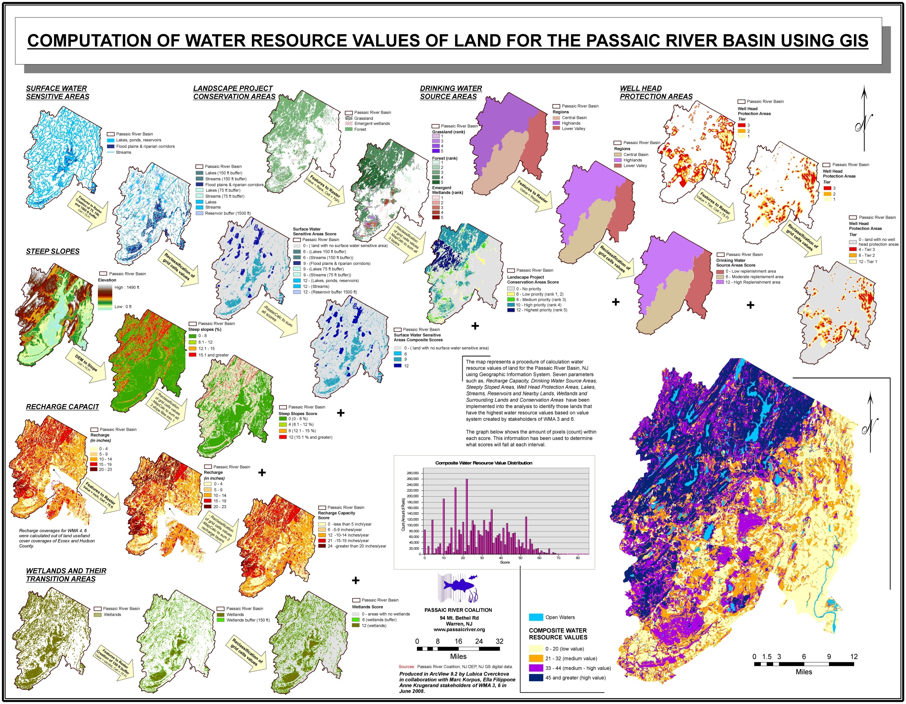
2nd Passaic River Coalition |
|
||
|
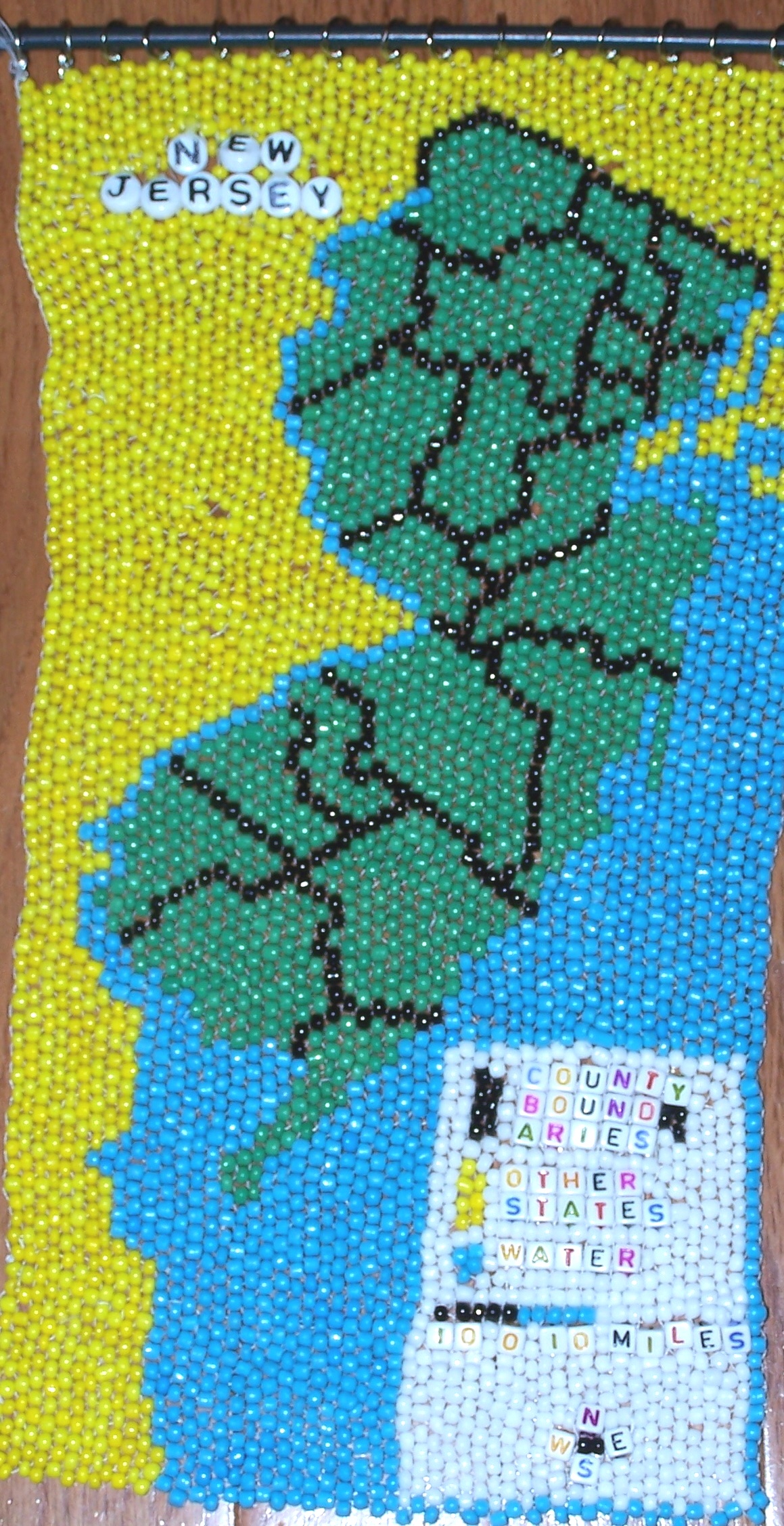
BEST INSTRUCTIONAL |
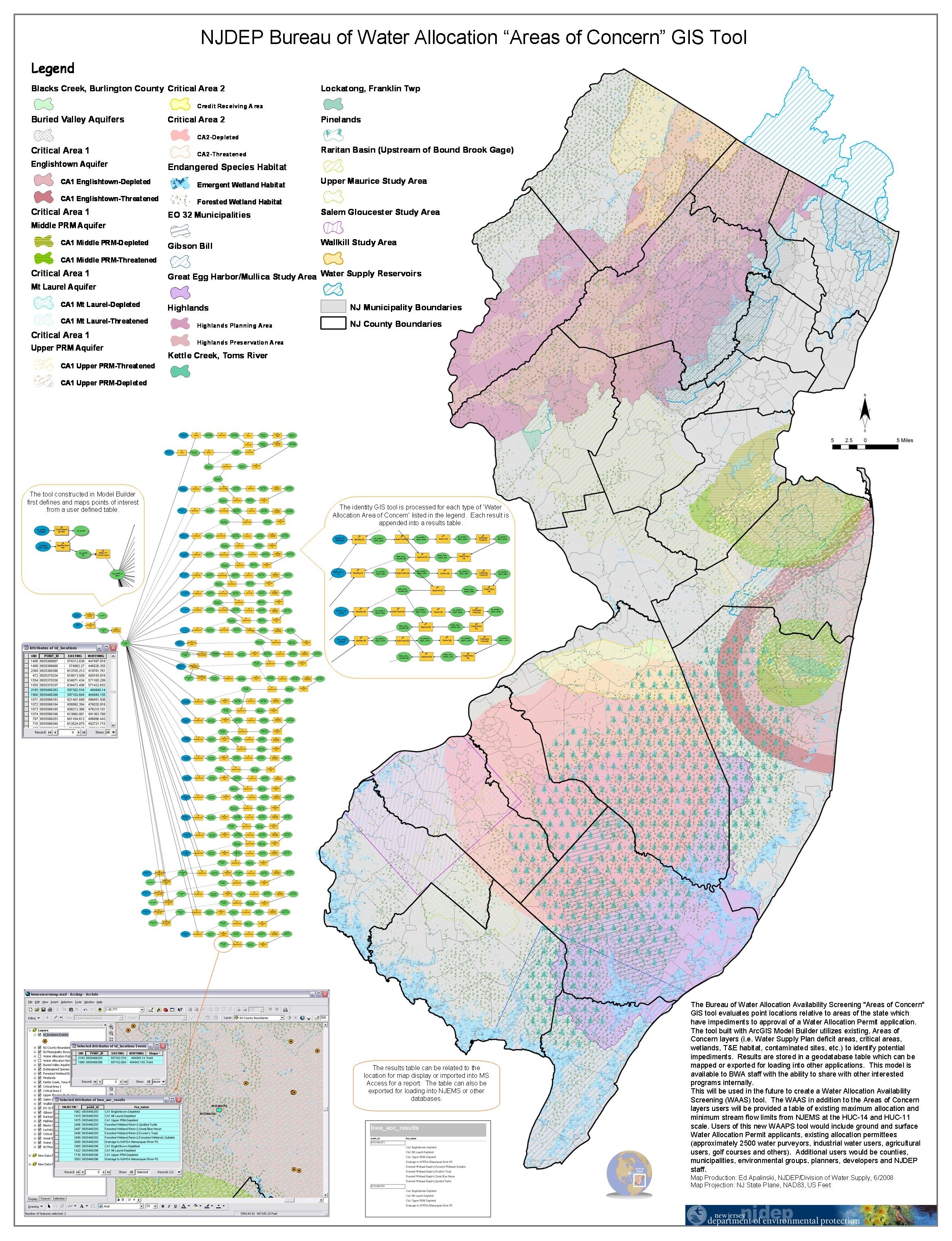
1st Ed Apalinski |
|
|
|
2nd A. Chris Gould |
|
||
|
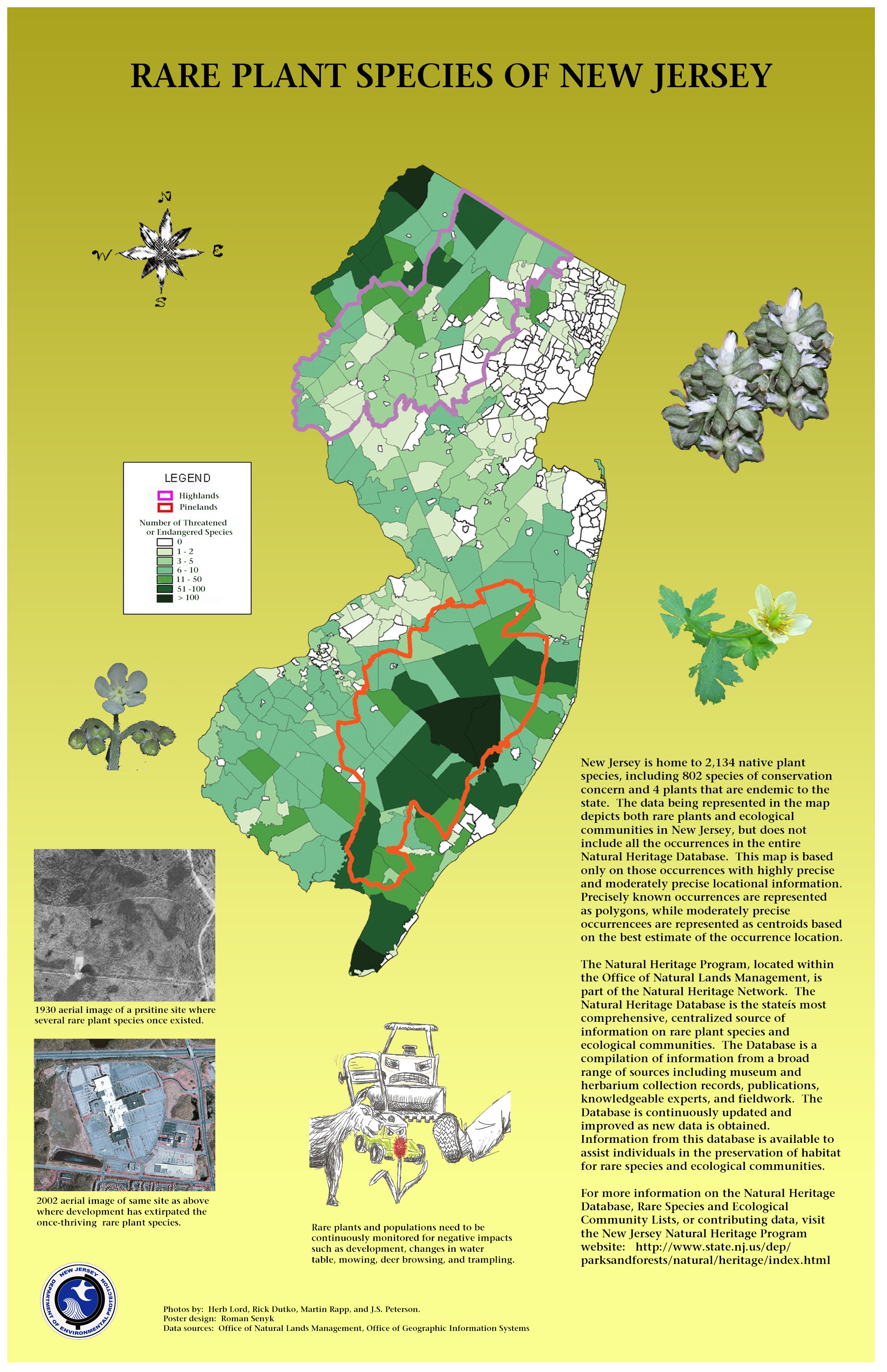
BEST |
1st Kenneth Fung |
|
|
|
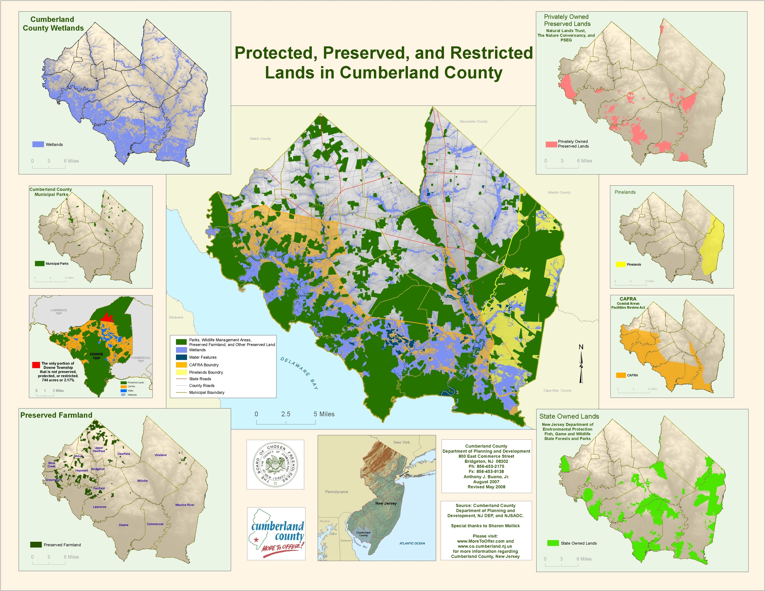
2nd Anthony Buono |
Protected, Preserved, and Restricted Lands in Cumberland County |
|
|
|
BEST |
1st Patricia Hicks |
|
|
|
2nd Roman Senyk |
|
||
|
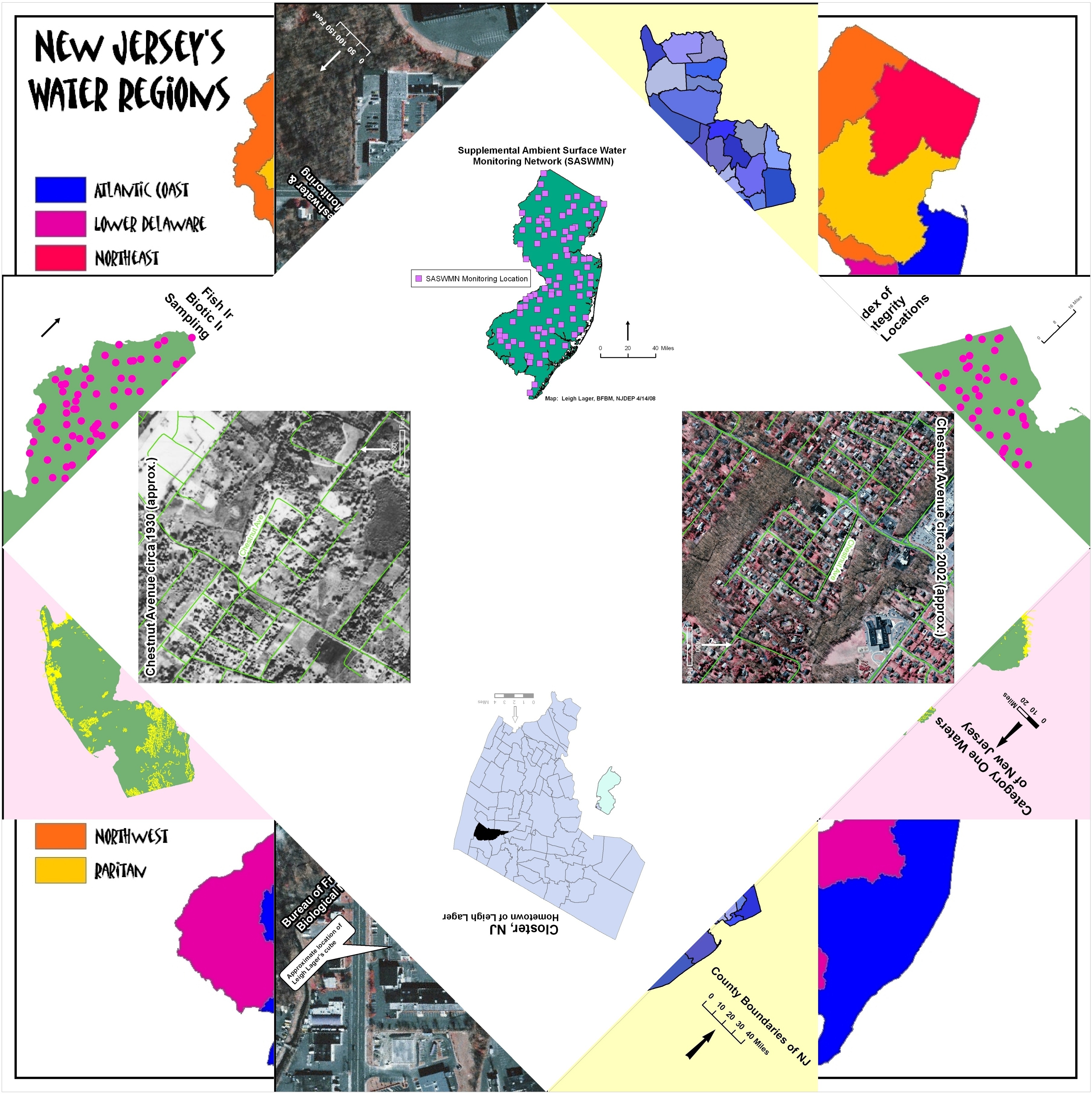
MOST |
1st Leigh Lager |
|
|
|
2nd David Rickert |
|
||
|
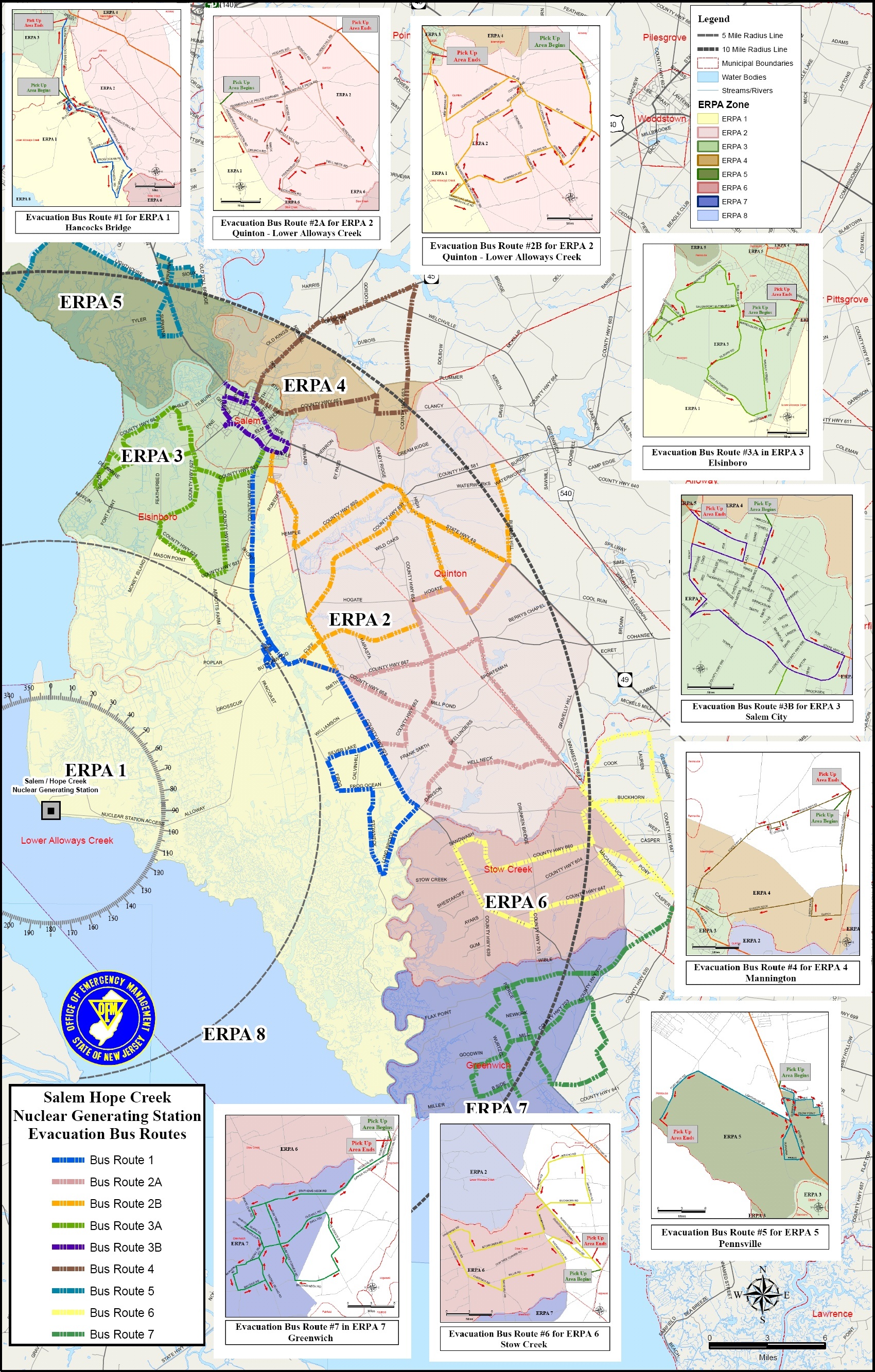
BEST |
1st Anthony Buono |
Protected, Preserved, and Restricted Lands in Cumberland County |
|
|
2nd Ed Apalinski |
|
||
|
BEST |
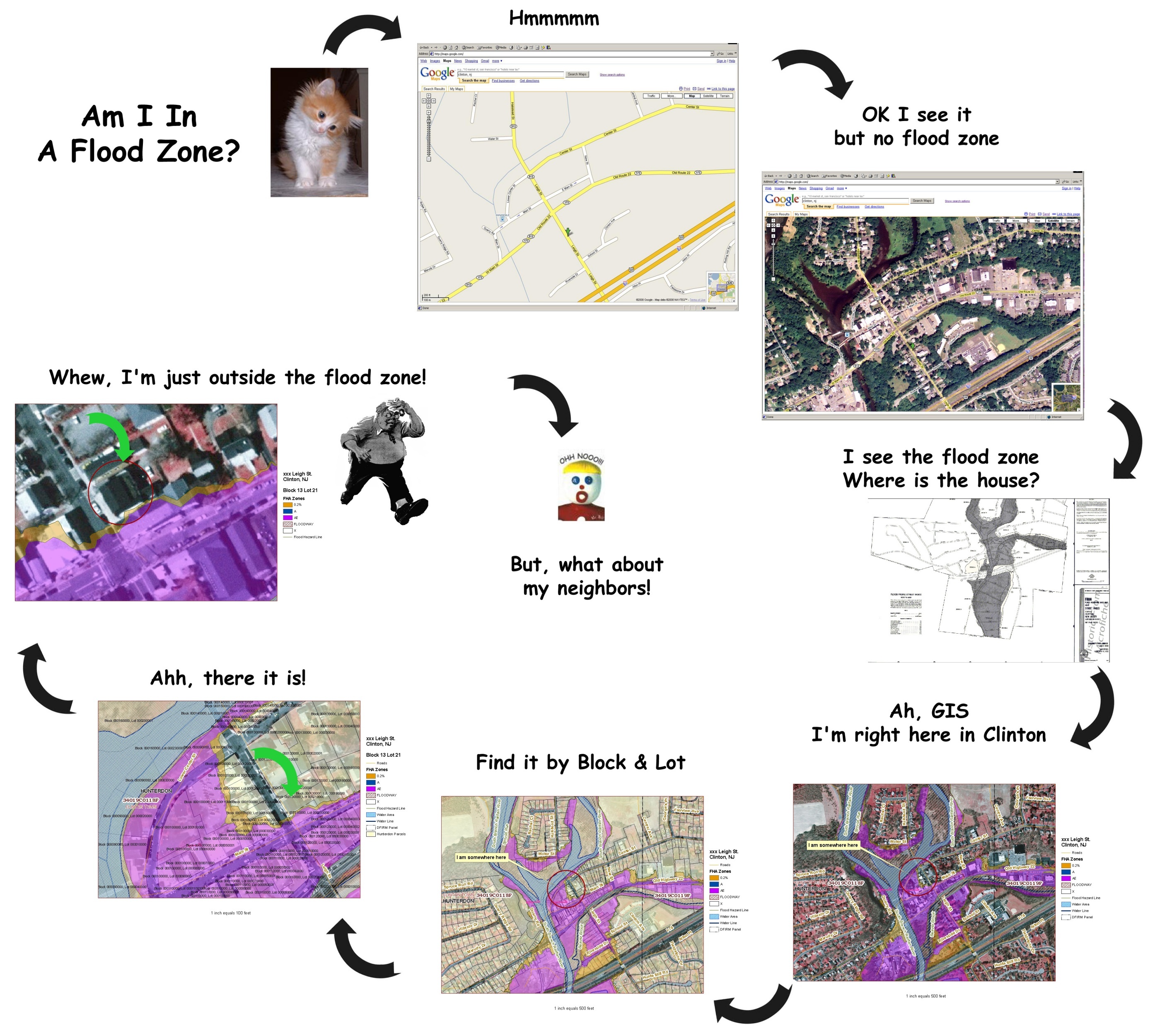
1st Ed Apalinski |
|
|
|
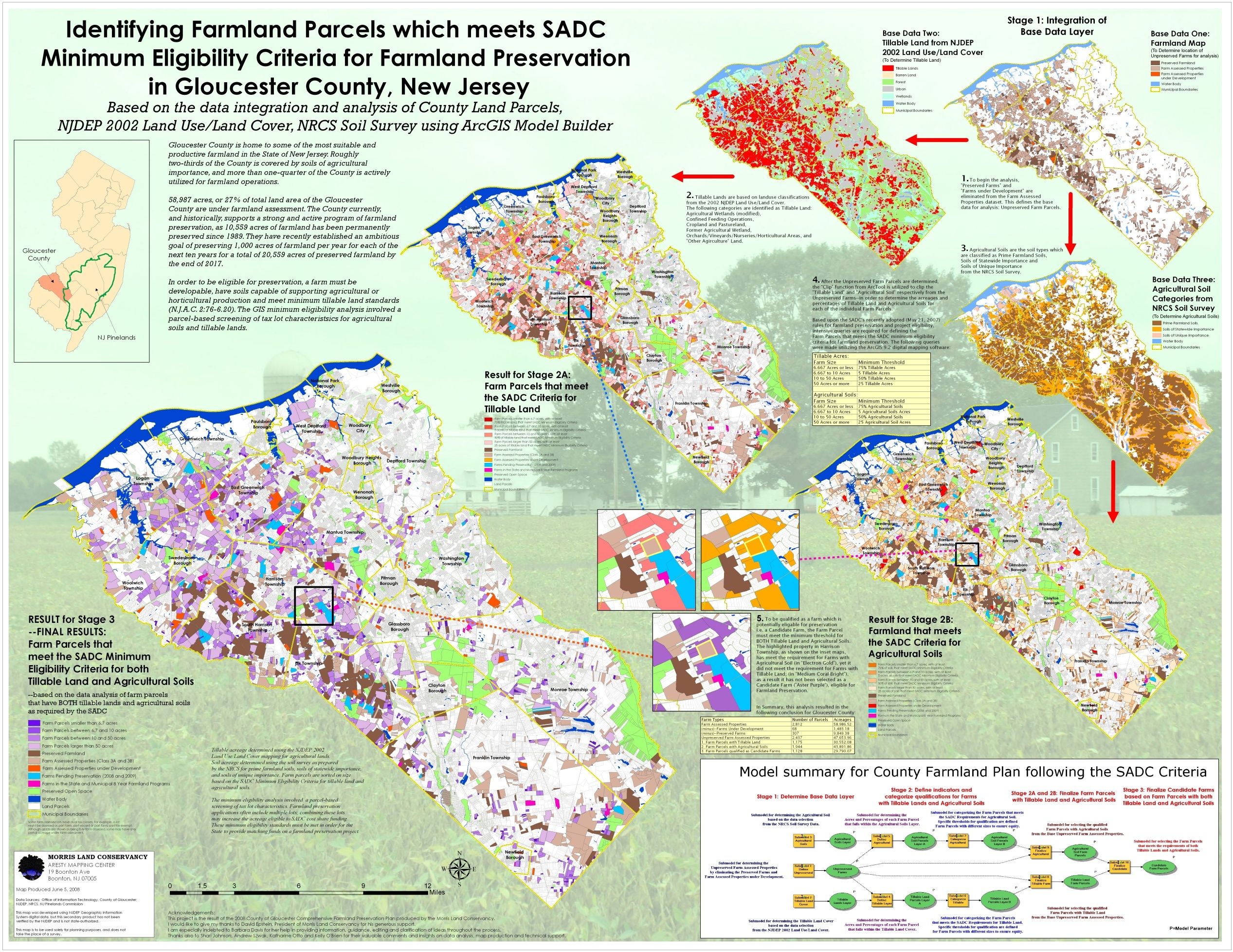
2nd Doug Carroll |
Open Source GIS Delivery – Web Model Supporting Data Capture and Collaboration |
|
|
|
BEST |
1st Anthony Buono |
Protected, Preserved, and Restricted Lands in Cumberland County |
|
|
2nd Kenneth Fung |
|
||
|
NEWBIE |
1st Anthony Buono |
Protected, Preserved, and Restricted Lands in Cumberland County |
|
|
2nd Passaic River Coalition |
|