")
TOOLS AND WEB APPS
Tools and Web Apps
This page holds a suite of data-visualization and mapping tools developed to provide a detailed overview of climate change and climate resilience-related data. These tools are designed to assist local government, businesses, landowners, and residents to gain knowledge on the impacts and indicators of climate change.
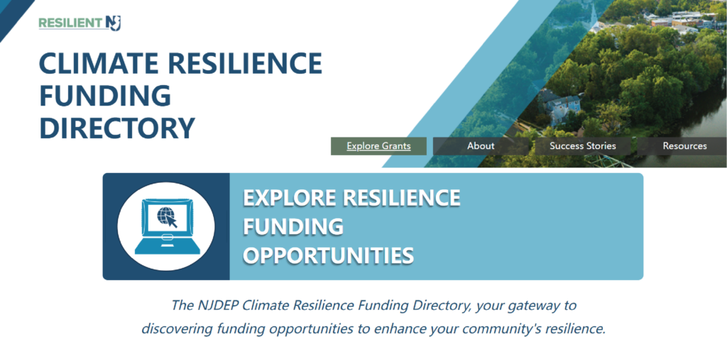
Climate Resilience Funding Directory
The Climate Resilience Funding Directory offers a curated list of federal and state funding sources that support climate adaptation and resilience projects. This Directory serves as a starting point to help users navigate funding opportunities.
Extreme Precipitation Projection Platform
This is an interactive tool displaying precipitation projections for New Jersey, including increases in the frequency and intensity of extreme precipitation events, rainfall depths, and comparisons with NOAA Atlas 14 values down to the parcel level.
Flood Risk Indicator Tool
This is a screening tool that provides users with information regarding the presence of indicators of potential flood risk on or near a property of interest.

Heat Hub
This web app is designed to be a source for all things related to extreme heat in New Jersey. Visitors will find key information on extreme heat and the impact it will have on people, communities, and the environment as well as live weather alerts, surveys, and quizzes.

NJ CERAP
The NJ Coastal Ecological Restoration and Adaptation Plan (CERAP) is open for your submissions. The goal of CERAP is to identify areas and projects for future ecological projects that have value in increasing community resilience, ecosystem health, and carbon sequestration.
NJ Community Solar PV Siting Tool
This tool was developed by the New Jersey Department of Environmental Protection’s Bureau of Climate Change & Clean Energy to support and inform the siting of solar projects under the New Jersey Board of Public Utilities’ Community Solar Energy Pilot Program.
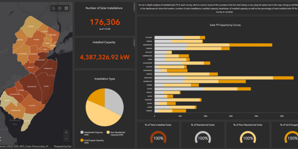
NJ County Solar PV Dashboard
The purpose of this dashboard is to provide a high level analysis of solar PV installations in New Jersey’s by county.
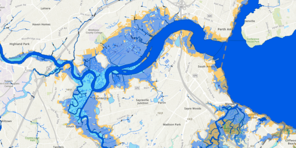
NJ FloodMapper
This is an interactive tool that allows users to conduct flood exposure analysis based on the best available science for sea-level rise and storm surge.
NJ Forest Adapt
This mapping tool identifies changes to temperature as well as changes to forest density, forest type, pests, and disease over time due to climate change.
NJ HazAdapt
This tool provides municipal and county hazard planners with easy access to data and resources that will assist with development of hazard mitigation plans.
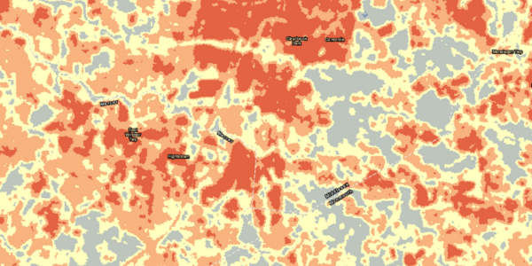
New Jersey-Specific Urban Heat Island (UHI) Mapping Resource
This web app allows users to view the surface temperature values within specific areas of interest (address, municipality, county) and to visualize land surface temperature (LST) values for New Jersey from the summer of 2022

New Jersey Work From Home Calculator
This is an interactive tool that can be used by individuals to find reductions in greenhouse gas emissions, particulate matter, gas consumption, and vehicle miles travelled by working from home.
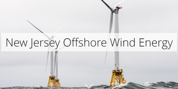
Offshore Wind Energy | Story Map
This story map was developed to provide background on the history of offshore wind in New Jersey.
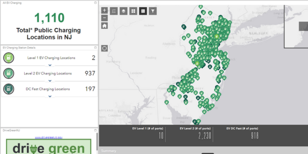
Public Electric Vehicle (EV) Charging Locator
This interactive map shows and overview of the current available public charging locations across New Jersey. Users of this map can click on each individual location for details on the charger types, address, and pricing if available.

Resilient NJ Local Planning for Climate Change Toolkit
This toolkit provides a compilation of guidance and resources to support local climate resilience planning, development of resilience action plans, and Municipal Land Use Law and Plan Endorsement requirements.
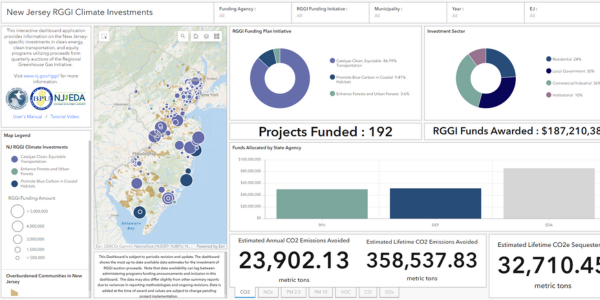
RGGI Climate Investments
This dashboard contains a number of different interactive charts and widgets with information about the climate investments being made by the NJDEP, NJBPU, and NJEDA utilizing funds obtained through quarterly auctions of the Regional Greenhouse Gas Initiative.
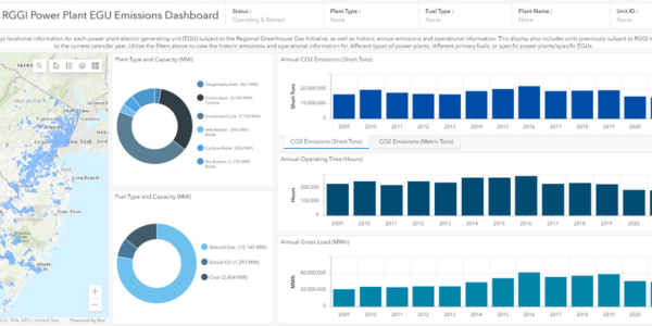
RGGI Power Plant Electric Generating Unit (EGU) Emissions
This dashboard displays locational information for each power plant electric generating unit (EGU) subject to the Regional Greenhouse Gas Initiative, as well as historic annual emissions and operational information.
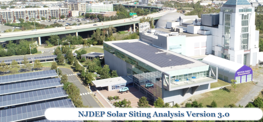
Solar Siting Analysis | Story Map (2024)
This tool was developed to aid local communities and potential solar developers in planning for solar installations by distinguishing between lands where the department encourages solar development from those where the department discourages solar development.
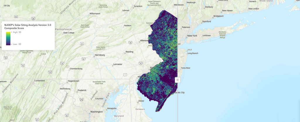
Solar Siting Analysis Web Application (2024)
This tool is an interactive web mapping application that illustrates the department’s preference for siting solar PV projects in the state based on the 2017 Solar Siting Analysis Update
Trees for Schools: Tree Planting Grant Assistance Tool
This web application was developed to support the “Trees for Schools: Tree Planting Grants for New Jersey Public Schools, Colleges & Universities” program, and the identification of public school locations that best meet the criteria for grant funds.
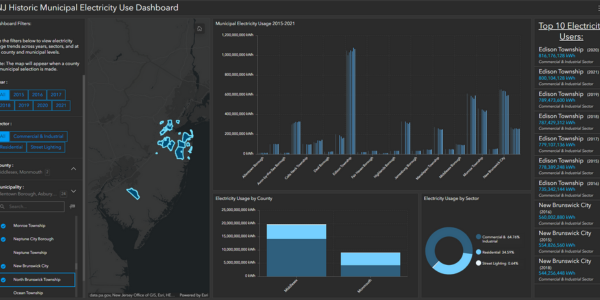
Municipal Electricity Usage
The purpose of this dashboard is to provide an overview of electricity usage trends across years, sectors, and at the county and municipal levels.
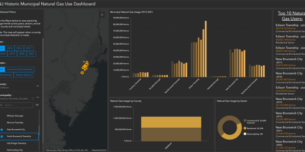
Municipal Natural Gas Usage
The purpose of this dashboard is to provide an overview of natural gas usage trends across years, sectors, and at the county and municipal levels.
Municipal Snapshots
The page provides easy access to information about the people, places, infrastructure, and assets that are at risk from flood-related climate change impacts in each municipality.