The mission of the Bureau of Evaluation and Planning is to protect human health and welfare by reducing the public’s exposure to criteria air pollution and toxic emissions.
The Planning Unit develops the State Implementation Plans to reduce criteria pollutant levels and maintain these levels at or below National Ambient Air Quality Standards (NAAQS), as well as improve visibility at our federal Class 1 Area at the Brigantine Wilderness Area of the Edwin B. Forsythe National Wildlife Refuge.
The Toxics Evaluation Unit evaluates the releases of air toxics in our state to ensure the permitted emissions are sufficiently low to protect public health.

State Implementation Plan (SIP) Dashboard
New Jersey’s State Implementation Plan (SIP) for air quality is the state’s plan for how it will attain or maintain compliance with the National Ambient Air Quality Standards (NAAQS).
National Ambient Air Quality Standards Regulatory Status in New Jersey
When a NAAQS is established or revised, the USEPA goes through a formal process to designate all areas of the country as either in attainment or in nonattainment.

Air Quality Risk Screening Tools
Learn about the risk assessment process, details on preparing a risk assessment, and accessing risk assessment tools associated with air permit applications.
Air Toxics
Learn about a large group of pollutants known as “Air Toxics” or “Hazardous Air Pollutants” and find the latest air toxics assessment for New Jersey.

Criteria Pollutant Air Emissions Inventories
New Jersey’s Bureau of Evaluation and Planning estimates and compiles inventories that consist of actual and projected (future estimated) air emissions for criteria pollutants.
What's Your Air Quality Today?
Information on USEPA’s Air Quality Index, Air Quality Forecast, Air Quality Alerts and ozone or fine particulate (PM2.5) exceedances.
What's New
- Final Five-year Progress Report for Regional Haze
- Proposed Five-year Progress Report for Regional Haze and Public Notice of 30-day Comment Period
- Air Quality Awareness Week, May 5 – May 9, 2025
- Final Equivalent Alternative Program Demonstration: Clean Air Act Section 185 Requirements for the Revoked 1-Hour Ozone National Ambient Air Quality Standard
- State Implementation Plan (SIP) Revision for Maintenance of the 2015 70 ppb 8-Hour Ozone, Moderate Classification
- New Jersey’s 2024 PM2.5 National Ambient Air Quality Standards Area Designation Recommendations
- Final State Implementation Plan (SIP): Incorporation of Adopted rules into the SIP for Advanced Clean Trucks Program (ACT), Advanced Clean Cars II program (ACCII), Omnibus and Medium Duty Diesel Vehicle Inspection and Maintenance
- Proposed State Implementation Plan (SIP) Revision: Memorandum of Agreement for the Implementation of New Jersey’s NOx State Implementation Plan (SIP) Call Requirements under 40 CFR 51.121(r)(2), Public Notice of Comment Period and Request for Public Hearing
- New Jersey Air Quality Flag Program
Air Quality Planning Information
What are the National Ambient Air Quality Standards?
The Federal Clean Air Act requires the United States Environmental Protection Agency (USEPA) to set National Ambient Air Quality Standards (NAAQS) for six common air pollutants. These commonly found air pollutants also known as “criteria pollutants” are particle pollution or particulate matter (PM), ground-level ozone, carbon monoxide (CO), sulfur dioxide (SO2), nitrogen dioxide (NO2), and lead. These pollutants can harm your health, the environment, and cause property damage. The USEPA calls these pollutants “criteria” air pollutants because it regulates them by developing human health-based and/or environmentally-based criteria (science-based guidelines) for setting permissible levels. Limits based on human health are called primary standards. The USEPA also can establish a second set of limits intended to prevent environmental and property damage, which are referred to as secondary standards. The Federal Clean Air Act further requires the USEPA to review and, if appropriate, revise the NAAQS for each criteria air pollutant every five years to ensure they continue to adequately protect human health and welfare.
What is ground-level ozone and how is it formed?
Ground-level ozone is an air pollutant known to cause a number of health effects and negatively impact air quality and the environment in the state of New Jersey. Ozone is formed when oxides of nitrogen (NOx) and volatile organic compounds (VOCs) react in the presence of sunlight. Ozone can irritate any set of lungs, but those with lung-related deficiencies should take extra precautions on bad ozone days.
Visit the link below to learn more about ozone and its health effects, and to view reports from days when New Jersey has exceeded federal ozone standards.

What is particulate matter?
Particulate matter is the term for particles found in the air, including dust, dirt, soot, smoke, and liquid droplets. Many manmade and natural sources emit particulate matter directly or emit other pollutants that react in the atmosphere to form particulate matter. Sources of fine particles include all types of combustion activities (motor vehicles, power plants, wood burning, etc.) and certain industrial processes. Other particles may be indirectly formed when gases from burning fuels react with sunlight and water vapor.
Particles less than 10 micrometers in diameter (PM10) pose a health concern because they can be inhaled into and accumulate in the respiratory system. Particles less than 2.5 micrometers in diameter, PM2.5 are referred to as “fine” particles and are believed to pose the greatest health risks. Because of their small size (approximately 1/30th the average width of a human hair), fine particles can lodge deeply into the lungs. Particles with diameters between 2.5 and 10 micrometers are referred to as “coarse.”
Health studies have shown a significant association between exposure to fine particles and premature death. Other important effects include aggravation of respiratory and cardiovascular disease (as indicated by increased hospital admissions, emergency room visits, absences from school or work, and restricted activity days), lung disease, decreased lung function, asthma attacks, and certain cardiovascular problems such as heart attacks and irregular heart beat. Individuals particularly sensitive to fine particle exposure include older adults, people with heart and lung disease, and children. Roughly one out of every three people in the United States is at a higher risk of experiencing PM2.5 related health effects: active children because they often spend a lot of time playing outdoors and their bodies are still developing and oftentimes the elderly population is at risk.
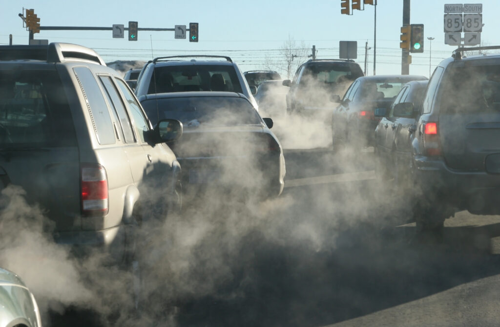
What is mobile source planning?
The mobile source planning group within Air Quality Planning is responsible for estimating emissions of criteria air pollutants from mobile sources for State Implementation Plans (SIPs) and evaluating ways to reduce air pollution. Mobile sources consist of on-road vehicles, including cars, trucks, buses and motorcycles, and non-road vehicles and equipment, such as airplanes, locomotives, commercial marine vessels, recreational watercraft, lawn and garden equipment, forklifts, and construction equipment.
What is regional air quality modeling?
The Clean Air Act (CAA) and federal regulations require that states use atmospheric photochemical grid modeling as part of their demonstration of attainment of the National Ambient Air Quality Standards (NAAQS) by the required attainment date. The United States Environmental Protection Agency (USEPA) modeling guidance also recommends this approach and provides more detailed recommendations. Atmospheric modeling is also used to estimate significant contributions of transported emissions and for Regional Haze plans.
Under the coordination of the Ozone Transport Commission (OTC) Modeling Committee, New Jersey works together with several northeast states to perform regional modeling runs and contribute to the preparation of technical information for the regional modeling efforts. New Jersey also participates in the Mid-Atlantic Northeast Visibility Union (MANE-VU) whose focus is on the development of regional strategies for air pollution control to reduce visibility impairment in our national parks and wilderness areas. New Jersey works with other states as a part of the Mid-Atlantic Regional Air Management Agency (MARAMA) Mid Atlantic Regional Air Management Association – MARAMA and USEPA to develop the regional air emission inventories used in the regional modeling. Through these regional efforts, the contribution of transported air pollution is estimated, and regional air pollution control strategies are developed.
New Jersey also coordinates regional modeling studies with the Ozone Research Center of Rutgers University.
New Jersey’s location along the northeast corridor between major metropolitan areas, along with meteorology, makes New Jersey the recipient of air pollutants transported from other States. Westerly winds from the Ohio River Valley and nighttime reservoirs of pollutants from southern States along the Appalachian Mountain Range have been shown to contribute to high ozone and fine particulate concentrations in New Jersey. To learn more about interstate air pollution transport see Interstate Air Pollution Transport | US EPA.
Wood Burning in New Jersey
Many people use wood burning as a primary or supplemental heat source for their homes. A growing trend is to burn wood in yards for recreational reasons. Fire pits and chimeneas have become increasingly popular. Another source of wood smoke comes from outdoor wood boilers used to heat hot water that in turn heats the home, swimming pools, greenhouses, etc. Wood is a renewable energy source, however, burning wood can impact public health and welfare.

What can I do to reduce air pollution?
From carpooling to watching your thermostat, there are many things you can do to reduce air pollution. Visit the link below for pollution-preventing tips and tricks you can use on the road, at the office, and in your home.
Glossary and Acronyms
Not sure what a term means? Check our Glossary and Acronyms page to find out!
Get Involved
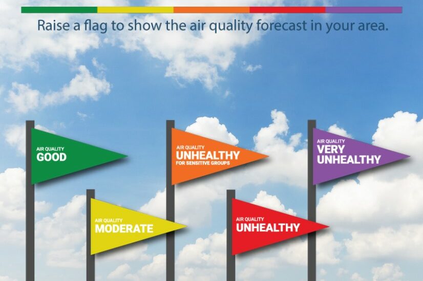
NJ Air Quality Flag Program
The New Jersey Air Quality Flag Program uses brightly colored flags that correspond to the U.S. Environmental Protection Agency’s Air Quality Index to communicate air quality in your community.

Air Quality Awareness Week
New Jersey typically joins EPA in celebrating Air Quality Awareness Week during the month of May. Each day of Air Quality Awareness Week offers new information and resources to help New Jersey residents learn about Air Quality.
Sign Up for Air Quality Alerts with EnviroFlash
Get notifications about your air quality via email or text with Enviroflash!

Email Notifications for Rule and SIP Updates
Subscribe to receive email updates of proposed, new, or modified regulations of New Jersey’s Administrative Code for air pollution controls and proposed or final State Implementation Plan changes.
Contact Us
PLANNING UNIT
DEP-Air Quality Planning
401 E. State Street, 2nd Floor
Mail Code 401-02
P.O. Box 420
Trenton, NJ 08625-0420
Phone: (609) 292-6722
Fax: (609) 292-1028
Email: NJDEP-BAQP@dep.nj.gov
TOXICS EVALUATION UNIT
DEP-Air Quality Evaluation
401 E. State Street, 2nd Floor
Mail Code 401-02
P.O. Box 420
Trenton, NJ 08625-0420
Phone: (609) 292-6722
Fax: (609) 292-1028