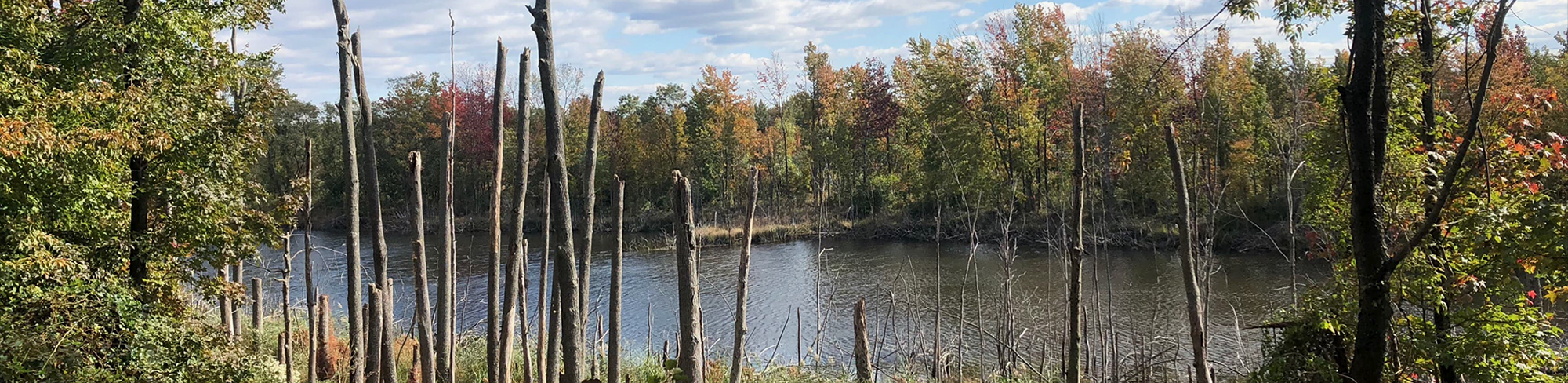
What is a Flood Hazard Area?
The Flood Hazard Area is the land, and the space above that land, which lies below the flood hazard area design flood elevation. The flood hazard area design flood elevation is a flood equal to the 100-year flood plus an additional amount of water in fluvial areas to account for possible future increases in flows due to development or other factors. This additional amount of water also provides a factor of safety in cases when the 100-year flood is exceeded. Structures, fill, and vegetation that are situated on land that lies below the flood hazard area design flood elevation are described as being “in” or “within” the flood hazard area. The inner portion of the flood hazard area is called the floodway and the outer portion of the flood hazard area is called the flood fringe. There are two types of flood hazard areas:
- Tidal flood hazard areas, in which the flood hazard area design flood elevation is governed by tidal flooding from the Atlantic Ocean. Flooding in a tidal flood hazard area may be contributed to or influenced by stormwater runoff from inland areas, but the depth of flooding generated by the tidal rise and fall of the Atlantic Ocean is greater than flooding from any fluvial sources; and
- Fluvial flood hazard areas, in which the flood hazard area design flood elevation is governed by stormwater runoff. Flooding in a fluvial flood hazard area may be contributed to or influenced by elevated water levels generated by the tidal rise and fall of the Atlantic Ocean, but the depth of flooding generated by stormwater runoff is greater than flooding from the Atlantic Ocean.
Pursuant to N.J.A.C. 7:13-2.3, a flood hazard area and a riparian zone exist along every regulated water that has a drainage area of 50 acres or more. If a regulated water has a drainage area of less than 50 acres, the water does not have a flood hazard area that is regulated under the Flood Hazard Area Control Act rules. However, it may still have a riparian zone. The flood hazard area is comprised of a flood fringe and a floodway, except for the Atlantic Ocean and other non-linear tidal waters such as bays and inlets, which do not have a floodway. Therefore, the entire flood hazard area along these tidal waters is considered to be a flood fringe. The methods for determining the limits of the flood fringe and floodway are described at N.J.A.C. 7:13-5.1 et seq.
Technical Manual
The FHACA Rules are designed to be both highly descriptive and, to a certain extent, prescriptive. All the design and construction standards related to undertaking a regulated activity in a flood hazard area or riparian zone are contained within the various sections of the rules. The purpose of this manual, which is one of a series of technical manuals produced by the Department in accordance with N.J.S.A. 13:1D-111 et seq., is to assist applicants in obtaining any approvals that may be necessary for an activity under the jurisdiction of the FHACA Rules. The material presented here is intended to explain the standards of the rules and to provide guidance on how to meet those standards. This manual is in no way intended to replace or supersede these standards. Should material in this manual conflict with a requirement of the FHACA Rules, the rules will govern.
View the Flood Hazard Area Technical Manual.
Riparian Zones
Research has shown that the vegetated areas adjacent to a watercourse provide a variety of significant functions and values, such as reducing adverse effects to water quality by removing nutrients and pollutants from storm runoff, moderating storm flows to streams providing flood storage capacity (which reduces downstream flooding), and stabilizing soils and stream banks naturally.
With a few exceptions, a riparian zone exists along every regulated water. The riparian zone is the land and vegetation within a regulated water and extending either 50 feet, 150 feet or 300 feet from the top of bank along both sides of the regulated water, depending on the environmental sensitivity of the water.
Flood Fringe
The flood fringe is the part of the flood hazard area that is outside of the floodway. The flood fringe is normally characterized by shallower water with little or no visible flow.
Development within the flood fringe is restricted, but to a lesser degree than the floodway. Generally, most development projects can occur within the flood fringe as long as the project causes little or no adverse impacts to the on-site flood storage and new structures have a lowest floor elevated to at least 1 foot above the flood hazard design flood elevation.
The flood hazard area is comprised of a flood fringe and a floodway, except for tidal waters such as bays and inlets, which do not have a floodway. Therefore, the entire flood hazard area along these tidal waters is considered to be a flood fringe for the purposes of this chapter. “Flood fringe” means the portion of the flood hazard area that is outside the floodway
The methods for determining the limits of the flood fringe and floodway are described at N.J.A.C. 7:13-5.
The regulations governing construction within the flood fringe are available at N.J.A.C. 7:13-11.4.
Floodway
The Floodway is defined as land, and the space above that land, which lies within the inner portion of the flood hazard area, and which is mathematically determined to be required to carry and discharge floodwaters resulting from the 100-year flood under certain conditions. The floodway always includes the channel and often includes land adjacent to the channel. The floodway is normally characterized by faster and deeper flows than the flood fringe, which is the portion of the flood hazard area outside the floodway.
Development within the floodway is severely restricted. Generally, only development that must occur within the floodway is permitted, such as bridges, culverts, outfalls, retaining walls, water control structures, or bank stabilization measures. New buildings are prohibited in the floodway (except on piers in the Hudson River). Buildings are prohibited in the floodway not only to protect those members of the public that could be present in the building during a flood, but also to protect other members of the public (or other pre-existing structures) downstream from floating debris that could result from construction within the floodway. The regulations governing construction within the floodway are located at N.J.A.C 7:13-11.3.
When planning construction within the floodway, there are other portions of the Flood Hazard Area Control Act Rules to consider. Separate standards must be considered for work proposed in a channel or the riparian zone. Depending upon the nature of the project, specific standards may apply.
It is important to note that the floodway may also be located within the jurisdictional boundaries of other rules implemented by the Division. Therefore, additional rules that may need to be addressed include the Freshwater Wetlands Protection Act rules (N.J.A.C. 7:7A), the Coastal Zone Management Rules (N.J.A.C. 7:7), the Highlands rules (N.J.A.C. 7:38), and the Stormwater Management rules (N.J.A.C. 7:8).
The location of a floodway can be determined using one of the methods outlined in the verification section of the rules at N.J.A.C. 7:13-5.
Types of Flood Hazard Area Authorizations
Verification:
When obtaining an individual permit or general permit, it is often necessary to know the limits of the flood hazard area, floodway, and/or riparian zone. When those limits are unknown, such as along a watercourse that has no available floodplain mapping, a verification can be used to determine those limits.
A verification is a document containing the Department’s approval of the flood hazard area design flood elevation on a site, includes either a flood hazard area limit or an indication that the entire site is in a flood hazard area, and may also include a floodway limit and/or a riparian zone limit, if applicable. There are six methods acceptable for use in determining the flood hazard area and floodway (see N.J.A.C. 7:13-3), and three possible riparian zone widths (See N.J.A.C. 7:13-4). A verification is issued in accordance with the standards in N.J.A.C. 7:13-5. See the “Forms and Checklists” page of this website for the verification application checklist.
Please be aware that in some cases a verification is required prior to or concurrent with a permit application. Generally, a verification is not required when applying for an applicability determination, or a general permit-by-certification or conducting work under a permit-by-rule. When applying for an individual permit or general permit, a verification may be required. The cases where a verification is or is not required prior to or concurrent with an individual or general permit application are explained at N.J.A.C. 7:13-5.5.
Method 1
This method is used when a Department delineation exists along the watercourse. A list of Department delineations is available in appendix 2 of the Flood Hazard Area Control Act Rules (N.J.A.C. 7:13). The Flood Hazard Area Elevation and the Floodway are taken directly from the available mapping under this method.
Method 2
This method is used when the watercourse in question is tidal and has available FEMA mapping that shows the 100-year tidal flood elevation. Under this method, the tidal 100-year flood elevation and the floodway are taken directly from the FEMA mapping. If a floodway is not shown, it is assumed to be at the top of bank for linear waterways. If a 100-year flood elevation is not shown, this method cannot be used.
Method 3
This method is used when the watercourse in question is fluvial and has available FEMA mapping that shows the 100-year fluvial flood elevation. Under this method the floodway is taken directly from the available mapping and one foot is added to the 100-year flood elevation. If a floodway is not shown on the mapping, it could be left unknown if not needed or must be calculated using method 4. It cannot be assumed to be at the top of bank under this method. If the 100-year flood elevation is not shown, this method cannot be used.
Method 4
This method is generally only used when the applicant wishes to compare pre and post condition water surface elevations, such as for the construction of a bridge. In tidal areas, the 100-year FEMA flow rate is used directly and in fluvial areas the FEMA 100-year flow rate + 25% is used. If no FEMA 100-year flow rate is available, this method cannot be used.
Method 5
This method is conservative and is used to approximate an unknown flood hazard area. However, since the determination is approximate is can only be used in certain circumstances, which are outlined at N.J.A.C. 7:13-9.7. The details of this method are available in appendix 1 of the Flood Hazard Area Control Act Rules (N.J.A.C. 7:13).
Method 6
Under this method the applicant calculates the flood hazard area and floodway using hydrologic and hydraulic calculations. This method can be used under all circumstances, except where a Department delineation for a regulated water has been promulgated on or after January 24, 2013. In such a case the applicant must use that Department delineation under method 1. The specific methods of calculation under this method must follow Division accepted methodology. The use of the DelMarVa unit hydrograph should be limited to stormwater runoff calculations where appropriate and should not be used for floodplain delineation under this method.
A riparian zone is the land and vegetation within and adjacent to a regulated water. A riparian zone exists along every regulated water, except there is no riparian zone along the Atlantic Ocean nor along any manmade lagoon, stormwater management basin, or oceanfront barrier island, spit or peninsula. When determining the limits of the riparian zone on-site, there are two steps. First, you must determine the riparian zone width. Second, you must determine from where to measure that width.
Determining the Riparian Zone Width
The width of the riparian zone along each regulated water on-site is as follows:
- The riparian zone is 300 feet wide along both sides of any Category One water, and all upstream tributaries situated within the same HUC-14 watershed;
- The riparian zone is 150 feet wide along both sides of the following waters not identified in 1 above:
- Any trout production water and all upstream waters (including tributaries);
- Any trout maintenance water and all upstream waters (including tributaries) within one linear mile as measured along the length of the regulated water;
- Any segment of a water flowing through an area that contains documented habitat for a threatened or endangered species of plant or animal, which is critically dependent on the regulated water for survival, and all upstream waters (including tributaries) within one linear mile as measured along the length of the regulated water; and
- Any segment of a water flowing through an area that contains acid producing soils; and
- The riparian zone is 50 feet wide along both sides of all waters not identified in 1 or 2 above.
Determining How the Riparian Zone is Measured
The riparian zone is measured landward from the top of bank where a discernible bank is present. However, if a discernible bank is not present the following standards apply:
- Along a linear fluvial or tidal water, such as a stream, the riparian zone is measured landward of the feature’s centerline;
- Along a non-linear fluvial water, such as a lake or pond, the riparian zone is measured landward of the normal water surface limit;
- Along a non-linear tidal water, such as a bay or inlet, the riparian zone is measured landward of the mean high water; and
- Along an amorphously-shaped feature, such as a wetland complex, through which a regulated water flows but which lacks a discernible channel, the riparian zone is measured landward of the feature’s centerline.
Permit-By-Rule
Each permit-by-rule specifically describes the regulated activity authorized, including the size and type of regulated activity and in some cases where in the flood hazard area and riparian zone the regulated activity may be conducted. If it is unclear whether a particular activity is regulated, the Department encourages applicants to obtain an applicability determination under N.J.A.C. 7:13-2.5 prior to commencing work. Unauthorized regulated activities may result in enforcement action pursuant to N.J.A.C. 7:13-24.
The table below organizes the 62 permits-by-rule into distinct categories. Each permit-by-rule specifically describes the regulated activity authorized, including the size and type of regulated activity and in some cases where in the flood hazard area and riparian zone the regulated activity may be conducted.
General Permits:
Public notice is required for an application for a general permit authorization and the application fee for a general permit is $1000.00 (except for general permit 1 at N.J.A.C. 7:13-9.1, general permit 4 at N.J.A.C. 7:13-9.4 and general permit 5 at N.J.A.C. 7:13-9.5 for which there is no application fee).Â
A 90-day review period applies to general permit applications, except for general permit 1 at N.J.A.C. 7:13-9.1, which has either a 15-day or 60-day review. An authorization under a general permit will be automatically approved if the Department does not reject or deny the application within 90 days of the receipt of a complete application. It is important to note that multiple or repeated activities on a site, which may individually qualify for authorization under a general permit, require an individual permit if the cumulative impacts exceed any limit contained in the applicable general permit.
This list of General Permits provides a brief description of each permit. For detailed information, go to the rules at N.J.A.C. 7:13-9.
Individual Permits:
If an applicant cannot perform a regulated activity or project under the criteria for a permit-by-rule, general permit-by-certification, or general permit, they have the option of applying for an individual permit. The Flood Hazard Area Control Act Rules at N.J.A.C. 7:13 set forth standards for the issuance of an individual permit associated with the location and type of the regulated activity or project.
General requirements for individual permits are located at N.J.A.C. 7:13-10. These provisions include the requirement to obtain an individual permit for activities that are not authorized under other types of permits and the duration of individual permits. Most individual permits are valid for five years, with the possibility of one five year extension. Individual permits for a linear development greater than ten miles in length, a flood control project, or a quarry or mining operation are valid for ten years and may not be extended.
Standards associated with the location of a project in a particular regulated area, such as a channel, riparian zone, or floodway, or the location of the project in relation to certain natural resources, are set forth at N.J.A.C. 7:13-11. These provisions set forth specific requirements and disturbance limits depending on the location and type of the activity.
Design and construction standards associated with a particular regulated activity, are set forth at N.J.A.C. 7:13-12.
A regulated activity that requires an individual permit is typically subject to multiple requirements that are set forth throughout N.J.A.C. 7:13-11 and 12 as described above. The applicant shall evaluate each regulated activity according to its location, nature, and potential impacts in order to determine which design and construction standards will apply to the applicant’s particular project. Please see the relevant section of the rules and contact the Division for more information. Applicants are encouraged to request a pre-application meeting for more complex permit authorizations.
Emergency Permits:
While many activities and projects are authorized under flood hazard general permits-by-certification, general permits, or individual permits, emergency situations sometimes make it impossible to undergo the full permitting process before starting activities. In these cases, the Department may issue an emergency authorization. The standards for issuance of an emergency authorization are located at N.J.A.C. 7:13-16. Refer to this subchapter for all applicable requirements.
As established by N.J.A.C. 7:13-16.1, the Department will issue an emergency authorization only if the person seeking such authorization demonstrates that a threat to life, severe loss of property, or environmental degradation exists or is imminent, and the threat, severe loss, or degradation:1. Can only be prevented or ameliorated through undertaking a regulated activity; and2. Is likely to occur, persist, or be exacerbated before the Department can issue an authorization under a general permit or an individual permit for the preventive or ameliorative activity.
Requirements
Requirements for the issuance of an emergency permit are located at N.J.A.C. 7:13-16.2.
An applicant for an emergency permit must provide the Department with the following information by telephone, and in addition by fax, electronic mail or letter, if possible:
- The name, address, and contact information for the owner(s) of the property where the activity will take place and for the owner(s) of any other properties affected;
- A demonstration that the property owner(s) have given permission for the proposed activity;
- The location of the property;
- The nature and cause of the threat to life, severe loss of property, or environmental degradation;
- The date and time the person requesting the emergency authorization became aware of the threat;
- The nature and extent of the proposed regulated activity;
- The proposed start and completion dates of the activity;
- Photographs of the area where the activity will be conducted;
- If possible, a site plant showing the proposed activity and anticipated impacts to flood hazard areas and riparian zones; and
- Any other information necessary to demonstrate compliance with the Flood Hazard Area Control Act Rules.
Public notice and an application fee are not required at the time of the emergency authorization request, but are required with the permit application submitted after the completion of emergency authorization activities.
If all conditions are met, the Director of the Division of Land Resource Protection, or the Director’s designee, will provide verbal approval of the necessary activities. This verbal approval will be followed within five working days by a written confirmation of the emergency authorization from the Department. Within 20 days of the verbal decision, the Department will publish notice of the emergency authorization in the DEP Bulletin.
After Issuance
The approved emergency activities must be commenced within 30 calendar days after the Department’s verbal approval of the emergency permit, unless a different timeframe is specifically established by the Department. If the emergency activities are not commenced within the applicable timeframe, the emergency authorization will expire.
All regulated activities authorized under the emergency authorization shall be completed within 60 calendar days of the Department’s verbal approval, unless a different timeframe is established by the Department. If the regulated activities authorized under the emergency permit are not completed in the applicable timeframe, these regulated activities must cease until an individual permit, general permit authorization, or another emergency authorization is obtained from the Department.
An emergency authorization may be modified or terminated at any time if the Department determines that it is necessary to do so to protect public health, safety, and welfare, and/or the environment.
The permittee must submit to the Department a complete application for an individual permit or a general permit authorization for the completed activities within 90 calendar days of the Department’s verbal approval of the emergency permit, unless extended different timeframe is established by the Department. The application must include the following, in addition to the application requirements for the general permit authorization or individual permit:
- A demonstration that the regulated activities conducted under the emergency authorization comply with this chapter, or an explanation of why full compliance could not be achieved; and
- “As-built” site plans, signed and sealed by a engineer, land surveyor or architect, as appropriate, showing the regulated activities that were conducted under the emergency permit.
Upon review of this application, the Department may require design changes, restoration, and/or stabilization measures as necessary. Be aware that if any regulated activities not authorized under the emergency authorization or subsequent permit are conducted that such activities constitute a violation of the Flood Hazard Area Control Act Rules subject to enforcement action.
General Permit-By-Certification:
(GPBC) allows an applicant to apply for and receive a permit utilizing the Department’s “DEP Online” system. Currently, there are 15 Flood Hazard GPBC’s available through this system. The list below provides a brief description of each permit.