Background
Bureau of Coastal & Land Use Compliance & Enforcement (CLUE) staff investigate and inspect sites for compliance with NJDEP issued land use permits, but primarily they respond to incident reports involving potential land use violations within regulated freshwater and coastal wetlands, wetland transition areas, flood hazard areas, stream channels and their riparian zones, waterfront development areas, the CAFRA zone and highlands preservation areas. On average, the Bureau receives approximately 1,100 such incident reports each year. The majority of these incidents result in a finding of no regulated activities or activities with minimal impact.
For those sites where CLUE staff do confirm that unauthorized impacts have occurred within regulated areas, the Bureau issues enforcement action documents such as Notices of Violation or Administrative Orders, and require the responsible party to either obtain a land use permit, implement restoration of the damaged resource, or a combination of both.
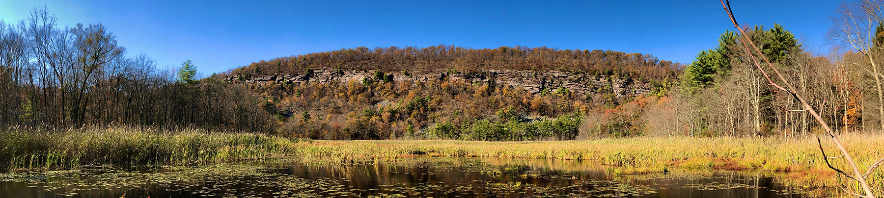
The following are examples of various restoration sites throughout New Jersey, with available before and after photographs. In some cases, photographs taken during the implementation phase of the restoration project are included. To better illustrate the scope of the larger restoration project sites, aerial imagery has been included. Some of these sites required great efforts by enforcement staff and sometimes years of litigation before the restoration projects were implemented and satisfactorily completed.
Atlantic County
15 Acre Freshwater and Coastal Wetlands Restoration, Atlantic County


- Subsequent investigation and field inspections by CLUE and the Army Corps of Engineers representatives confirmed that a property owner had impacted a large area of both freshwater wetlands and mapped coastal wetlands. In addition, waterfront development and tidelands violations were also discovered along the River in the form of unauthorized docks and piers.
- The wetland impacts involved the mechanized clearing of scrub-shrub and maritime forested wetlands, the construction of an access road and earthen dam across a tidal creek and subsequent flooding of over 15 acres of freshwater tidal wetlands. The unauthorized activity also impacted approximately 14,000 square feet of mapped coastal wetlands.
- A Notice of Violation was issued to the property owner in 2015, followed up by an Administrative Order and Penalty Assessment in 2016. In 2018 the Army Corps also instituted an enforcement action, via the U.S. Attorney for the District of New Jersey, for Clean Water Act violations. The property owner engaged the services of environmental consultants to prepare permit applications for certain minor authorizable activities and a restoration plan for the remainder.
- In 2020 both CLUE and the Army Corps reached settlement agreements with the property owner and the jointly approved restoration plan was implemented. Restoration involved the complete removal of dredge or fill material including the fill used for the access road and dam structure, draining of the pond and the complete revegetation of the areas of impact.
- In 2022, the Division of Land Resource Protection issued permits authorizing certain activities within the waterfront development area. As of 2023, the areas where remediation activities were carried out were found to have been satisfactorily restored with near 100% aereal vegetative cover. CLUE will continue to monitor the site into the future.
Bergen County
Wetlands Restoration, Northern Bergen County


- In 1991, the Department’s Bureau of Coastal and Land Use Enforcement (CLUE) received several reports concerning the recent clear-cutting of trees, filling and grading within freshwater wetlands associated with Muddy Brook on a parcel of land located between the Pascack Valley rail line and the brook.
- Inspection by CLUE personnel confirmed that these activities had occurred in regulated areas including within approximately 27,000 square feet of wetlands. A Notice of Violation was issued to the property owner in September 1991.
- Subsequent enforcement actions and litigation, including an Administrative Order and Penalty Assessment in February 1992, culminated in Commissioner Shinn’s Final Order of April 1996 and the Appellate Division’s July 1997 affirmation of the said order. At that point, the property owner engaged the services of environmental professionals to conduct field investigations and create a site plan and restoration proposal for CLUE’s review and approval.
- In 1999 a wetlands restoration plan was approved by CLUE and the project, involving the removal of 18 to 48 inches of fill material and replanting and seeding was completed that year. A total of 50 tree saplings including Red Maple and Green Ash, and 40 shrub species including Red-osier Dogwood, Northern Arrowwood and Spicebush were planted.
- By 2001 the restoration was found to have successfully provided greater than 85% areal vegetative coverage within the restoration area. Twenty years later in 2019, the entire site has through successional growth become a forested wetland again. It is noted that in subsequent years Muddy Brook, being a tributary to the Woodcliff Lake and Oradell Reservoirs, was re-classified by NJDEP for water purity status to a Category 1 Water.
Burlington County
12-Acre Wetlands/Transition Area/Riparian Zone Restoration & Conservation Restriction at a Burlington County Farm


- In the fall of 2006, the Bureau of Coastal and Land Use Enforcement (CLUE) received reports from county and municipal officials concerning recent clearing, filling and grading activities at a large horse farm.
- An initial inspection and subsequent investigation confirmed that approximately 12 acres of wetlands and wetland transition area, including approximately 1 acre of riparian zone along Crafts Creek, had been impacted by land disturbance activities after 1995. Filling and grading with several feet of soil, had occurred within approximately 2.1 acres of the wetlands and transition area, including a portion of riparian zone. The remainder of the regulated area disturbances consisted primarily of clearing of vegetation.
- A Notice of Violation was issued to the farm owner in January 2007. Six months later an Administrative Order with Penalty Assessment was issued by CLUE, requiring complete restoration of the regulated areas at the site.
- In October 2012, the Department executed an Administrative Consent Order (ACO) with the property owner, which required implementation of an approved restoration plan that had been prepared by an environmental professional. The plan proposed to restore 2.1 acres by fill removal and plantings while another 10 acres of degraded wetlands would be enhanced via soil preparation and plantings.
- Fill removal and restoration work began in the Spring of 2013 and was completed by the early summer. After removal of approximately 8,000 cubic yards of fill soils the restoration areas were planted with a total of 96 trees and shrubs plus a wetland seed mix. The larger enhancement area was planted with a total of 1,425 trees and shrubs plus a wetland seed mix.
- The ACO also required the recording of a Conservation Restriction for all restoration and enhancement areas totaling 12.12 acres. The Conservation Restriction was filed with and recorded by the County Clerk in 2013.
Gloucester County
Wetland Clearing and Filling in Gloucester County


- In 2006 an incident was reported to CLUE involving recent clearing and filling activities possibly within wetlands at a large property in Monroe Township, Camden County.
- Inspections and investigation confirmed that approximately 5.3 acres (231,000 square feet) of wetlands had been cleared and filled with soil, gravel and concrete rubble. A Notice of Violation was issued to the property owner/responsible party (PO/RP).
- In 2007, the Department issued an Administrative Order with Penalty Assessment requiring complete restoration of the wetlands at the site.
- In 2012, the Department entered into an Administrative Consent Order with the PO/RP, wherein they would implement a restoration plan that had been prepared by an environmental consultant the previous year.
- Implementation of the restoration plan began in 2013, with the removal of fill from the vast majority of the affected area.
- After a number of growing seasons, it was determined that the restoration was not entirely successful in re-establishing wetland hydrology in all areas, and that removal of an additional 6-12 inches of soil would be necessary. An updated restoration plan was provided by the PO/RP’s consultant.
- The scraping off of the additional 6-12 inches of fill soil was implemented in 2019.
- In 2022, PO/RP removed fill material from the last remaining unrestored area, approximately 20,000 square feet.
- CLUE will continue to monitor the restoration area for several more years to ensure that there is 85% or greater areal vegetative coverage. While a significant portion of the restoration area has been colonized by Phragmites Australis, natural reforestation has been occurring (Black Willow, Sweetgum & Red Maple) which will eventually shade out the Phragmites.
2.7 Acre Wetlands and Flood Hazard Area Restoration, Gloucester County


- In early 2020 the Department’s Division of Land Resource Protection (DLRP) received a wetlands application from a contract purchaser warehouse developer. Review by DLRP professional staff revealed soil anomalies and the proposed wetland delineation did not match existing conditions.
- A joint investigation by DLRP and Land Use Enforcement staff, including close examination of a progression of aerial imagery between 2015-2020, revealed that a large-scale clearing, excavation and filling operation had occurred during 2017-18, mostly eliminating the wetland feature that had existed in 2015, totaling approximately 2.7 acres.
- A Notice of Violation was issued in April 2020. In response, the developer who by now had purchased the various parcels for its warehouse development, offered to remove all fill material and restore the wetland to its approximate pre-existing condition.
- In December 2020, the Department entered into an Administrative Consent Order with the developer, wherein they would implement a restoration plan that had been prepared by their environmental consultant.
- Fill removal and restoration work began in Spring 2021 and was completed by the early summer, including the planting of 495 trees and shrubs .
- DEP staff will continue to monitor the restoration site to ensure that restoration parameters are met, including the requirements for at least 85% areal vegetative cover and at least 85% survival of woody plantings.
Mercer County
Wetland Clearing/Partial Filling in Mercer County


• In the Spring of 2017, CLUE received a self-reported incident in which the responsible party volunteered that a contractor’s work crew had machine-cleared approximately 7.8 acres of wetlands, including 1.5 acres located within the riparian zone of a small tributary stream.
• An April 2017 site visit confirmed the activity, and a Notice of Violation was issued to the responsible party.
• The responsible party’s environmental consultant prepared a detailed restoration plan, and upon NJDEP approval, it was implemented between November 2018 –January 2019.
• Over 400 native trees and 600 shrubs were planted, and 1.2 linear miles of perimeter herbivory (deer) fence was installed to prevent browsing damage. Native seed mix was also applied throughout the area. An invasive species control program was also instituted.
• Within a year, the restoration was found to have successfully provided greater than 85% areal vegetative coverage as well as greater than 85% survival of woody plantings within the restoration area.
11 Acre Stream Corridor Restoration in West Windsor Township, Mercer County


- In the Fall of 1988, an incident was reported to CLUE involving recent land clearing as well as major excavation activities involving impacts to a stream channel.
- An October 12, 1988, inspection confirmed that recent excavations had resulted in the relocation of approximately 1,200 feet of the channel of Duck Pond Run, a tributary to Bear Swamp and Stony Brook in the Raritan River Watershed, as well as impacts to an unknown area of freshwater wetlands. See Polaroid photo below of a segment of the newly excavated stream channel.
- A Notice of Violation was issued to the property owner by DEP on October 26, 1988.
- Because of the extensive unstable condition of the soil disturbances over many acres, the local Soil Conservation District as well as the State Soil Conservationist became involved in requiring immediate stabilization measures as well as assisting the property owner’s engineer in crafting a robust restoration plan.
- Through an enforcement settlement in 1989 that also included payment of a penalty, a restoration plan was approved and implemented by the property owner. The stream channel area was regraded to much reduced side-slopes, and the area stabilized and seeded. One section of stream at the intersection of the piedmont and coastal plain was armored to prevent erosion during high water events.
- In 2001 the entire 213-acre tract was acquired from the developer-owner by the Township of West Windsor and is now part of a 540-acre greenway that includes Duck Pond Park and Great Blue Heron Preserve.
- Over the 25+ years since the restoration project was completed, the entire 10-11 acres that had been cleared of forest cover has regenerated, and Duck Pond Run is protected by a 150-300-foot-wide forested riparian zone
Morris County
Floodway Restoration in Morris County


- Initial Inspection in 2001 revealed a large volume of fill had recently been placed and graded within the floodway of the Passaic River, with a portion extending into the State open waters of the River. A Notice of Violation was issued to the property owner/responsible party (PO/RP).
- With the aid of the Attorney General’s office, some progress was made towards the development of a restoration plan.
- Soon after January 2008 passage of the Environmental Enforcement Enhancement Act (EEEA), the Department issued an Administrative Order with Penalty Assessment to the PO/RP.
- In 2013, the Department entered into an Administrative Consent Order with the PO/RP, wherein they would implement a restoration plan that had been prepared by an environmental consultant with extensive guidance from CLUE personnel and the Morris County Soil Conservation District.
- Restoration work involved first the removal of approximately 2,000 cubic yards of fill material from the floodway. Final grade, tree and shrub plantings and seeding of the area were completed in the Fall of 2013.
- The restoration was found to be satisfactory and the case was closed in 2016.
Floodway & Riparian Zone Restoration in Morris County


- Initial inspections in 2004 revealed ongoing clearing of vegetation, filling and grading on several acres within the floodway of the Rockaway River and Beaver Brook and associated riparian zone. The fill was later found to contain low levels of polyaromatic hydrocarbons (PAH’s) which precluded normal removal and disposal but would require the soil material to be disposed of at a landfill.
- Notices of Violation were issued to the property owner and an additional responsible party.
- Litigation over liability ensued between the property owner and the additional responsible party, which was not resolved until 2012.
- In 2008 the Department issued an Administrative Order with Penalty Assessment to all responsible parties requiring removal of fill and restoration of the affected areas.
- Litigation, with frequent settlement discussions, ensued between the Department and the responsible parties and continued until a Final Order was issued by the Commissioner in January 2019. The Final Order reiterated the requirement for fill removal and restoration of affected areas.
- In March 2020, the Department entered into an Administrative Consent Order with the property owner, wherein they would implement a restoration plan that had been previously prepared by an environmental consultant.
- Fill removal and restoration work began in Spring 2020 and was completed by midsummer. Approximately 3,100 cubic yards of slightly contaminated material (“dirty dirt”) was removed from the floodway and riparian zone and transported to a landfill for disposal.
- During the 2021 growing season, the restoration was found to have successfully provided greater than 85% areal vegetative coverage within the restoration area. Periodic monitoring will continue.
Flood Plain and Wetlands Restoration, Florham Park, Morris County


- In late 2005, CLUE received an Incident Report concerning recent clearing, filling and grading activities at a site in Florham Park, Morris County.
- Off-site evaluation indicated that virtually the entire site was in the flood plain, probably contained wetlands and that there was no permit authorization on file to conduct these activities. Available aerial imagery indicated that the site had been entirely forested until recently.
- A site inspection confirmed that wetlands and transition areas had been impacted and that a total of 35,000 square feet of area within the flood hazard area had been filled. A Field Notice of Violation was issued to a representative of the real estate development company which owned the parcel.
- As there was no possibility that any construction project could receive the necessary DEP permit approvals, CLUE issued an Administrative Order and Penalty Assessment requiring the owners to restore the site by removing all fill material and replanting and revegetating all of the affected areas.
- In 2009, the Department entered into an Administrative Consent Order with the party and the approved restoration plan was implemented. Restoration involved the removal of approximately 2,000 cubic yards of fill soil and rock, the planting of approximately 100 tree saplings (Silver Maple, Black Gum, Pin Oak and Ash), and an appropriate wetland seed mix.
- By 2011, follow up inspections found that the restoration had been successful, and the matter was closed. In total approximately 5,000 square feet of wetlands, 9,000 square feet of transition area and 35,000 square feet of flood plain area. By 2023 it was observed that the forest habitat is slowly becoming re-established.
1-acre wetland restoration, Jefferson Township, Morris County


As a result of enforcement actions between 1997-2002, approximately 1 acre of wetlands and open waters were restored at the pictured site. The site receives drainage from Mase Mountain and then drains north to Lake Hopatcong. The entire site was slated for a residential development as originally proposed in the mid-1980’s. Initial inspections in early 1997 found a severely altered site, including recently filled wetlands and a ditched watercourse. By the summer of 1998, because of apparent high-water tables, wetland vegetation was found persisting even in fill up to 18 inches deep.
In October 1999 a settlement was reached with the developer involving the removal of one apartment building and parking areas from their original site plan, and the reconfiguration of two additional buildings and a roadway, in order to restore a functional wetland. Excavation and removal of fill began in the Spring of 2000 and was completed in 2001. Below is the wetland area in July 2002. The majority of the wetland is now open water habitat one to two feet in depth. The wetland margins are well vegetated with hydrophytic species. Over time, through natural succession, much of the wetland will trend away from open water to a marsh and wet meadow habitat. Had this project not been flagged by CLUE and this wetland feature restored, a much greater volume of stormwater from the developed site would have flowed unfiltered directly downstream into Lake Hopatcong.
Enforcement Actions Lead to Restoration and 135-Acre Preservation, Mt Olive Twp, Morris County


- In early 2004, the Department issued wetlands and flood hazard permit approvals to a developer proposing to construct a 16-lot subdivision on a 135-acre tract in Mount Olive Township.
- Beginning in the Fall of 2004, inspections and investigations by CLUE, DEP Water Enforcement and the Morris County Soil Conservation District revealed massive erosion and sedimentation into tributaries to the South Branch Raritan River, leading to degradation of water quality within the South Branch itself. Further evaluation also revealed that not all of the tributaries, wetlands and transition areas had been properly identified and disclosed during the permit application process. A Notice of Violation was issued by CLUE, and the Division of Land Resource Protection revoked the permits.
- The inspections had found excessive clearing of forested areas for road construction and the installation of unauthorized drainage facilities, some of which were not depicted on the approved site plans. Several failed attempts by the developer to stabilize the site led to additional enforcement actions by the agencies, including a 2006 combined CLUE/Water Enforcement Administrative Order which included a $763,500 penalty assessment.
- Over the next four years various restorative work was approved by CLUE and implemented by the developer to eliminate the erosion and sedimentation, resulting in the restoration of approximately 1 acre of wetlands and wetlands transition area and stabilization and revegetation within approximately 12,000 square feet of riparian zone.
- In 2010, the Department settled the matter with the developer via an Administrative Consent Order, which included a substantial penalty settlement.
- Also in 2010, a consortium of land conservation organizations purchased the entire 135-acre parcel and implemented their own restoration project. This restoration involved the removal of infrastructure including home foundations, sewers, roads and stream crossings, and stormwater detention facilities, and the planting of over 1,000 trees and shrubs. The site is now part of the 195-acre South Branch Preserve South.
- The property is noted for a rich diversity of plant species as well as being documented habitat for bobcat, barred owl, wood turtle and several species of neotropical songbirds. The South Branch Raritan and all tributaries are classified as Trout Production and Category 1 waters, the highest surface water quality designation in New Jersey. The South Branch supports a significant trout fishery, including a naturally reproducing trout population.
Somerset County
Stream Riparian Zone and Wetlands Restoration in Northern Somerset County


- In the Spring of 2007, an Incident was reported to the DEP Communications Center, involving clearing of trees and vegetation and regrading along a Category 1 stream and associated wetlands and riparian zone.
- Inspections and investigation confirmed impacts including 1.1 acre of wetlands, 0.8 acre of wetland transition area and approximately 3 acres of riparian zone along two tributary streams to the North Branch Raritan River, classified as Category 1 Waters. Inspections also revealed the unauthorized realignment of a total of 530 linear feet of these stream channels. A Notice of Violation was issued to the property owner/responsible party.
- Division of Fish & Wildlife freshwater biologists conducted a stream survey and confirmed that a population of breeding Brown Trout were present immediately downstream.
- In 2010 the Department issued an Administrative Order with Penalty Assessment to the responsible party requiring removal of fill and restoration of the affected areas in accordance with a restoration plan prepared by a consultant for the responsible party.
- The restoration work involved modifications of the stream channel to control stream velocity, stabilize the stream banks and create additional aquatic habitat.
- Upon completion of the stream stabilization work, a significant planting plan was implemented including
- The planting of approximately 560 shrub tubelings within a 5-foot streambank stabilization zone, including 140 Pussy Willow, 140 Silky Dogwood, 140 Red Osier Dogwood, and 140 Elderberry;
- The planting of approximately 40 tree saplings within the riparian zone, freshwater wetland, and wetland transition area, including 8 River Birch, 8 Swamp White Oak, 8 Sycamore, 8 Green Ash and 8 Ironwood. Also in this area, the planting of approximately 144 shrubs, including 8 Serviceberry, 17 Spicebush, 17 Witchhazel, 17 Highbush Blueberry, 17 Swamp Azalea, 17 Buttonbush, 17 Southern Arrowwood, 17 Winterberry and 17 Steeplebush; and
- The planting of approximately 480 herbaceous plugs, including 80 Tussock Sedge, 80 Swamp Milkweed, 80 Cardinal Flower, 80 Pickerel Weed, 80 Joe-Pye-Weed and 80 Blueflag Iris
- During the 2017 growing season, the restoration areas were found to be completely stabilized and sufficiently revegetated, and the case was closed.
Wetlands Restoration in Southwestern Somerset County


- In the Spring of 2004, the Department’s Communications Center received a report concerning the recent clear-cutting of trees, regrading and excavation of a pond within freshwater wetlands on a small farm in the Sourland Mountain section of rural southwestern Somerset County.
- Inspection by CLUE personnel confirmed that these activities had occurred in regulated areas including within approximately 18,000 square feet of wetlands and 7,000 square feet of wetland transition area.
- A Notice of Violation was issued to the property owner.
- A restoration plan, which was prepared by an environmental consultant on the property owner’s behalf, was approved by CLUE in mid-2005. A separate approval was obtained from the Somerset-Union Soil Conservation District for sediment and erosion control.
- The restoration plan was implemented in 2005-2006, with additional tree plantings in 2007.
- A subsequent follow up inspection in 2007 found that the restoration project had successfully re-created the necessary wetland hydrology and provided greater than 85% areal vegetative coverage as well as greater than 85% survival of woody plantings, within the restoration area.
2.1 acre wetlands/transition area/riparian zone restoration, Franklin Twp., Somerset County


- A large residential development project on 240 acres received a Land Use Individual Permit approval in 2002. The permit contained specific limitations on disturbances within regulated areas which was reflected in the approved site plans. The permit allowed for a modified transition area
- Permit Compliance Inspections and investigation in 2005 revealed that the ongoing project was in violation of permit conditions, namely excessive impacts to wetlands, the modified transition area and the riparian zone along two stream corridors. The developer had also failed to record the required deed restriction for the modified transition area with the Office of the Somerset County Clerk.
- In 2006 a restoration plan was approved and implemented, providing for the removal of fill, soil stabilization and the revegetation of all affected areas. The restoration included the planting of 78 tree saplings and 587 shrubs of various native indigenous species.
- CLUE and the developer entered into an Administrative Consent Order which included a penalty settlement and a provision whereby the developer instituted internal controls to prevent a recurrence of noncompliance at its numerous major development sites.
- All wetlands, transition areas and stream corridors were restored, and this enforcement matter was closed in 2007
Sussex County
Wetlands Restoration in Sussex County
Case Summary
- Large development site with extensive wetlands and environmentally sensitive stream corridors.
- During the 1990’s wetland and flood hazard permits were issued for various activities associated with the construction of a residential subdivision and golf course.
- Compliance inspections in the 2000’s revealed substantial noncompliance with land use permits, including unauthorized impacts to 0.3 acre of wetlands, 4.6 acres of wetland transition area and placement of fill and other violations within the floodway, flood fringe and riparian zone
- In 2008, the Department issued an Administrative Order with Penalty Assessment to the responsible parties. By this time the principals of the development company went bankrupt.
- The matter remained in litigation, with ongoing settlement discussions for the next 12 years, An escrow fund arose from the bankruptcy agreement which was used to fund the creation and implementation of a restoration plan.
- In 2021 the Department entered into an Administrative Consent Order with the current responsible parties, wherein the restoration plan would be implemented and completed.
- Inspections in 2022 found that the restoration had successfully provided greater than 85% areal vegetative coverage as well as greater than 85% survival of woody plantings, within the restoration area.
CLUE Enforcement Actions Lead to Restoration and Preservation of 852-Acre Bear Swamp Parcel


- In 2003 an incident was reported to CLUE alleging that recent clearing and filling activities were occurring within wetlands at a large property in Frankford Township, Sussex County.
- Off-site review found that the property in question was composed of 852 undeveloped forested acres immediately adjacent to a large wetland complex known as Bear Swamp, a headwater to the Paulinskill and other waters. Available records also indicated that the property contains state-documented habitat for threatened and endangered species such as Bobcat, Bald Eagle, Timber Rattlesnake, Northern Goshawk and Barred Owl, and is home to several dozen vernal habitat features. As such, all wetlands on the property were determined to be of Exceptional Resource Value, which requires a 150-foot transition area (or buffer), rather than the standard 50-foot transition area. Because the property also contained substantial areas of non-regulated uplands, the owners were in the process of planning a large-scale development project prospectively to include a 750-unit age-restricted facility and a shopping center.
- Site investigations in 2003 confirmed that road widening activities had been occurring within forested areas, with clearing, filling and grading impacting upon six separate wetland areas totaling approximately 22,000 square feet plus an additional estimated 20,000 square feet of areas within the 150-foot-wide wetland transition areas. A review of DEP and County soil conservation files revealed that no permit approvals had been obtained for any of the land disturbance work being conducted within these regulated areas.
- CLUE subsequently issued an Administrative Order and Penalty Assessment to the property owner. Two years of litigation ensued.
- In 2005, the property owner negotiated the sale of the property to the State Green Acres program and a consortium of conservation organizations (see news article below). The entire 852-acre property was to become a significant addition to the adjacent Bear Swamp Wildlife Management Area. The final closing of the sale was in part contingent upon the property owner resolving all enforcement issues with CLUE.
- In late 2005, certain restorative measures, including the removal of unauthorized fill and debris, were implemented. During the following year, CLUE reached a settlement with the property owner over the penalty to be paid.
- The property is now permanently preserved as part of a 3,000+ acre wildlife management area managed by the New Jersey Division of Fish and Wildlife.