Flood Risk Reduction Facility Operation and Maintenance
The Office of Coastal Engineering (OCE) is responsible for the operation and maintenance of three Coastal Storm Risk Reduction Projects along the Raritan Bay in Monmouth County. The projects located within the Borough of Keansburg, the Port Monmouth section of Middletown Township, and the Borough of Union Beach all serve to reduce flood damages during coastal storm events.
Keansburg
The Raritan Bay and Sandy Hook Bay Beach Erosion and Hurricane Project was constructed in partnership with the United States Army Corps of Engineers (USACE) in two phases. Phase One, “shore work”, consisted of 14,700 feet of beach protection, 3 stone groins, and 11 drainage structures along Keansburg’s bayfront. The project was completed in December 1969.
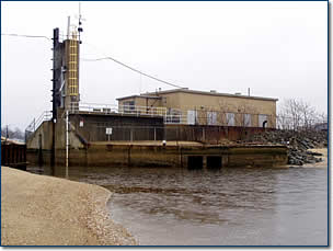
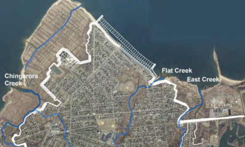
Phase Two, the Waackaack/Thorns Creek closure gate, now known as the Keansburg Floodgate, consisted of 5,221 feet of levee, 1,332 feet of I wall, a pump station, and a 30 foot hurricane closure gate across Waackaack/Thornes Creek. This phase also consists of 6,690 feet of levee, 8 drainage structures, a ponding area and fill areas in addition to a railroad stop log closure system adjacent to Pews Creek, tying into the high ground near Route 36 (no longer operable). This phase of the work was completed in January 1973.
Phase One and Phase Two are both commonly referred to as the “Keansburg Project”. OCE personnel operate and maintain all aspects of the project from the gate closures during high tide events, to routine maintenance of all features such as pumps, engines, outfall structures, sluice gates, flap gates, dikes, and other facilities.

Port Monmouth, Middletown
The Port Monmouth Hurricane and Storm Risk Reduction Project is a partnership between USACE and the State, funded entirely by USACE. The two-phase project is currently under construction utilizing multiple contracts. OCE personnel will operate and maintain all aspects of the project as each contract is completed. The full project is estimated to be in place in 2028 and will include:
A beach fill of roughly 375,000 cubic yards and 2,640 linear feet of dune, 6,473 linear feet of concrete T-Floodwall, 3 road closure gates, 413 feet of bulkhead, 3,900 feet of levee, 1 tide gate and pump station facility (known commonly as the Pews Creek Tide gate), 1 sluice gate, 1 pump station, interior drainage, and road raising.

Union Beach
The Union Beach Coastal Storm Risk Management Project is a multi-contract flood damage reduction project protecting the 1.8 square miles of Union Beach. Five contracts will be utilized to implement this massive resilience project with an anticipated completion date of 2027.
Once complete, Union Beach will be protected by a beach and dune consisting of 688,000 cubic yards of sand fill, 2 groins, and an outfall. The Borough of Union Beach will be responsible for maintenance of these features. The remaining features consisting of 3 pump stations, 6,800 linear feet of levee, 12,900 linear feet of concrete T-floodwall, 1 road closure gate, interior drainage, and road raising will be the responsibility of OCE personnel.

