 Official Site of The State of New Jersey
History
In the 1980s, the Bureau of Marine Habitat and Shellfisheries received federal funding to inventory the State’s estuarine shellfish resources. The first modern comprehensive survey of hard clams (Mercenaria mercenaria) in Raritan and Sandy Hook bays was performed in 1983, where the purpose was to determine the standing stock, distribution, and relative abundance (density) of hard clams in the bay.
As part of the 1980s funding, a hard clam stock assessment was conducted in all major estuaries along the Atlantic Coast from Raritan Bay to Great Egg Harbor Bay. Unfortunately, the estuaries in the remainder of Atlantic County and all of Cape May County were not surveyed because federal funding ceased before the work could be completed. No comprehensive stock assessments were completed in the 1990s.
In the early 2000s, the Bureau received funding to survey Raritan/Sandy Hook Bays and Little Egg Harbor Bay.
Beginning in 2011, the Bureau reinstated the hard clam stock assessment with a goal of surveying a different estuary or estuarine system annually. Due to a variety of factors, an annual survey has not always been completed as hoped, but the Bureau continues to strive for the annual survey. Below is a list of estuaries and years of being surveyed.
| LOCATION | YEARS |
|---|---|
| Raritan Bay | 1983, 2000, 2014 |
| Sandy Hook Bay | 1983, 2000, 2014, 2021, 2024 |
| Navesink River | 1983, 2015 |
| Shrewsbury River | 1983, 2015 |
| Shark River | 1985 |
| Manasquan River | 1984 |
| Metedeconk River | 1984 |
| Barnegat Bay | 1986, 2012* |
| Little Egg Harbor Bay | 1987, 2001, 2011 |
| Great Bay | 1988, 2016 (unpublished) |
| St. George’s Thorofare | 1985 |
| Brigantine Thorofare | 1990 (unpublished) |
*Barnegat Bay 2012 report includes Post-Superstorm Sandy Investigation of 2013
The main objective of the survey is to estimate the standing stock of adult hard clams and describe their relative distribution throughout the estuary. Where appropriate, comparisons are made between the most recent and the immediately preceding assessments.
When non-target, “associated” species are retained in the sample, those species are documented also, particularly other commercially/recreationally important bivalves, common bivalve predators, and commonly found non-commercial bivalve species.
Hard Clam (Mercenaria mercenaria) Biology
Hard clams survive in a wide range of water quality and sediment characteristics. Adults have an optimal temperature range of about 20-30°C (68-86°F) for growth and reproduction, but can survive temperatures ranging 0-35°C (32-95°F). Feeding activity and growth are curtailed at the extremes of the range, sometimes resulting in death after extended periods of exposure to temperature extremes. Hard clams prefer a salinity range of 20-35 ppt, with mortality occurring at <12-17ppt. Clams are very tolerant of low dissolved oxygen levels (as low as 0.5mg/L) but are stressed at levels <5.0mg/L. Eggs and larval stages have narrower temperature and salinity tolerances than adults. Both juvenile and adults stages are sensitive to pH values outside of 7.0-8.75.
Hard clams are an infaunal species, burrowing into substrates by as much as 8 inches, but typically staying within the top 4 inches. They are found in sand, mud, and shell substrates (or any combination thereof) but grow fastest in sandy sediments and slowest in muds. Areas with shell often provide some protection from predators, especially at juvenile stages.
Survey Methods
Sampling stations are generally established on an approximately ¼ mile by ¼ mile grid system, with adjustments made as necessary based on coastline morphology, navigational channels, and known obstacles. When repeating a survey in an estuary, the same station is targeted in order to allow for direct comparisons over time.
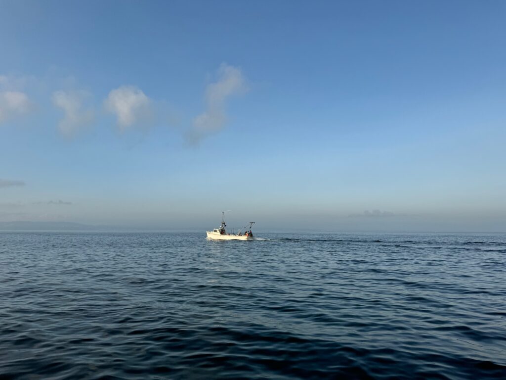
Vessel(s) and Gear or Equipment Used
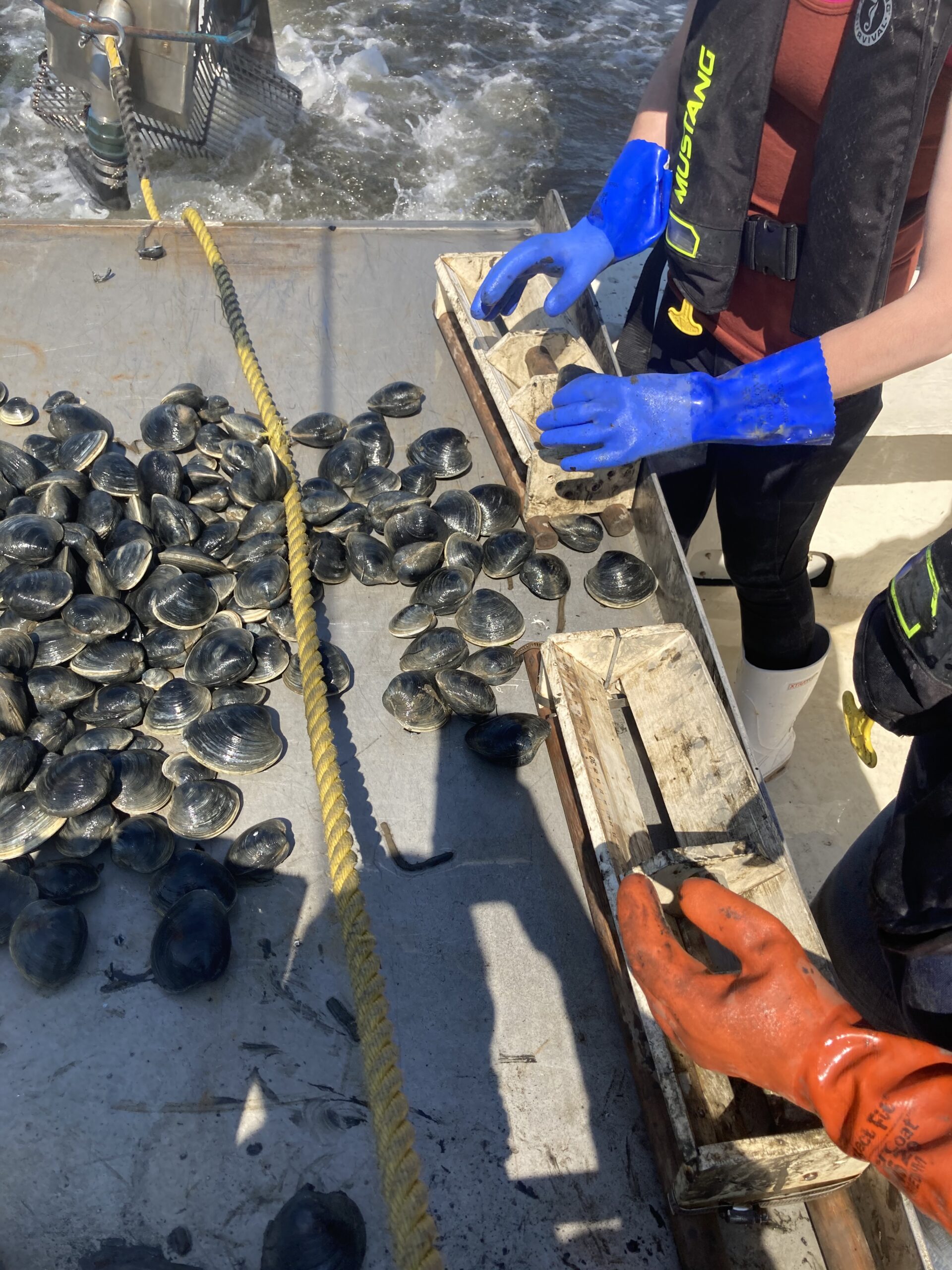
A hydraulic hard clam dredge is towed behind the Bureau’s research vessel, the R/V Zephyrus. The knife of the dredge cuts four inches into the substrate, funneling anything in the dredge’s pathway into the dredge basket. The bars on the basket are spaced to retain all adult clams at least 30mm in size. Two 100-foot tows are attempted at each station. After each tow, all clams in the sample are measured to the nearest millimeter. A Petersen grab is used to collect a sediment sample at each station for grain size analysis in the laboratory.
Season(s) or Frequency of Sampling
Surveys are usually conducted in late spring or early fall to avoid increased recreational boating traffic in the summer, but that is not always the case. Since the clam dredge is towed along the bay bottom, the dredge, tow line, cable, and water hose connected to it cannot be seen underwater. Nearby vessels should keep a safe distance to avoid potential entanglement in the survey gear. Further, a wide turning radius is needed to set and retrieve the dredge and reduce the chances of fouling the gear in the propeller. It is easier and safer to conduct the survey when the estuary is not crowded.
Project Lead Contact
Scott Stueber, Senior Fisheries Biologist