Official Site of The State of New Jersey
What is Submerged Aquatic Vegetation?
Submerged aquatic vegetation, also known as SAV, refers to rooted, vascular plants that grow completely underwater, except for periods of brief exposure at low tides. In New Jersey, the two dominant species of SAV are eelgrass (Zostera marina) and widgeon grass (Ruppia maritima), and both species can be found throughout the Barnegat Bay to Little Egg Harbor estuary system. In fact, the Barnegat Bay contains ~75% of New Jersey’s seagrass beds! The remaining 25% can be found largely in Little Egg Harbor Bay, and in a few of the state’s northern coastal rivers.
SAV provides various ecosystem services, such as nutrient cycling, sediment stabilization, food, and shelter. It has also been praised for its ability to sequester atmospheric carbon dioxide (CO2), and because of this, it is included in the DEP’s Natural and Working Lands Strategy under Aquatic Habitats. You can learn more about SAV and its conservation at Conservation | Submerged Aquatic Vegetation.
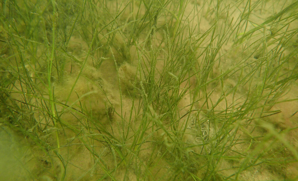
Widgeon grass (Ruppia maritima)
Photo Credit: Dr. Elizabeth Lacey
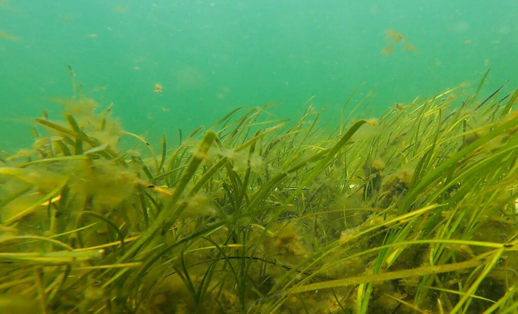
Eelgrass (Zostera marina)
About the Survey
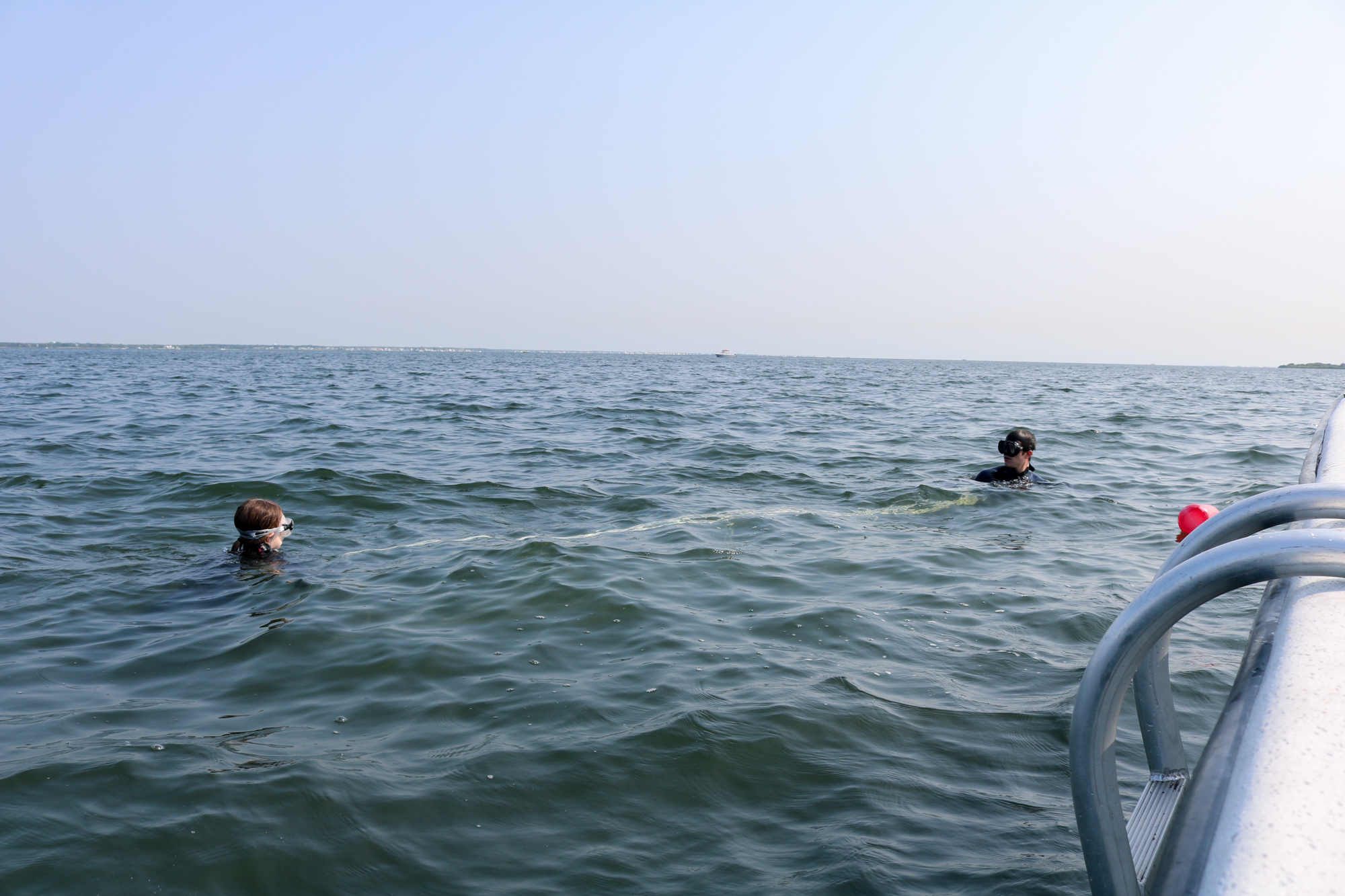
In the summer of 2023, the Marine Resources Administration (MRA), Rutgers Center for Remote Sensing and Spatial Analysis (CRSSA), and Stockton University partnered on a project to map SAV habitat throughout the Barnegat Bay to Little Egg Harbor estuary. The aerial mapping portion of the survey was funded by the DEP and led by Dr. Richard Lathrop, while the boat-based, in-situ portion was funded by the Barnegat Bay Partnership (BBP) and led by Dr. Elizabeth Lacey. MRA staff trained alongside Dr. Lacey and her team for a few days before sampling the remaining stations separately.
Aircraft was used to collect the aerial imagery, and those images were interpreted by data collected in the water by divers throughout the study area. This project was last conducted in 2003 and again in 2009, and the results of this new assessment will enhance our understanding of where SAV is present throughout the estuary and to determine the health and status of these habitats. Routine and consistent monitoring and mapping will allow biologists to take the next steps in conserving New Jersey’s SAV, enhancing policy and regulations currently in place, and establishing additional monitoring and public educational programs.
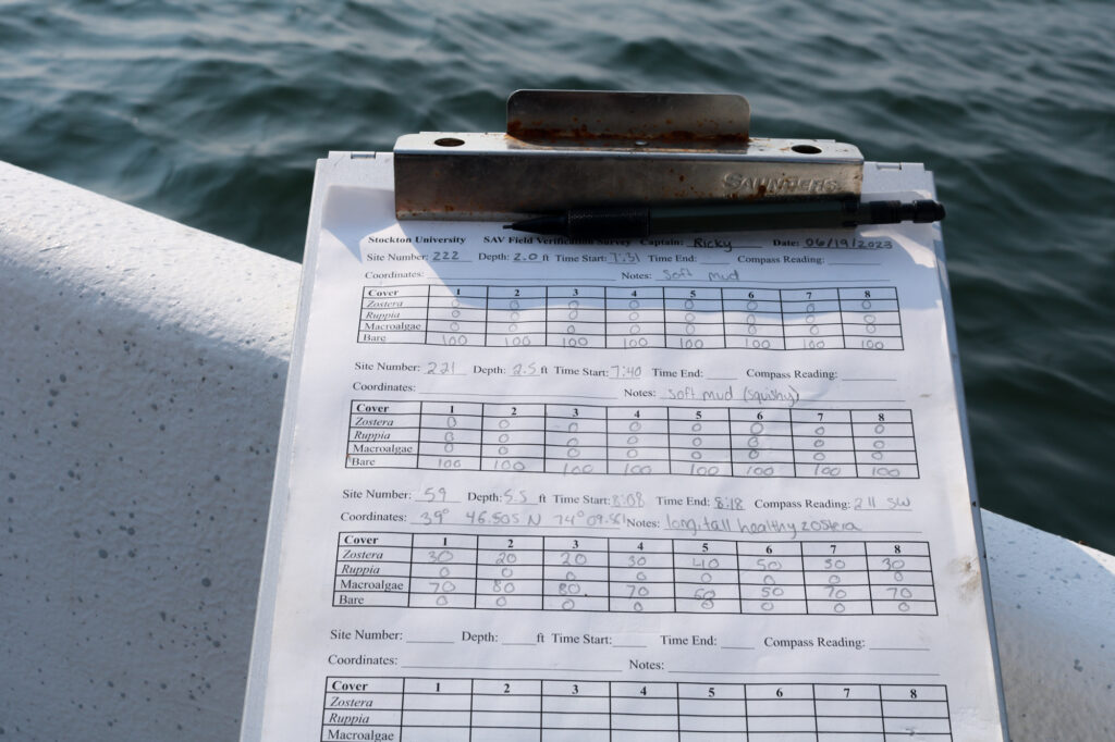
For the field validation portion of the survey, and L-shaped survey grid consisting of 8 quadrats was used to estimate percent cover in 10% increments of eelgrass, widgeon grass, and macroalgae, to compare with the aerial imagery. All estimates were relayed to staff on board the vessel, who recorded the data. At each station, a handheld GPS unit was used to take a compass reading at the left-hand axis of the sampling grid.
Future Plans
MRA staff is currently working with project partners to interpret the 2023 data and assess the health of these critical habitats. The next survey is being planned for 2024 and will focus on New Jersey’s coastal rivers, such as the Metedeconk, Navesink, Shrewsbury, and more. The results of both mapping efforts will allow the DEP to have new, updated mapping of SAV coverage throughout New Jersey. This is an important step in the MRA’s efforts to conserve and project these critical habitats.
Submerged Aquatic Vegetation Video
Project Partners