 Official Site of The State of New Jersey
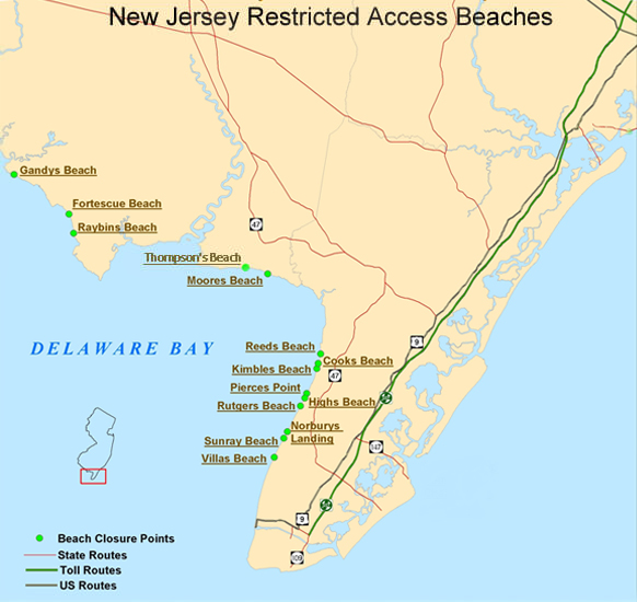
The map below shows Delaware Bay beaches with seasonal restricted access from May 7 to June 7. Various beaches have been seasonally restricted since 2003 to protect a rapidly-declining population of migrating shorebirds. Delaware Bay is a major migratory stopover along the Atlantic Flyway where shorebirds stop each spring to feed on the fat-rich eggs of the horseshoe crab before heading to the Canadian Arctic to breed. (For more information on shorebirds see the Delaware Bay Shorebirds Information page.)
Seasonally-restricted areas will be marked with printed signs and rope fencing from the street end to the water’s edge. The best Delaware Bay beaches for shorebird viewing are Reeds Beach, Norburys Landing, Kimbles Beach and Cooks Beach. There are viewing platforms at the northern end of N. Beach Ave., in Reeds Beach, and at the end of Milman Blvd. at Norburys Landing. DEP staff will be present to educate the public about the interaction between the shorebirds and horseshoe crabs and the need to let the birds feed undisturbed.
Detailed maps of the seasonally-restricted areas are linked from the map below by clicking on the beach name. The specific areas with access restrictions are indicated in red.
Delaware Bay Shorebirds brochure (has directions to viewing areas) (pdf, 425kb)