|
FOR IMMEDIATE RELEASE |
Contact: Lawrence Hajna (609) 984-1795 |
|
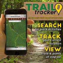
DEP LAUNCHES TRAIL TRACKER SMART DEVICE TOOL TO ENHANCE VISITS TO STATE PARKS AND FORESTS (17/P109) TRENTON – The New Jersey Division of Parks and Forestry today officially launched a new smart device tool to enhance visits to state parks by helping users plan visits around the state park system’s vast network of trails. The Trail Tracker application, demonstrated by the Park Service during a news conference today at Allaire State Park in Monmouth County, may be downloaded to smart devices to help visitors make detailed plans tailored to trails, activities and terrain that interest them.
“Having used Trail Tracker myself while hiking recently in Swartswood State Park, I’m confident that all levels of outdoor enthusiasts will find it useful and fun,” said DEP Deputy Commissioner David Glass. “With just a few swipes on your device, you can find attractions and plot out a hike to meet your abilities – and know where you are all the time.” To get started, visit: http://www.spstrailtracker.nj.gov or http://www.nj.gov/dep/parksandforests/ Trail Tracker was soft-launched earlier this year and has been available to users for approximately two months. It was developed by the Division of Parks and Forestry’s Geographic Information System (GIS) department as part of a project to map and highlight amenities in the state park system. The state park system boasts nearly 1,000 miles of officially designated trails.
The park service advises all hikers to follow marked trails, pay attention to signs and always be aware of their surroundings and trail hazards. The park service recommends downloading trail maps to your device before entering areas with limited cell service. The state park system is comprised of 50 parks, forests recreation areas and marinas, from High Point State Park in Sussex County to Cape May State Park at the southernmost tip of the state. Hiking opportunities range from the rocky woodlands of the Highlands and Skylands regions to secluded sojourns through coastal marshes, Revolutionary War battlefields, and Pine Barrens forests. Some trails are designated for foot traffic only while others also accommodate bicyclists and horseback riders. |
|
 The Trail Tracker tool helps visitors find activities available at state parks and forests during each season, search for trails by difficulty ratings and points of interest, and access detailed geographic maps that provide information on terrain and natural features along trails. The tool also enhances safety by enabling visitors to maintain their bearings while hiking and by providing emergency contact numbers.
 “The State Park Service gathered information on our vast network of trail over the past 10 years and now we’re excited to debut Trail Tracker and put this tool in visitors’ hands too,” said Division of Parks and Forestry Director Mark Texel.