Survey and Inventory
Introduction
Identification of historic and archaeological resources is fundamental to almost every historic preservation program or process. New Jersey’s cultural resources inventory represents the collective efforts of governments, organizations and citizens to survey, register and plan for cultural resources. In support of these survey efforts, our office provides:
- Survey guidelines that specify how to document and evaluate archaeological and architectural resources.
- Indexing and search tools for research existing documentation.
- Technical assistance for those undertaking identification efforts.
Types of cultural resource surveys
There are two main survey efforts for identifying and documenting cultural resources:
- Archaeological Survey
- Assesses buried or submerged cultural resources.
- Architectural Survey
- Assesses the built environment — buildings, structures and objects — and designed or cultural landscapes.
Archaeological survey
Phase I-III surveys
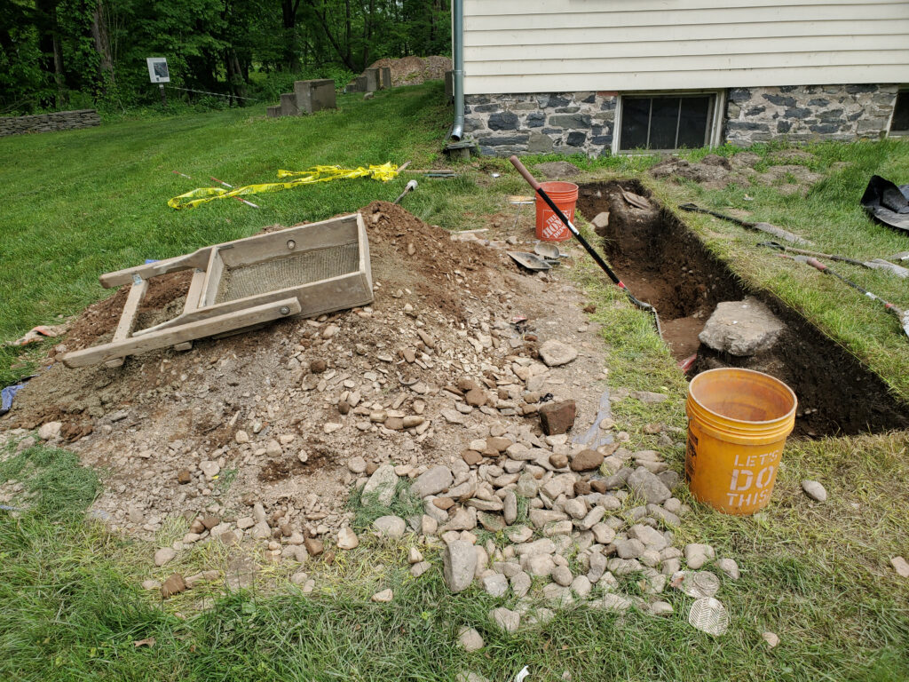
An archaeological survey is a field effort to locate and register pre-Contact, historic, industrial and/or maritime archaeological sites.
- Survey begins with an initial Phase I field survey. This identification survey …
- Assesses the site’s environmental and topographic factors, ranking on current archaeological sensitivity models for New Jersey, and land use history.
- Includes an initial field survey for the presence or absence of archaeological resources.
- If Phase I archaeological survey identifies potentially important archaeological deposits, a following Phase II archaeological survey is conducted. This assesses whether the identified archaeological deposits are eligible for listing in the New Jersey and National Registers of Historic Places.
- If a project cannot avoid impacting an eligible site, Phase III is required to mitigate this loss. Also known as data recovery, Phase III thoroughly documents the site and answers research questions.
Archaeological survey
Learn when an archaeological survey is recommended and HPO’s guidelines and rules for field survey and writing archaeological survey reports.
Other types of archaeological surveys
- Archaeological Construction Monitoring
- Observing construction sites after phased archaeological survey is completed. This ensures any important archaeology is documented prior to removal.
- Collection/Non-field
- Museums with archaeological collections available to the public and archaeologists for study and interpretation.
- Geomorphology
- A specialist in geology, soils and archaeology studies natural landscape evolution along major waterways and how it affects archaeological sites.
- Geophysical survey
-
These identify buried archaeological remains and burial features using
- Specialized ground penetrating radar (GPR)
- Magnetometer
- Electrical resistance
- Electromagnetic surveys
In addition, metal detecting surveys are employed for military sites.
- Maritime archaeological survey
- Typically used to identify shipwrecks but also used to find submerged archaeological sites. Survey effort included scuba diving and/or specialized remote sensing equipment such as side-scan sonar, sub-bottom profiler and magnetometer equipment. Soil coring is also employed for understanding earlier environmental data.
Architectural survey
Reconnaissance- and intensive-level surveys
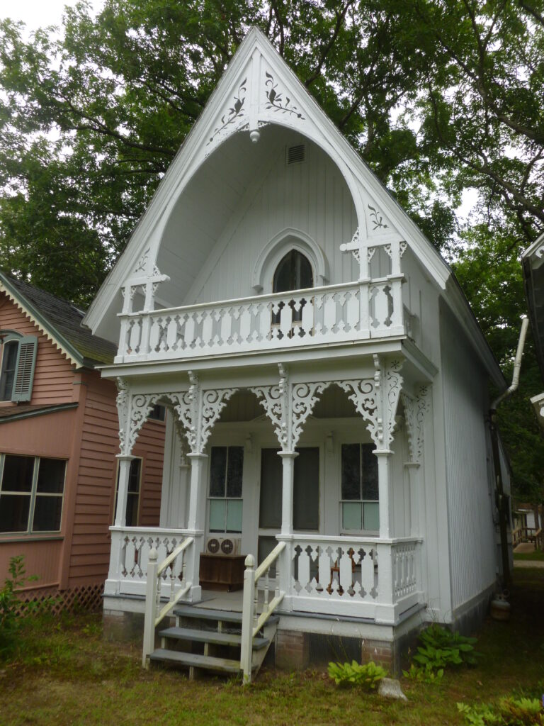
An architectural survey is a blend of background research and fieldwork. The two main types are reconnaissance-level and intensive-level. Our architectural survey guidelines describe each in greater detail, but these are the most important differences:
| Type | Reconnaissance | Intensive |
|---|---|---|
| Purpose |
|
|
| Level of detail |
|
|
| Goals |
|
|
Architectural survey
Architecture includes more than buildings. Learn more about recording architectural resources and how to use our survey forms.
Historic Structure Reports and Management/Preservation Plans
Historic Structure Reports (HSR) and Preservation Plans are tools that aid preservation decisions by documenting historic properties. The main distinction between these is the level of detail:
- Preservation Plan
- A broader overview of the historic resource and its preservation needs.
- Historic Structure Report
- A methodical record of each part of the building or property’s current conditions, then detailed recommendations.
Historic Structure Reports and Preservation Plans
Read the revised preparation guide for both types of surveys.
Design Guidelines
Design guidelines are a tool created by municipalities to make fair, open and consistent decisions about projects affecting locally designated properties and districts. They are not mandatory by themselves but work in tandem with local ordinances.
The Secretary of the Interior’s Standards for Rehabilitation and Guidelines for Rehabilitating Historic Buildings include guidance for preparing design guidelines. They establish an underlying historic preservation philosophy with an emphasis on:
- Above all, maintain and protect.
- Repair if needed.
- Replace, but only when maintenance or repairs are no longer feasible or cost-effective.
Design guidelines typically address the following:
Historical data
Each municipality’s resources have different architectural and historical qualities, and design guidelines reflect this.
When preparing guidelines, municipalities should incorporate data on their historic resources. This includes historical data on community-level development and specifics about its designated properties, such as:
- Height
- Massing — shape, form and size
- Siting — setbacks and orientation to the street
- Construction materials
- Architectural style(s)
Existing structures
Design Guidelines have an emphasis on features visible from the street, such as:
- Building facades
- Materials and surface treatments
- Windows
- Doors and related entrance features, such as porches
- Ornamental details
- Storefronts and signage (if commercial)
New construction
These guidelines also address new construction with the potential to impact designated properties. Some factors governed by design guidelines include:
- Visual compatibility with nearby designated properties’ characteristics.
- Directional emphasis — whether the building emphasizes a horizontal or vertical form, and whether that form is compatible with surrounding historic properties.
- Rhythm — the pattern of solids and voids in facades, or of built to open spaces.
NPS references
The National Park Service prepared an online guide and several related documents as a reference for municipalities. We also have related NPS guidelines on our Tools page.
Working on the Past in Local Historic Districts (NPS)
This online guide discusses the value of local historic districts and how to develop local design guidelines.
Working on the Past print version
Download the published version of NPS’s guide, collected into a single PDF from NPS’s section downloads.
Tools
Find links to the Standards for Rehabilitation and other guidelines.
Mitigation Documentation
This type of survey is an archival record of an architectural resource or historic landscape. It mitigates the loss of a resource that cannot be avoided by a project. At the federal level, the National Park Service (NPS) refers to the following group of programs as the Heritage Documentation Programs (HDP):
- Historic American Buildings Survey (HABS)
- Documentation of historic buildings. This is the first, and still ongoing, federal documentation program for historic properties.
- Historic American Engineering Record (HAER)
- Documentation of engineering and industrial resources. This program has a greater emphasis on structures and objects but follows a similar format to HABS.
- Historic American Landscapes Survey (HALS)
- Documentation of historic landscapes. This is the newest of the Heritage Documentation Programs and follows different methodologies from the earlier programs.
Heritage Documentation Programs Standards & Guidelines (NPS)
Visit NPS’s guidelines portal for more detailed HABS/HAER/HALS guidelines, including specific film recommendations.
Other types of surveys
Alternatives Analysis
This type of survey explores ways to reduce the effects of a project on historic resources. It encourages planners to develop multiple treatments instead of only the first idea. Then, these are narrowed down through objective analysis. Over the course of the survey, an alternatives analysis …
- Assembles alternative plans for developing a project. These include a no-action alternative as a control example. Even if it is “obvious” the project has benefits, this creates a baseline for comparison.
- Weighs the benefits and losses of each alternative. This is not limited to effects on historic resources — it considers all key factors. For instance, local traffic volume may motivate a bridge project. The alternatives would weigh the effects of rehabilitation and replacement proposals on traffic.
- Recommends a preferred alternative. This should address the primary needs of the project with the least negative effects.
Alternatives Analysis Outline for Protecting Buildings
Download the PDF version for printing or desktop computer use.
eBook (EPUB)
Download an EPUB file for your phone, tablet or e-reader.
Historic Bridge Alternatives Analysis Report Outline
Download the PDF version for printing or desktop computer use.
eBook (EPUB)
Download an EPUB file for your phone, tablet or e-reader.
Mapping resources and other survey data
Modern mapping and geolocation technologies handle data in ways that were not possible with paper maps. We created the Cultural Resources Geographic Information System (CRGIS) program to manage our map data.
Geographic Information Systems (GIS)
Read an overview of our GIS data layers and access our public data.
Significant survey initiatives
Women’s history initiatives
New Jersey was the first state in the country to take on such a comprehensive statewide survey of women’s historic sites. Sponsored by the HPO and the Alice Paul Institute, this groundbreaking project contributes to an increased historical understanding of the women, ideas and forces that shaped the history of New Jersey, the United States and the world.
Women's history initiative
Learn about initiatives to share the stories of women throughout New Jersey’s history, including an inventory of sites significant to the state and nation.
Revolutionary War initiatives
New Jersey played a central role in the American war for independence, and much of the landscape Washington’s Continental Army traveled over remains open today. These initiatives aim to preserve that landscape for future generations.
Revolutionary War initiative
Learn about efforts to trace the path of the Revolutionary War through New Jersey, including the creation of the Crossroads of the American Revolution National Heritage Area.

