|
Category
|
Winner
|
Map Title
|
Thumbnail
|
|
BEST
ANALYTICAL
PRESENTATION
|
1st
Meaghan Martin
Marine Academy of Technology and Environmental Science
|
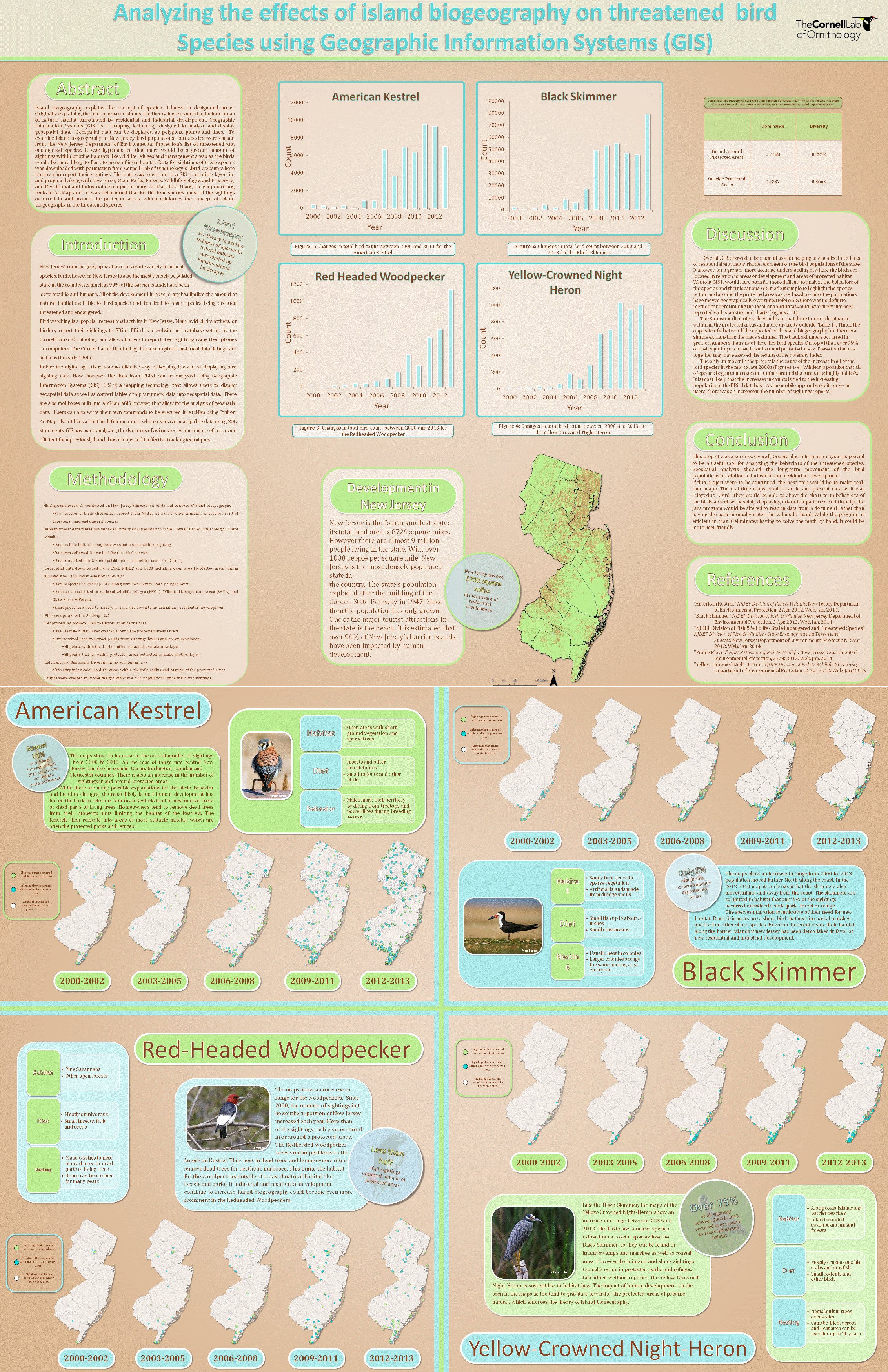
Analyzing Island Biogeography on threatened bird species using Geographic Information Systems
|
|
|
2nd
Eden Buenaventura
Rutgers University
|
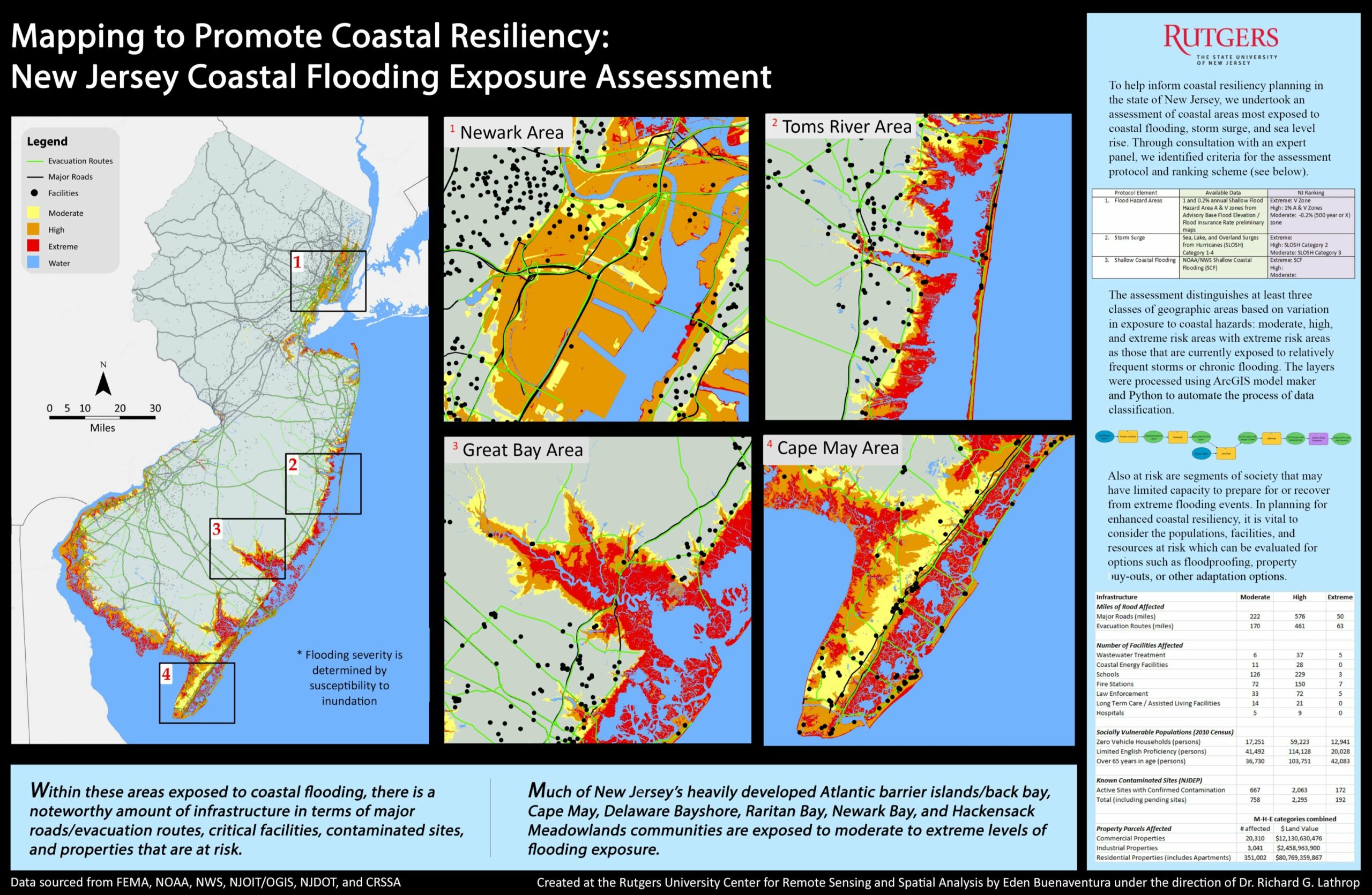
Mapping to Promote Coastal Resiliency: New Jersey Coastal Flooding Exposure Assessment
|
 |
|
BEST
DATA
INTEGRATION
|
1st
Dave DuMont
Land Use Planning
John Tyrawski
Bureau of GIS
NJDEP
|
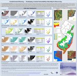
Coastal Hazard Planning – Developing a Coastal Vulnerability Index Map for New Jersey
|
|
|
2nd
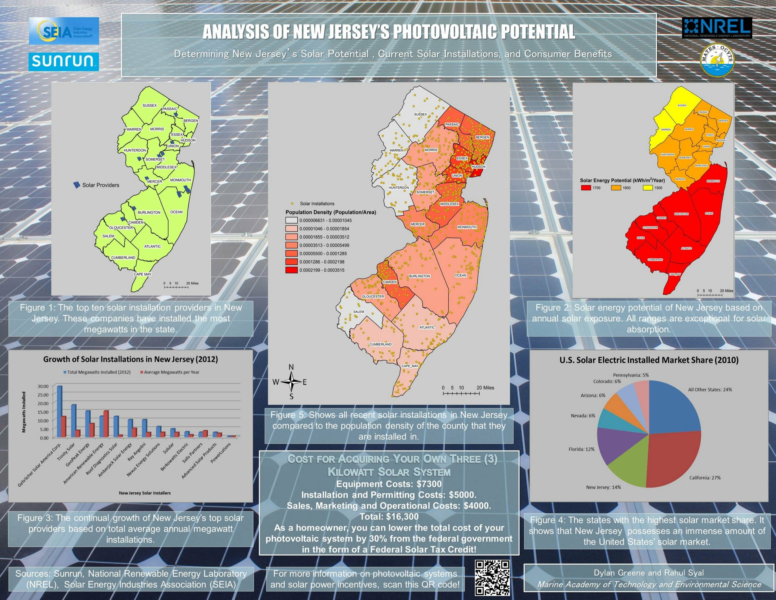
Dylan Greene
Rahul Syal
Marine Academy of Technology and Environmental Science (MATES)
|
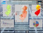
Analysis of New Jersey’s Photovoltaic Potential
|
 |
|
BEST INSTRUCTIONAL
PRESENTATION
|
1st
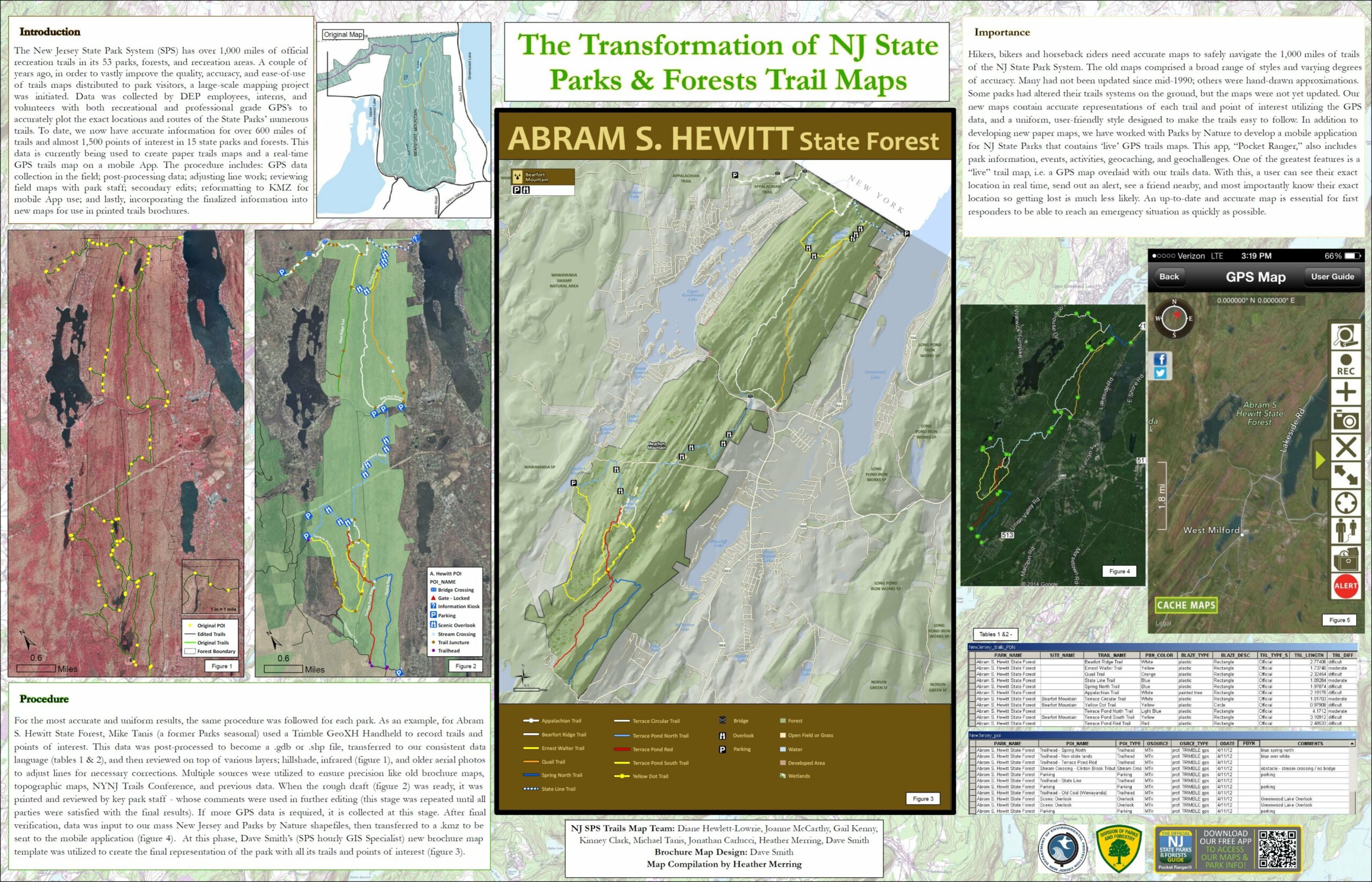
Heather Merring
Dave Smith
NJDEP
State Park System
|
The Transformation of NJ State Parks & Forests Trail Maps
|
 |
|
2nd
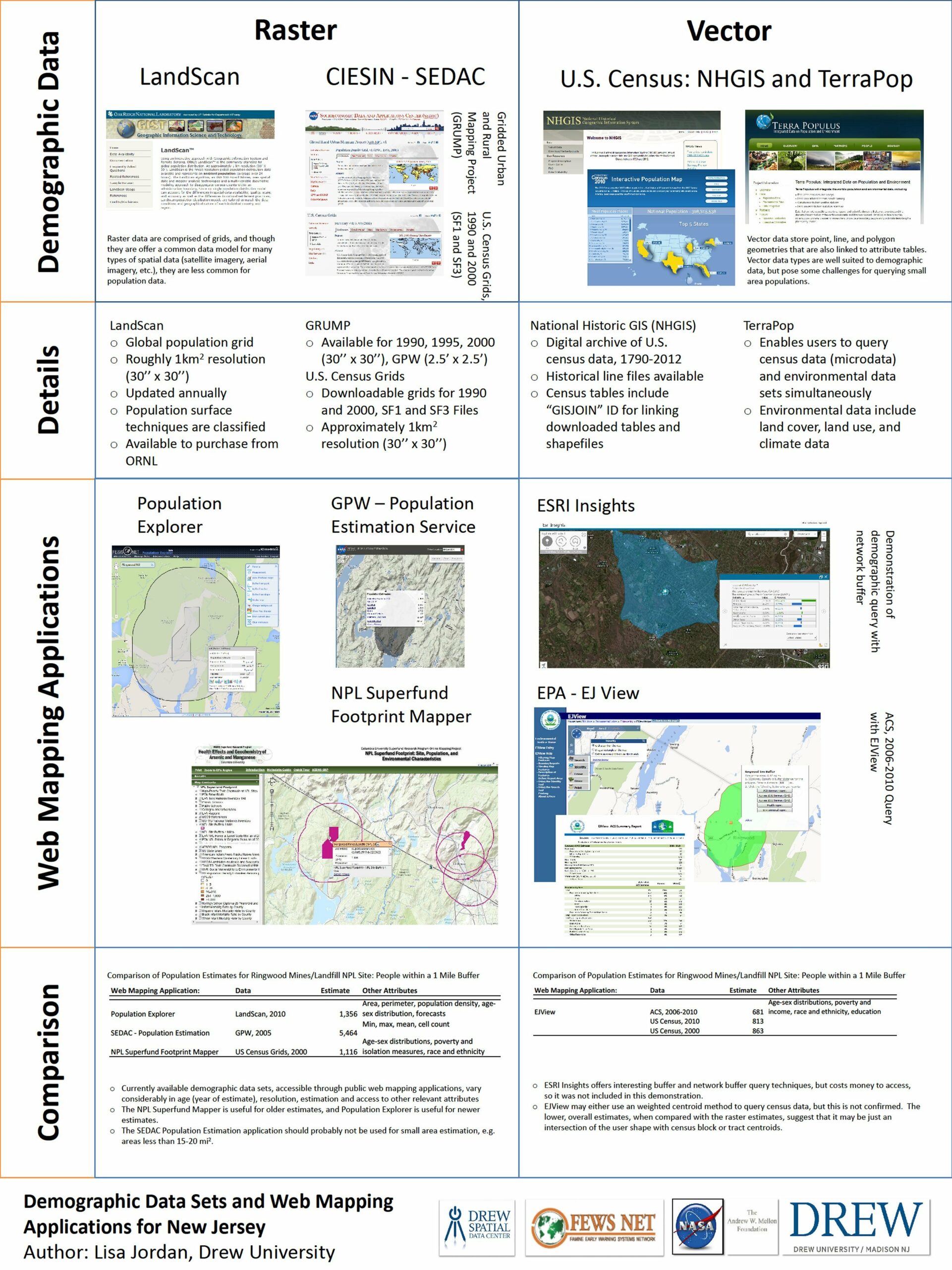
Lisa Jordan
Drew University
Environmental Studies Program
|
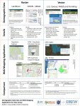
Demographic Data Sources and Web Mapping Applications for New Jersey
|
 |
|
MOST
UNIQUE
|
1st
Dnyanada Bhide
NJDEP
Bureau of GIS
|
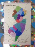
New Jersey – 3 D Puzzle
|
 |
|
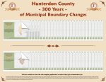
2nd
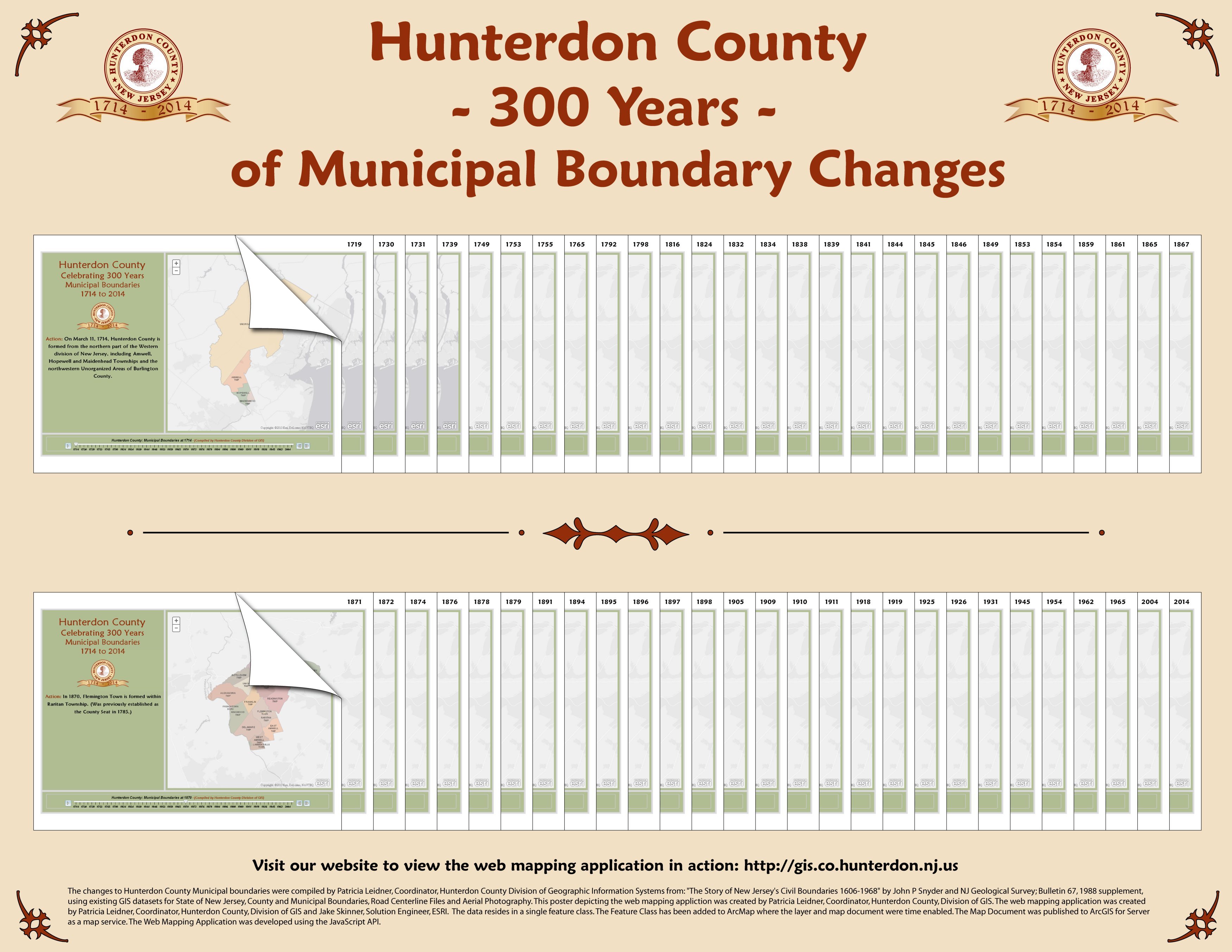
Patricia Leidner
Hunterdon County Division of Geographic Information Systems |
Hunterdon County – 300 Years – of Municipal Boundary Changes
|
 |
|
BEST
SMALL
FORMAT
|
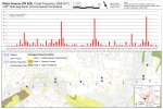
1st
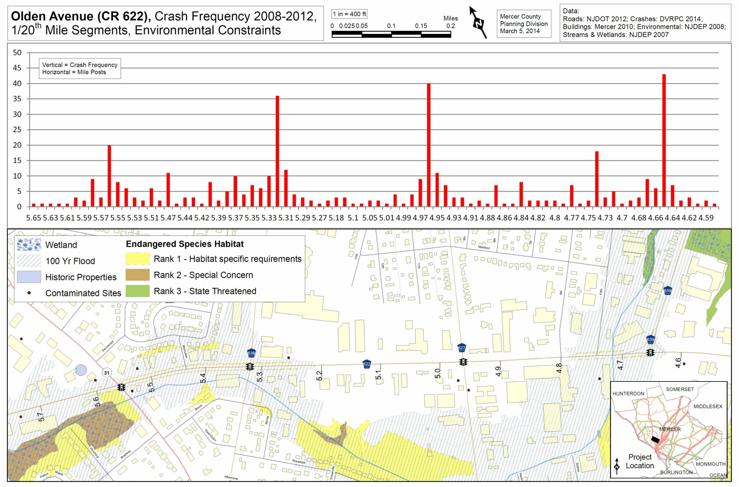
Matthew Lawson
County of Mercer, NJ |
Olden Avenue (CR622)
Crash Frequency
2008-2012
1/20th Mile Segments
Environmental Constraints
|
 |
|
2nd
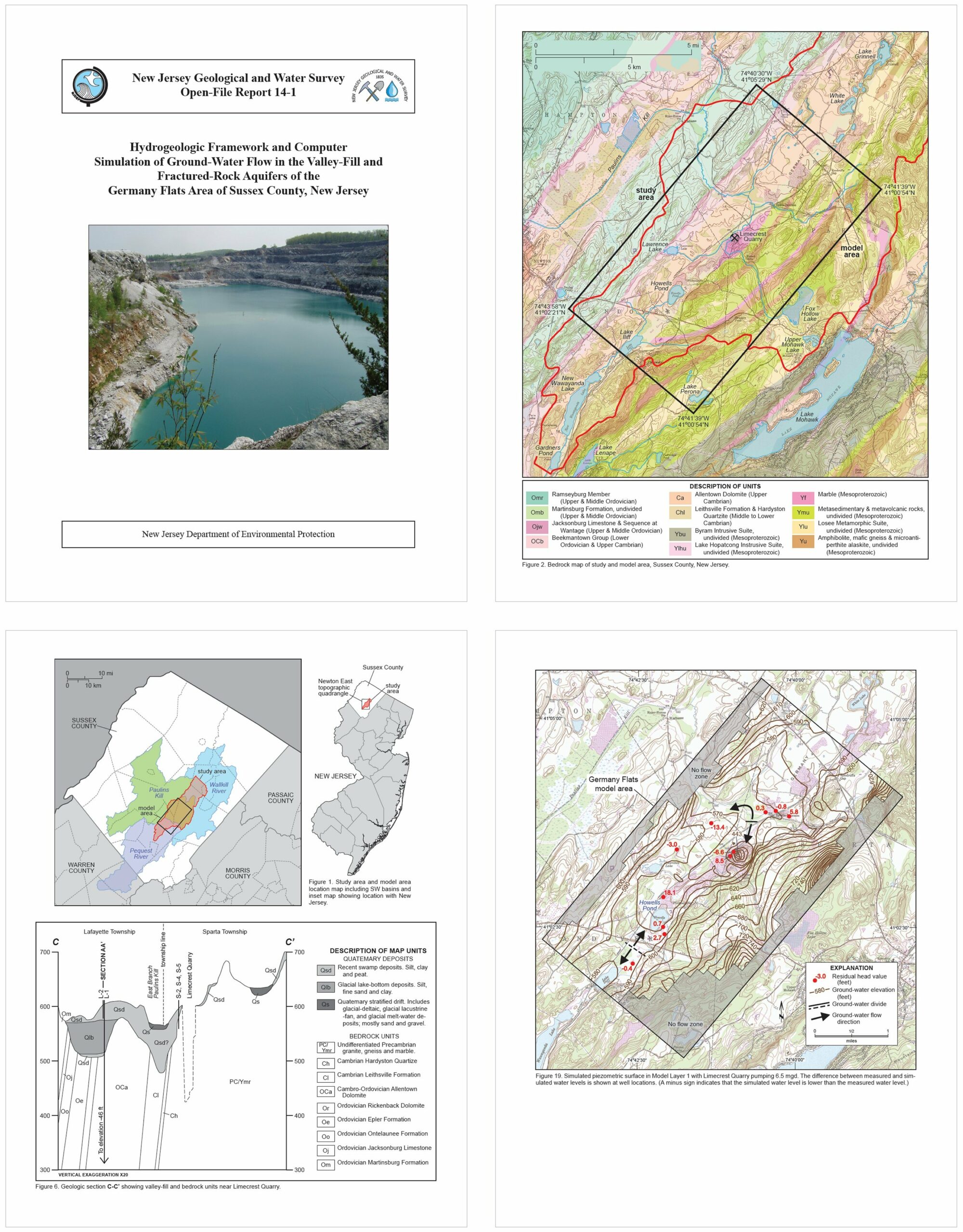
Zehdreh Allen-Lafayette
Laura Nicholson
NJDEP
NJ Geological & Water Survey |
Hydrogeologic Framework and Computer Simulation of Ground-Water Flow in the Valley-Fill and Fractured-Rock Aquifers of the Germany Flats Area of Sussex County, NJ
|
 |
|
BEST
SOFTWARE
INTEGRATION
|
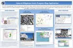
1st
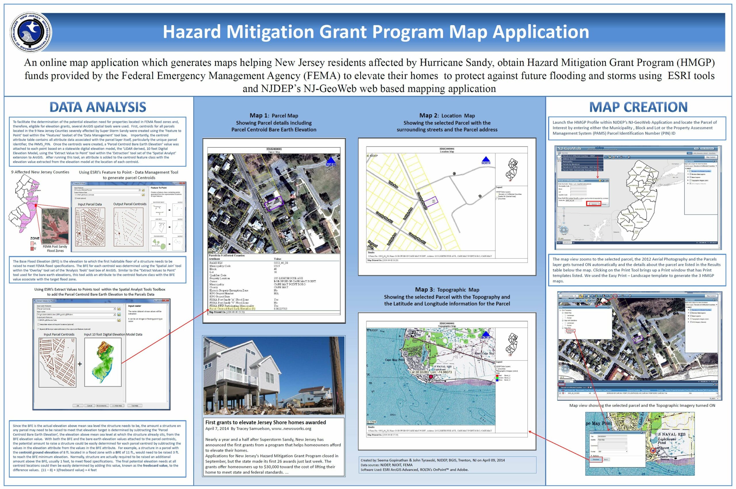
Seema Gopinathan
John Tyrawski
NJDEP
Bureau of GIS
|
Hazard Mitigation Grant Program Map Application
|
 |
|
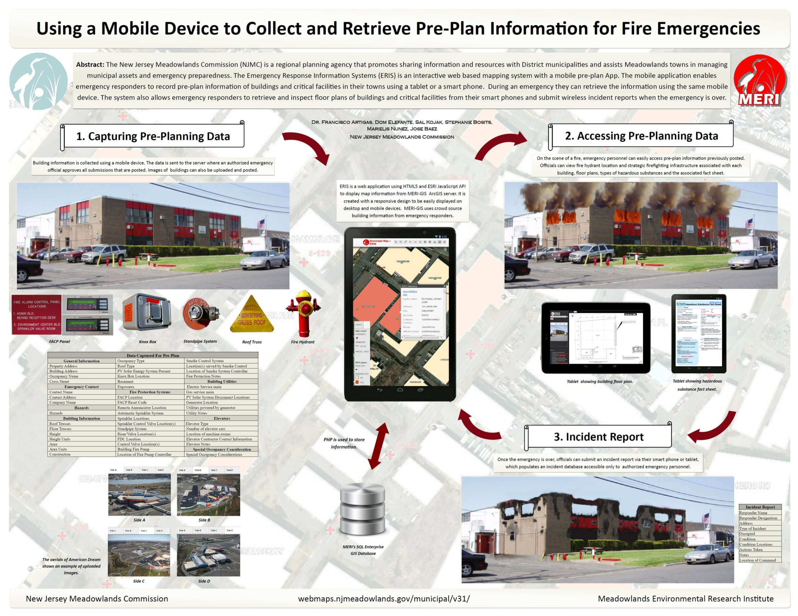
2nd
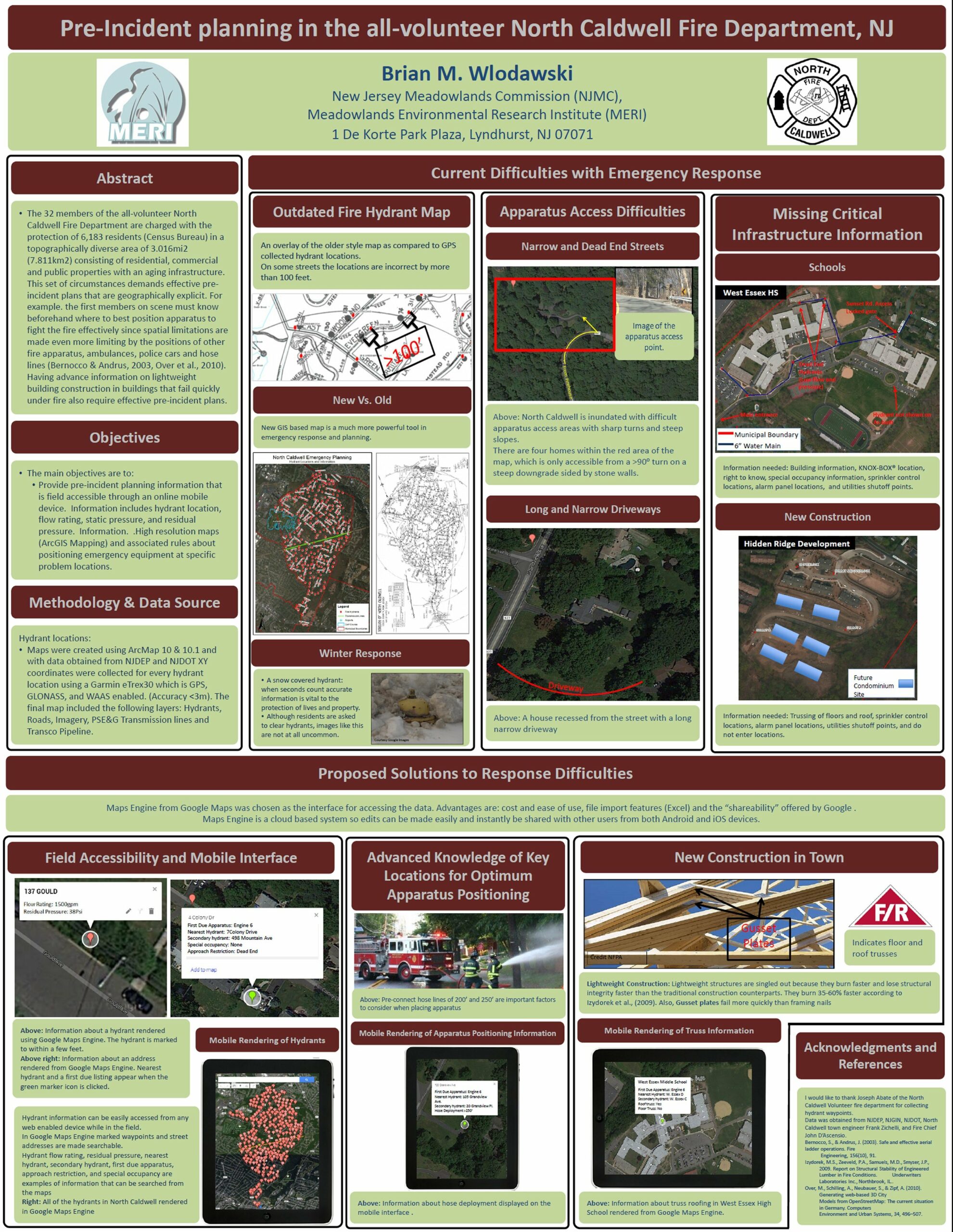
Brian Wlodawski
Meadowlands Environmental Research Institute |
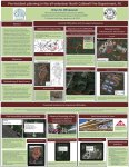
Pre-Incident Planning
in the All-Volunteer
North Caldwell
Fire Department, NJ
|
 |
|
BEST
CARTOGRAPHIC
DESIGN
|
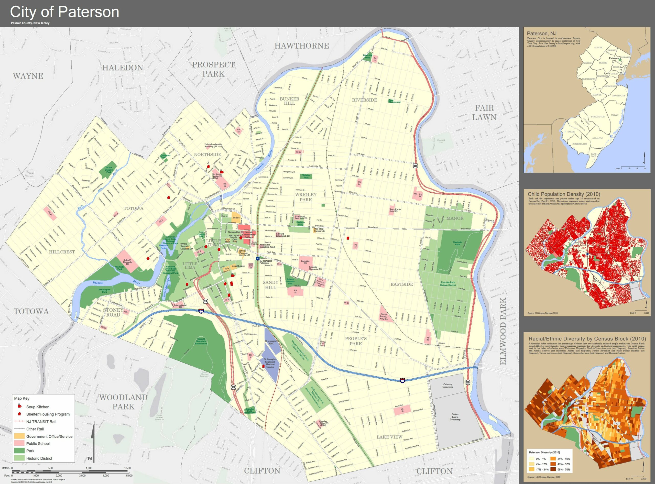
1st
Chuck Colvard
NJ Dept of
Human Services
|
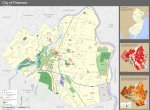
City of Paterson, NJ
|
|
|
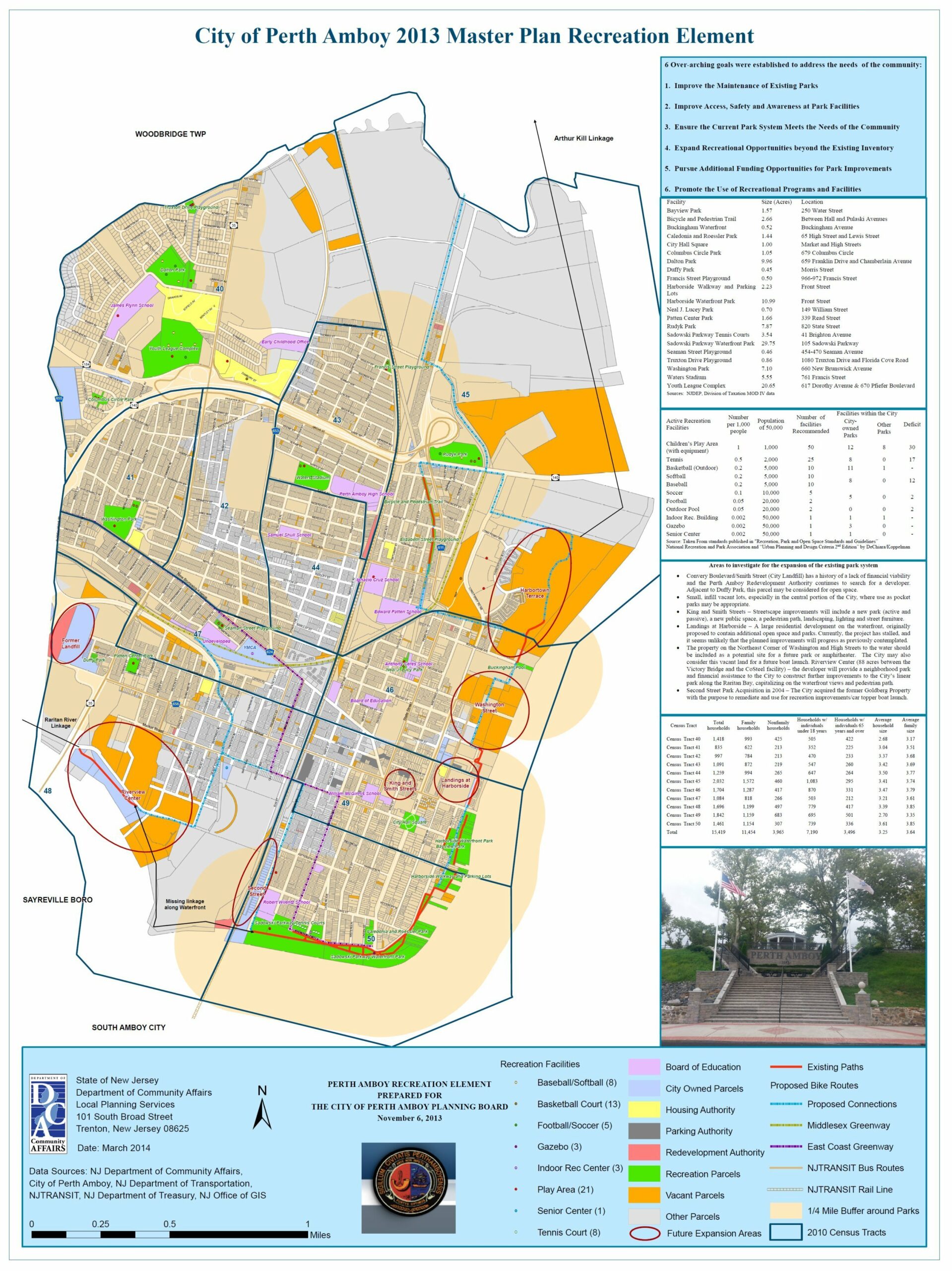
2nd
Tom Stanuikynas
NJ Department of
Community Affairs
|
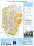
City of Perth Amboy 2013 Master Plan Recreation Element
|
 |
|
NEWBIE
OF THE YEAR
|
1st
Meaghan Martin
Marine Academy of Technology and Environmental Science
|
Analyzing Island Biogeography on threatened bird species using Geographic Information Systems
|
|
|
2nd
Eden Buenaventura
Rutgers University
|
Mapping to Promote Coastal Resiliency: New Jersey Coastal Flooding Exposure Assessment
|
|