|
Category
|
Winner
|
Map Title
|
Thumbnail
|
|
BEST
ANALYTICAL
PRESENTATION
|
1st
Daniel Constanza
Burlington County
Department of IT
GIS Section
|
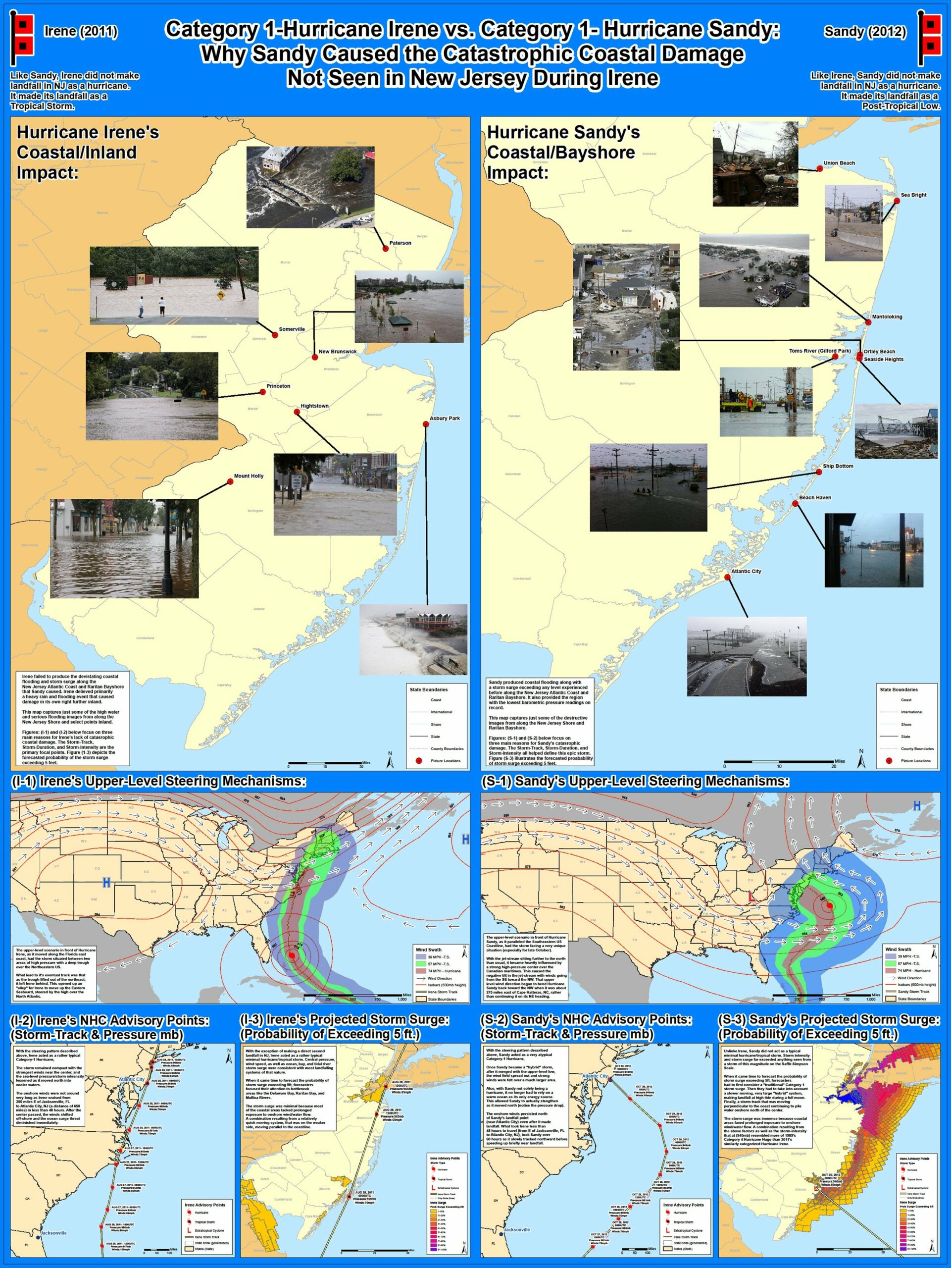
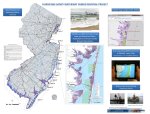
Category 1 – Hurricane Irene vs. Category 1 Hurricane Sandy
|
|
|
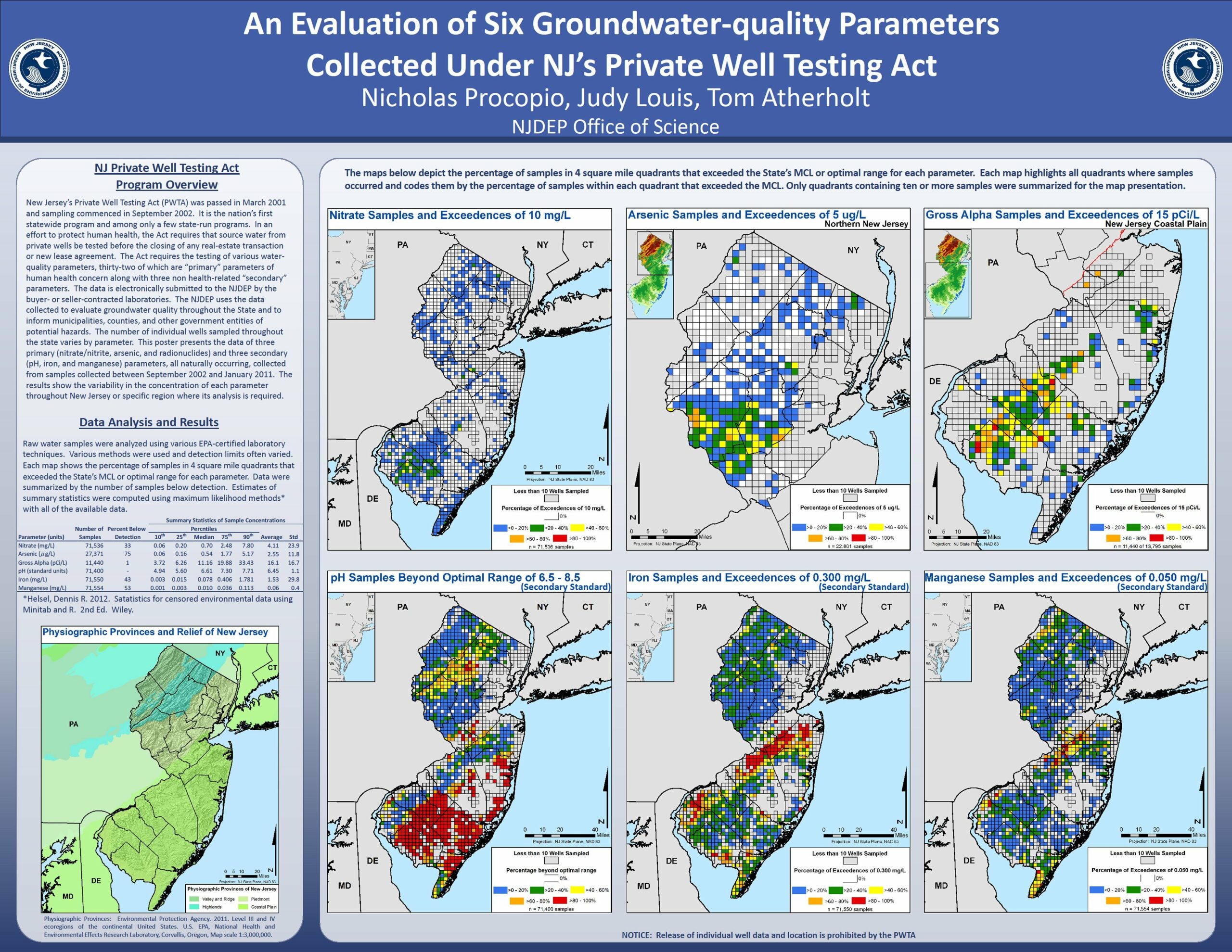
2nd
Nick Procopio
Judy Louis
Tom Atherholt
NJDEP
Office of Science
|
An Evaluation of Six Groundwater-quality Parameters Collected Under NJ’s Private Well Testing Act
|
 |
|
BEST
DATA
INTEGRATION
|
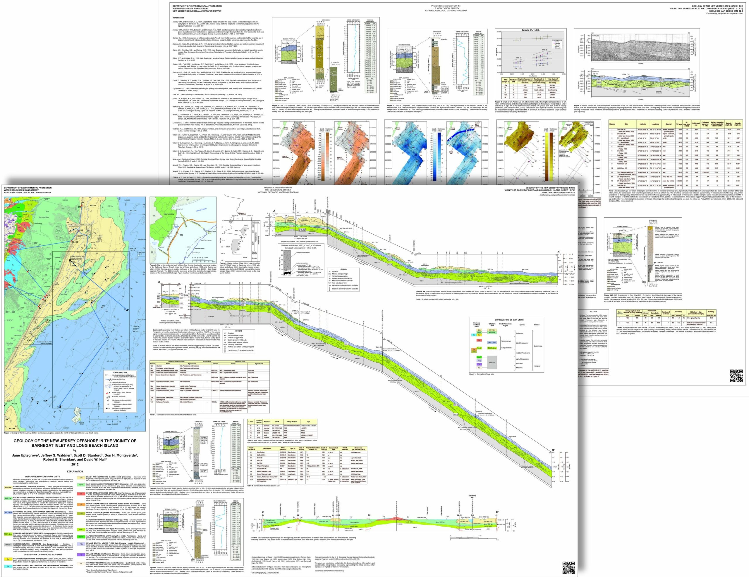
1st
Zehdreh Allen-Lafayette
Jane Uptegrove
Jeffrey S. Waldner
Scott D. Stanford
Don H. Monteverde
Robert E. Sheridan
David W. Hall
NJDEP
|
Geology of the New Jersey Offshore in the Vicinity of Barnegat Inlet and Long Beach Island
|
|
|
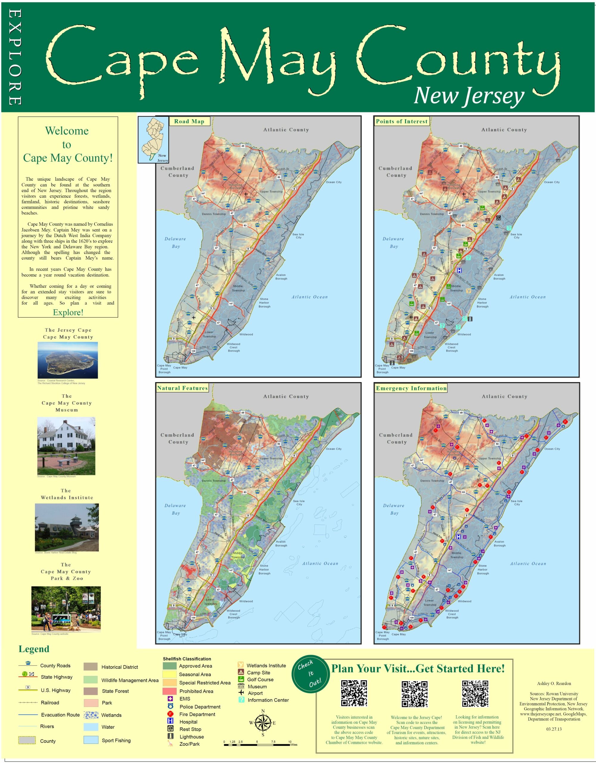
2nd
Ashley Reardon
Rowan University
|
Cape May County
|
 |
|
BEST INSTRUCTIONAL
PRESENTATION
|
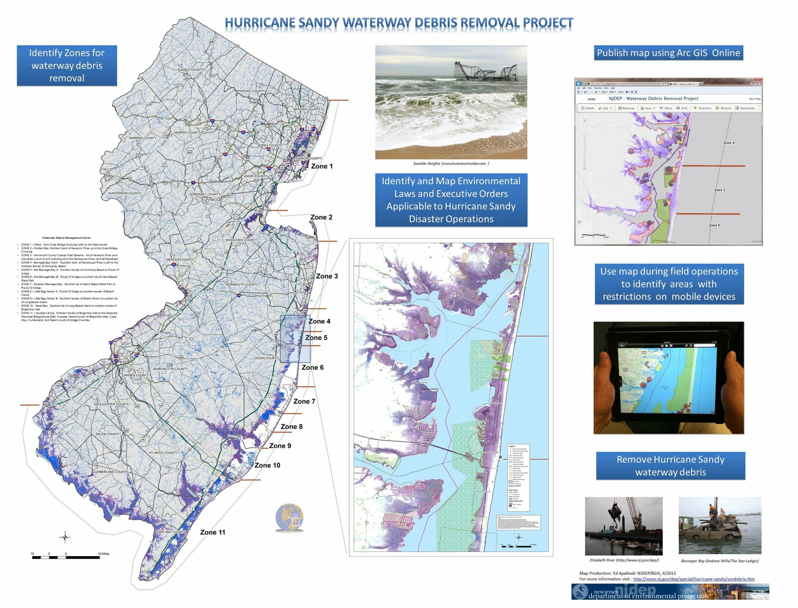
1st
Ed Apalinski
NJDEP
Bureau of GIS
|
Hurricane Sandy
Waterway Debris
Removal Project
|
 |
|
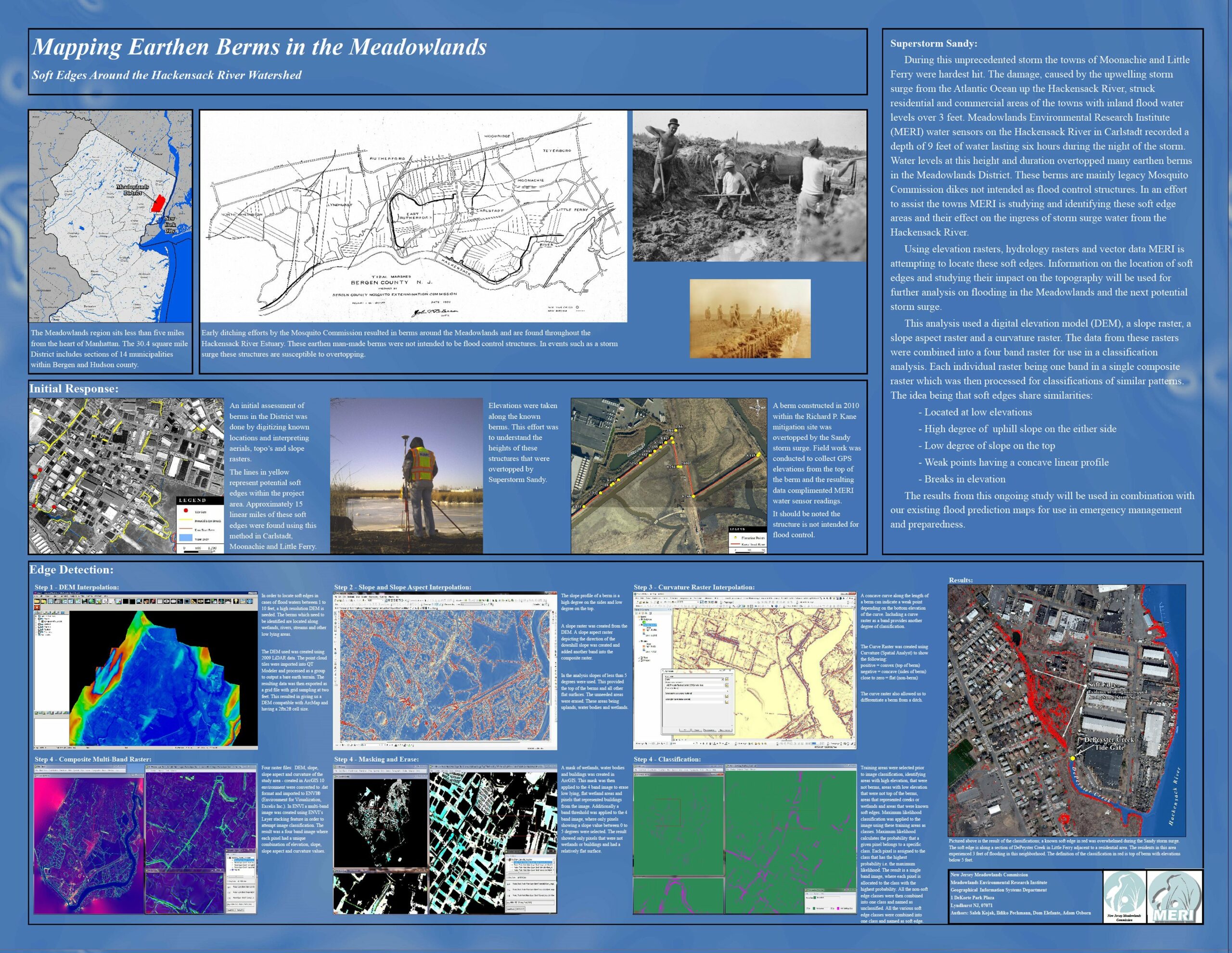
2nd
Dom Elefante
Sal Kojak
Adam Osborn
NJ Meadowlands Commission
Meadowlands Environmental Research Institute
|
Mapping Earthen Berms
in the Meadowlands
|
 |
|
MOST
UNIQUE
|
1st
Diana Johnson
Dnyanada Bhide
NJDEP
Bureau of GIS
|
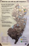
What do I do with
my old computer?
Electronic Recycling
Centers in NJ
(Made with dismantled computer hard drive magnets.)
|
 |
|
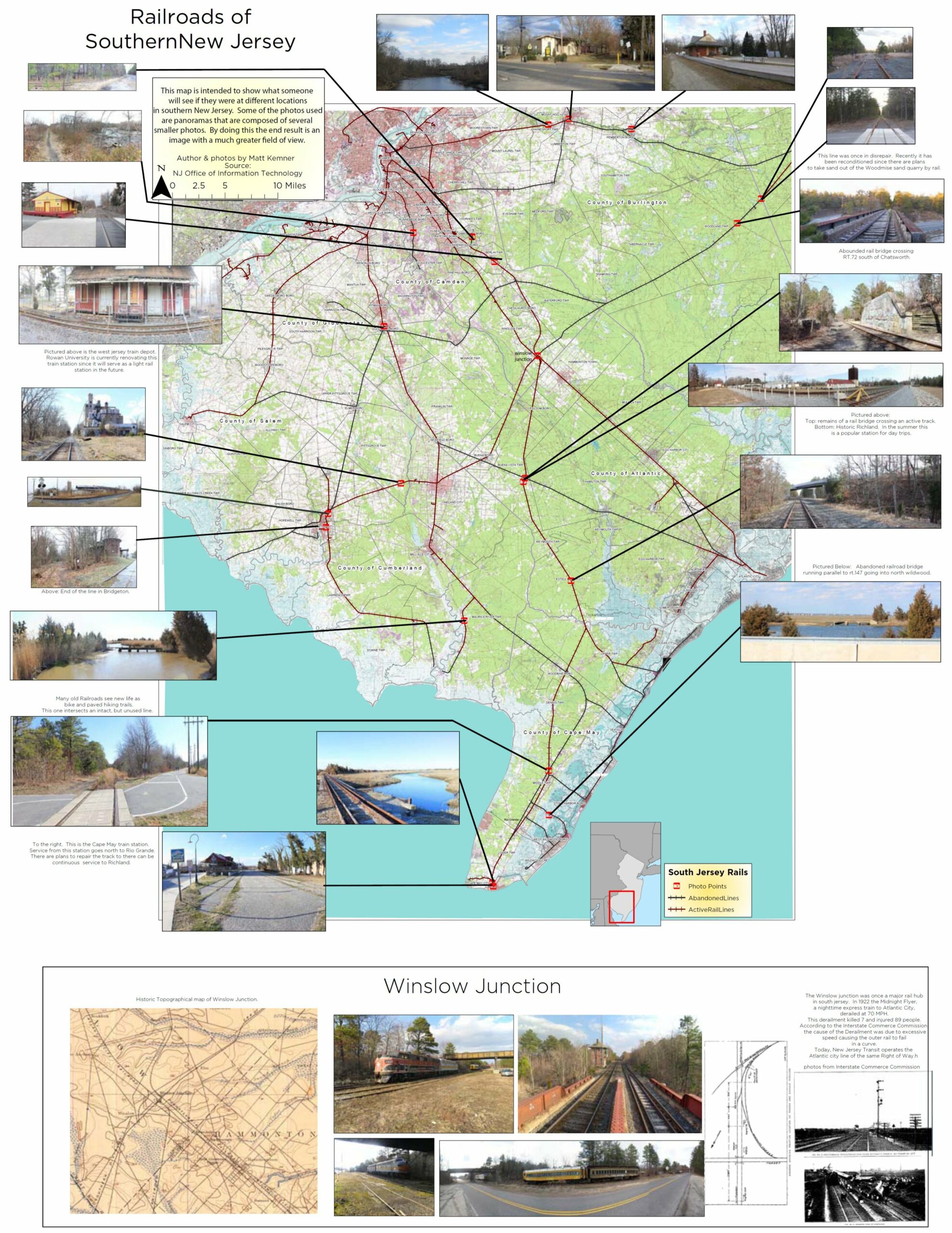
2nd
Matt Kemner
Rowan University |
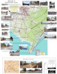
Railroads of Southern New Jersey
|
 |
|
BEST
SMALL
FORMAT
|
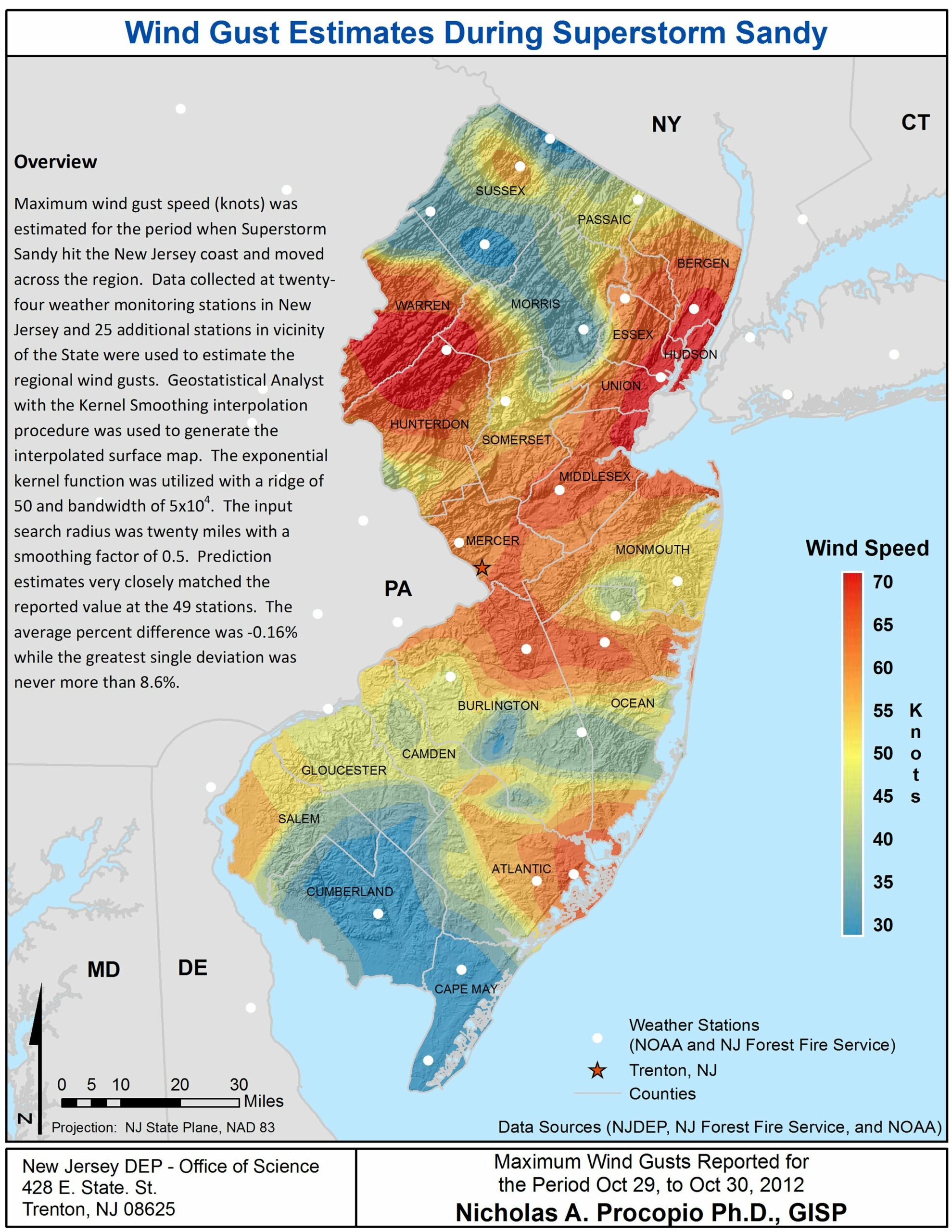
1st
Nick Procopio
NJDEP
Office of Science |
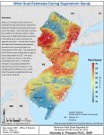
Wind Gust Estimates During Superstorm Sandy
|
 |
|
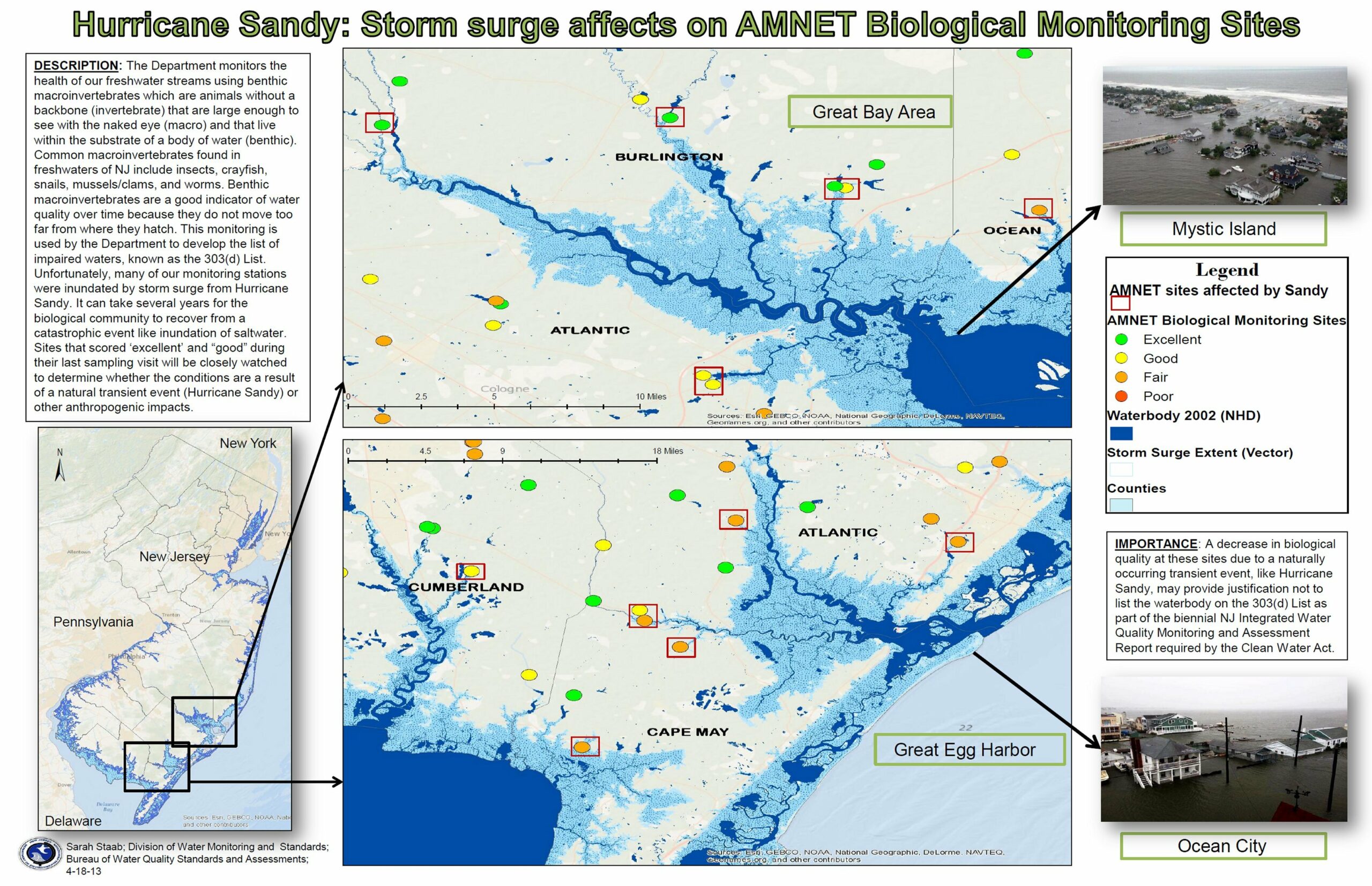
2nd
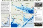
Sarah Staab
NJDEP – Division of Water Monitoring and Standards |
Hurricane Sandy: Storm surge affects on AMNET Biological Monitoring Sites
|
 |
|
BEST
SOFTWARE
INTEGRATION
|
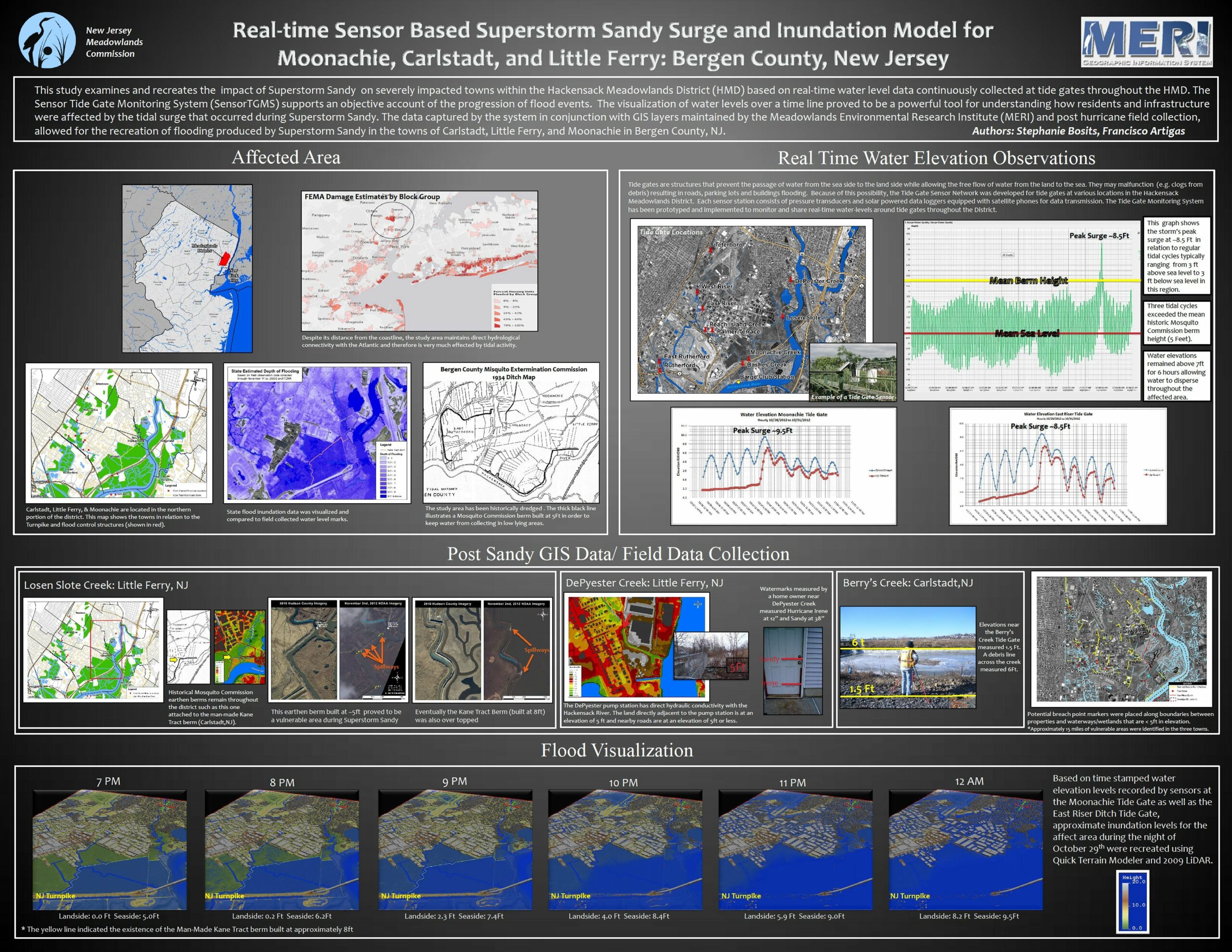
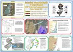
1st
Stephanie Bosits
Francisco Artigas
NJ Meadowlands Commission
Meadowlands Environmental Research Institute
|
Real-time Sensor Based Super Storm Sandy Surge and Inundation Model for Moonachie, Carlstadt, and Little Ferry: Bergen County, New Jersey
|
 |
|
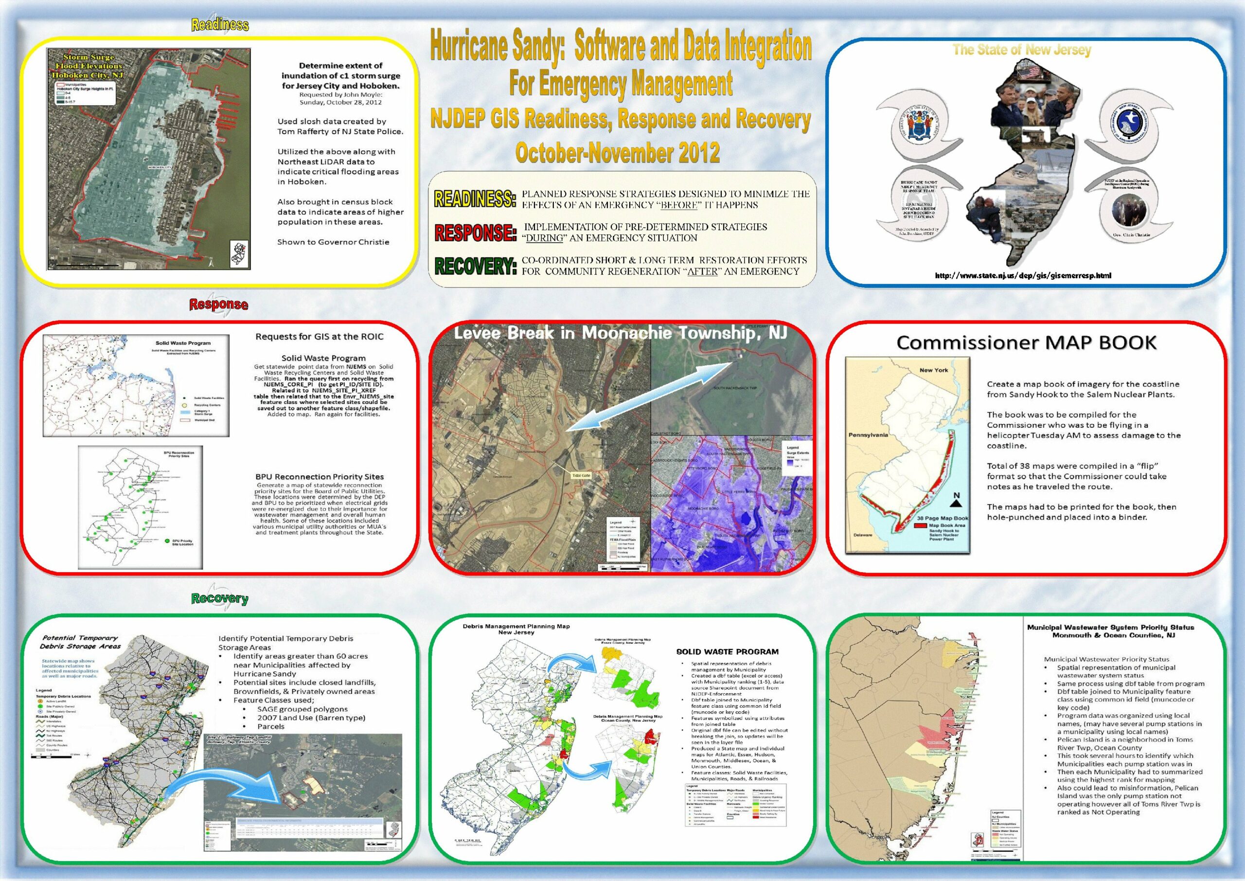
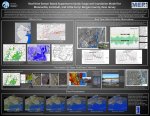
2nd
John Bocchino
Ed Apalinski
Seth Hackman
Dnyanada Bhide
Seema Gopinathan
NJDEP Bureau of GIS |
Hurricane Sandy: Software and Data Integration for Emergency Management
NJDEP GIS Readiness, Response and Recovery
October-November 2012
|
 |
|
BEST
CARTOGRAPHIC
DESIGN
|
1st
Zehdreh Allen-Lafayette
Jane Uptegrove
Jeffrey S. Waldner
Scott D. Stanford
Don H. Monteverde
Robert E. Sheridan
David W. Hall
NJDEP
|
Geology of the New Jersey Offshore in the Vicinity of Barnegat Inlet and Long Beach Island
|
|
|
2nd
Ashley Reardon
Rowan University
|
Cape May County
|
|
|
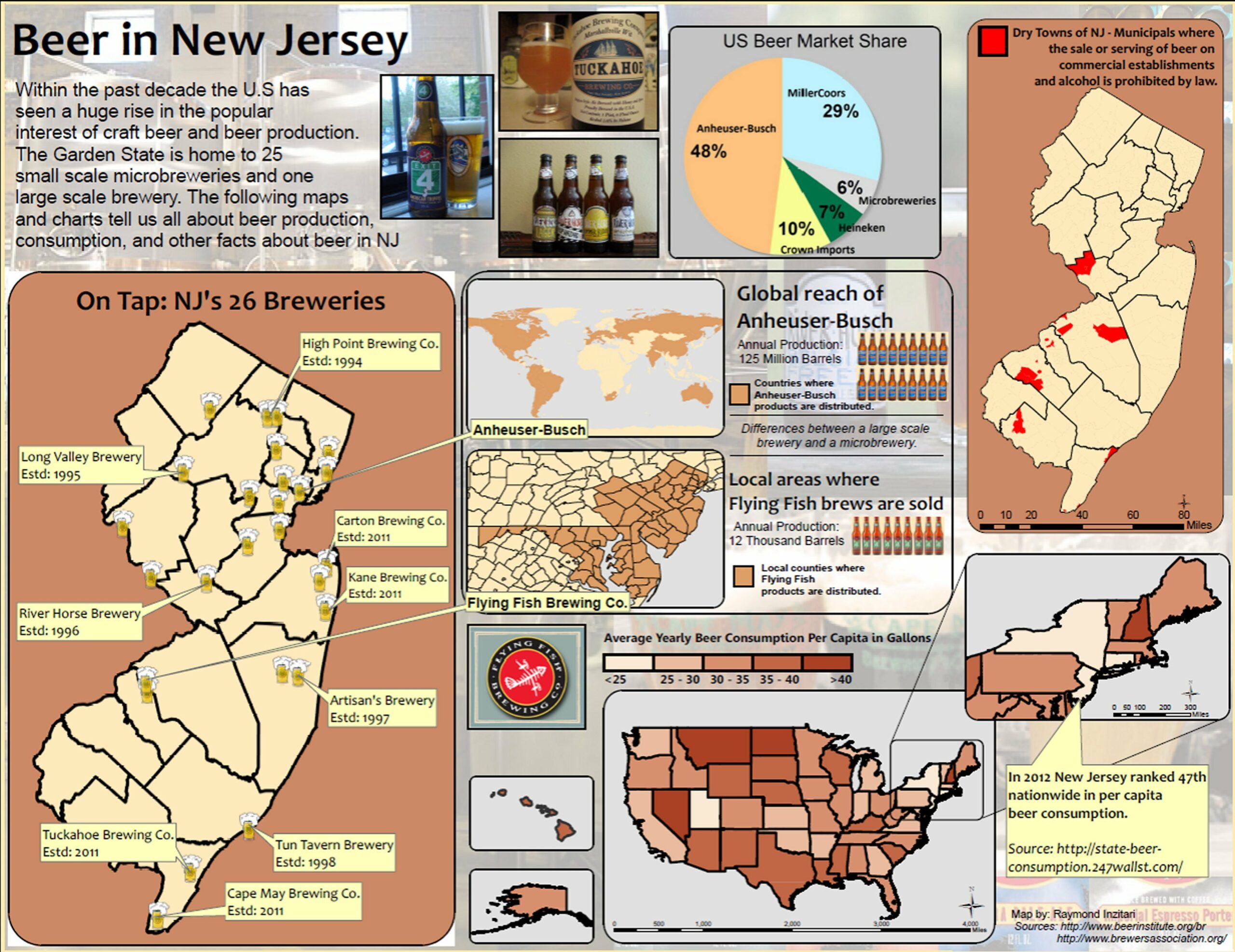
NEWBIE
OF THE YEAR
|
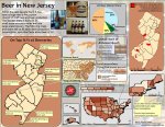
1st
Raymond Inzitari
Rowan University
|
Beer in New Jersey
|
|
|
2nd
Daniel Constanza
Burlington County
Department of IT
GIS Section
|
Category 1 – Hurricane Irene vs. Category 1 Hurricane Sandy
|
|