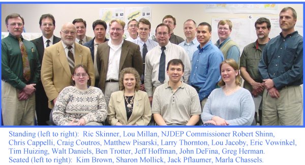
14th ANNUAL NJDEP GIS MAPPING CONTEST WINNERS
2001 MAPPING CONTEST AWARDS
April 12, 2001
|
Category |
Winner |
Map Title |
Thumbnail |
|
BEST |
1st Greg Herman |
|
|
|
2nd John DeFina, |
|
||
|
BEST USE |
1st Sharon Mollick, |
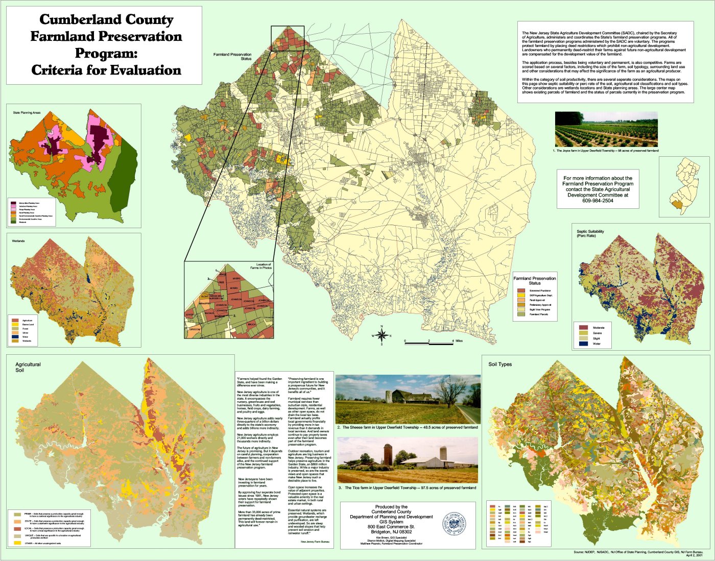
Cumberland County Farmland Preservation Program: Criteria for Evaluation |
|
|
2nd Louis Millan |
|
||
|
BEST USE |
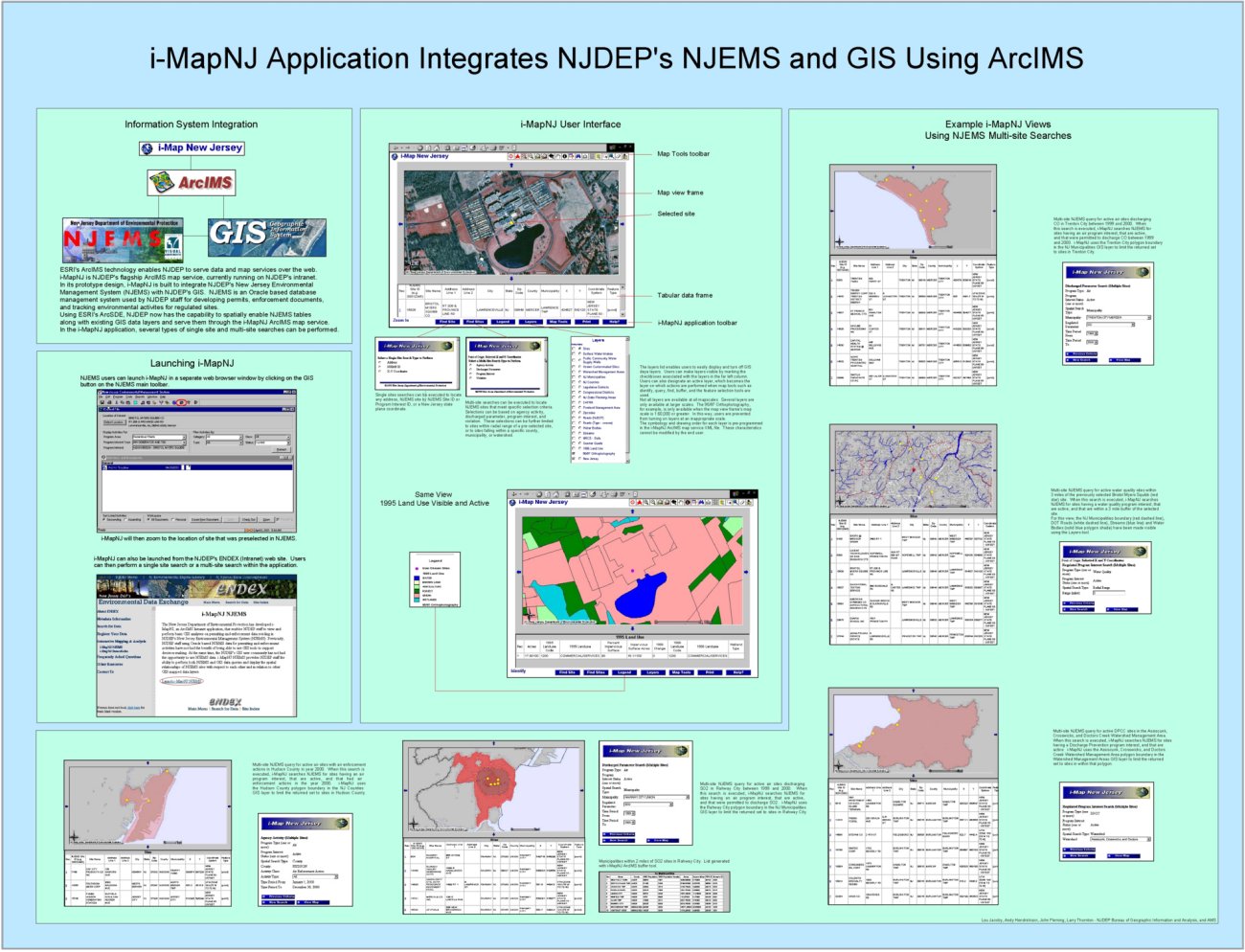
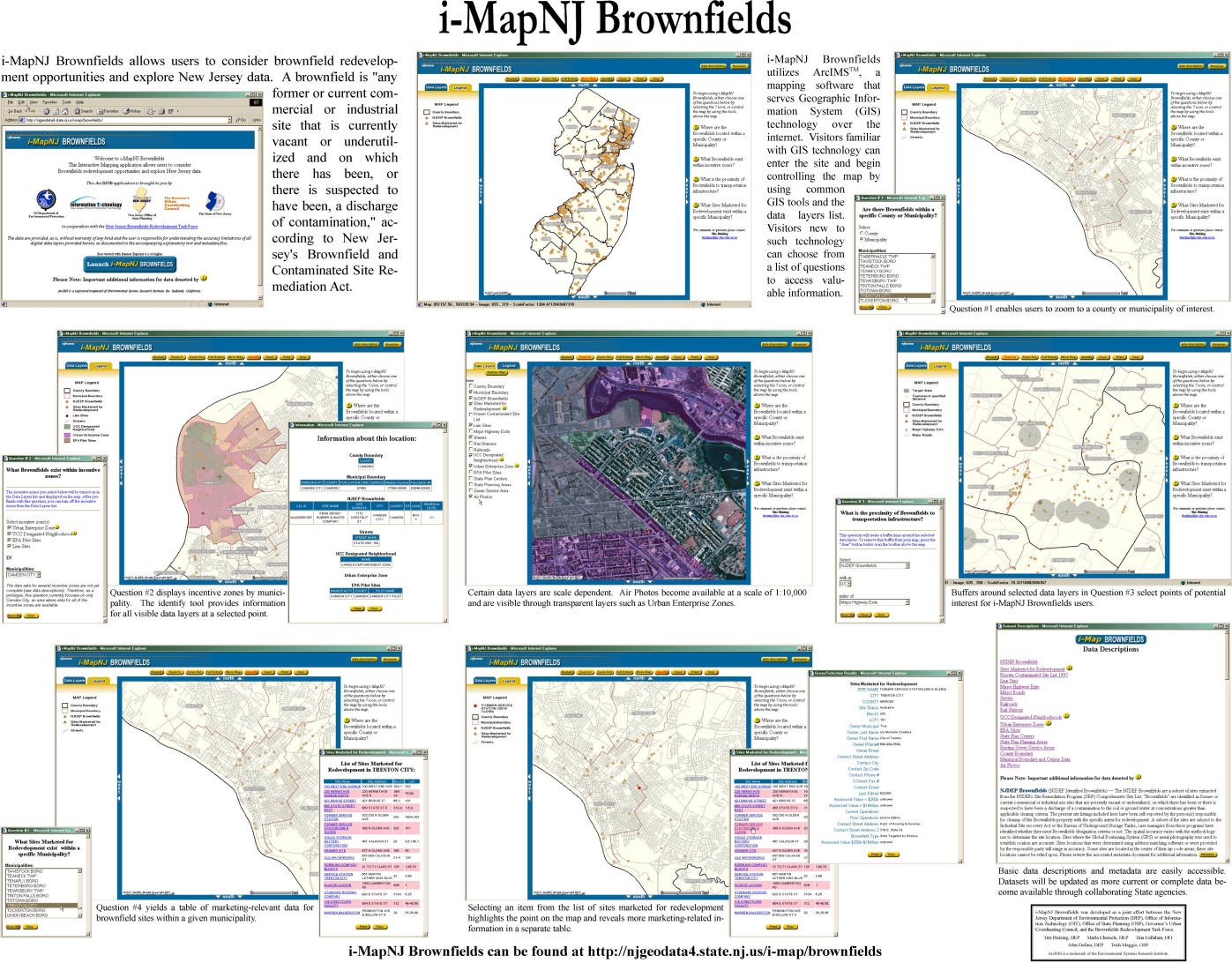
1st Lou Jacoby |
|
|
|
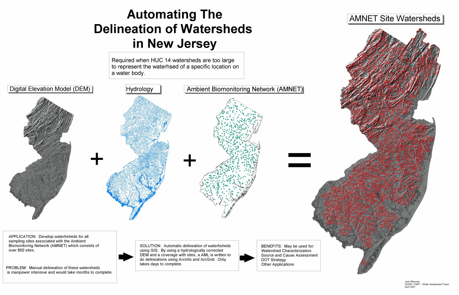
2nd Jack Pflaumer |
|
||
|
MOST |
1st Tim Huizing, |
|
|
|
2nd Ric Skinner |
|
||
|
BEST |
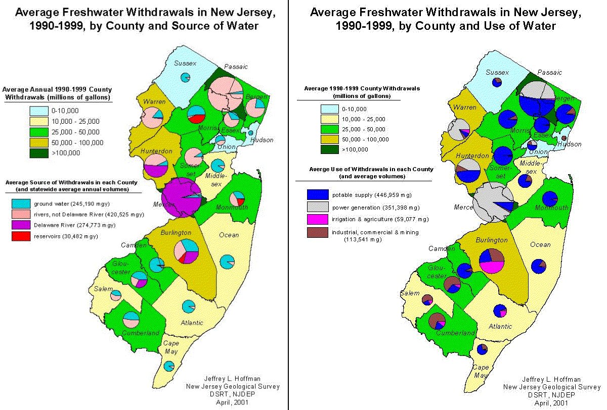
1st Jeff Hoffman |
|
|
|
2nd Craig Coutros |
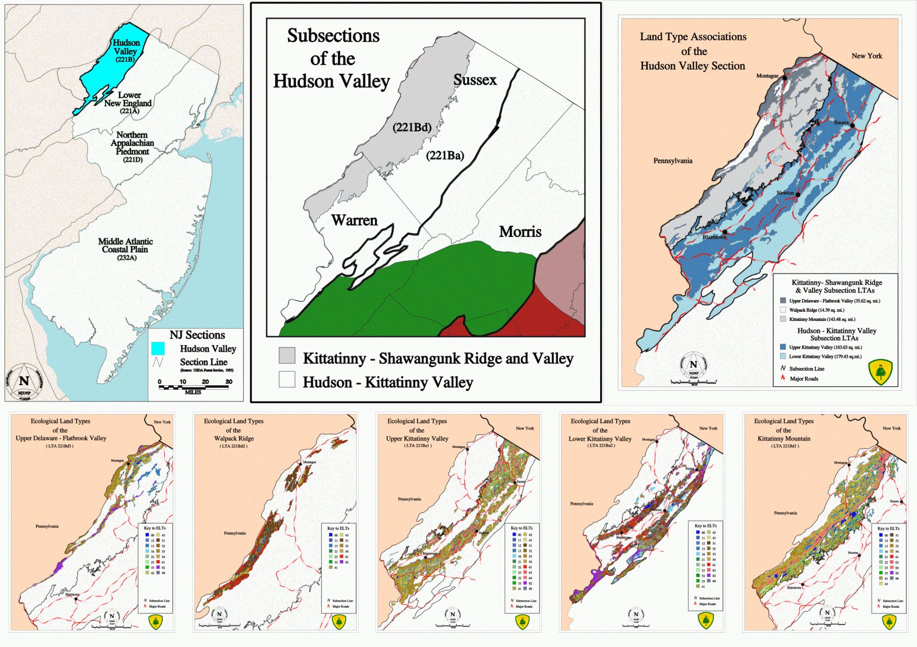
Ecological Landtypes – Landscape Classification for the Hudson Valley Section |
|
|
|
MOST |
1st Sharon Mollick, |
Cumberland County Farmland Preservation Program: Criteria for Evaluation |
|
|
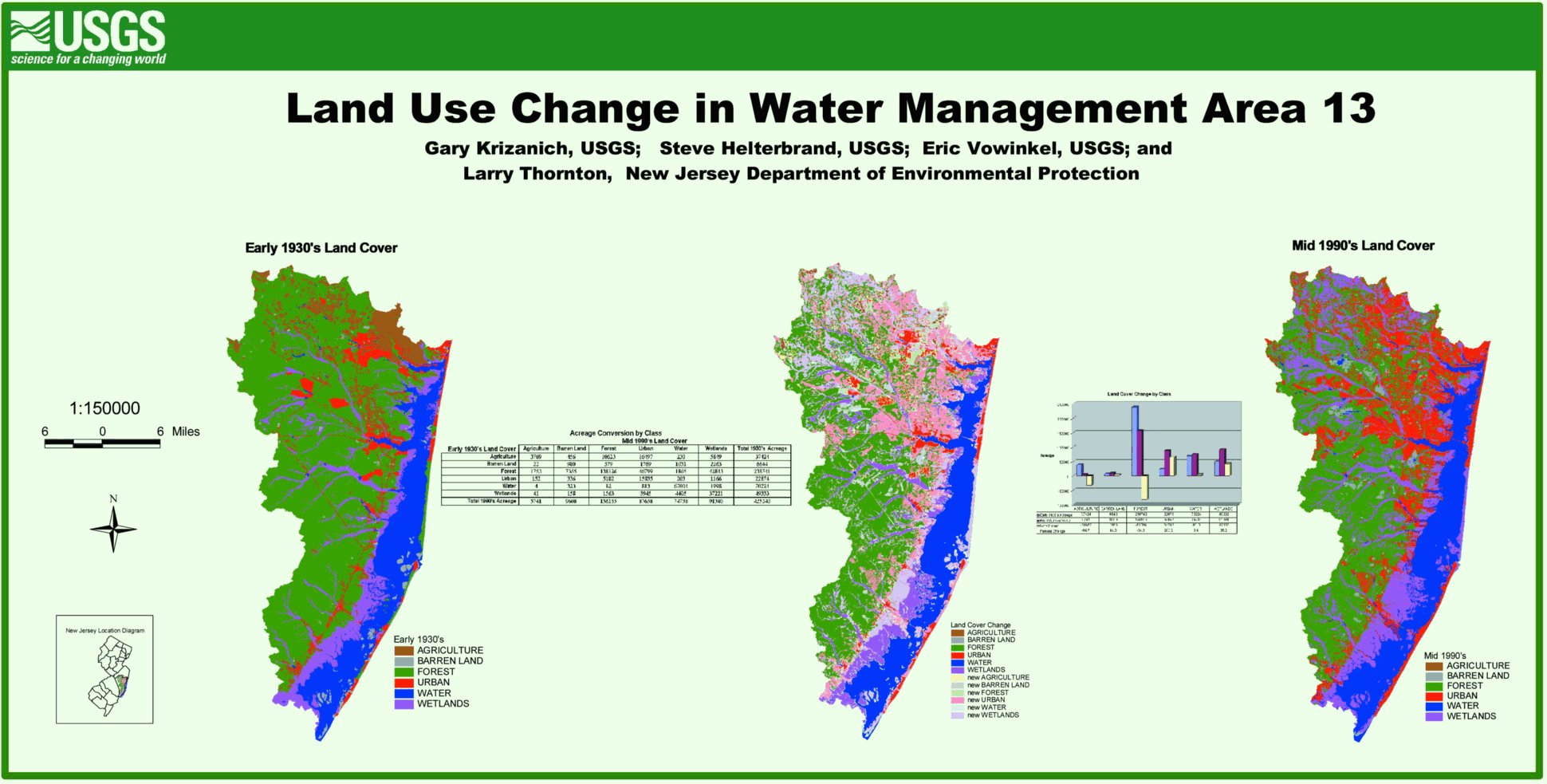
2nd Gary Krizanich, |
|
||
|
BEST |
1st Ben Trotter |
|
|
|
2nd Tim Huizing, |
|
||
|
BEST |
1st Sharon Mollick, |
Cumberland County Farmland Preservation Program: Criteria for Evaluation |
|
|
2nd Herb Chong |
|