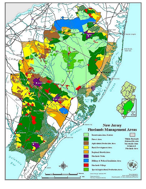
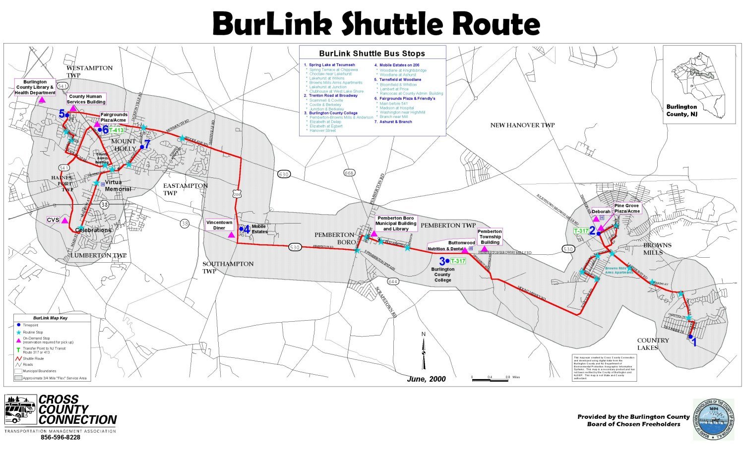
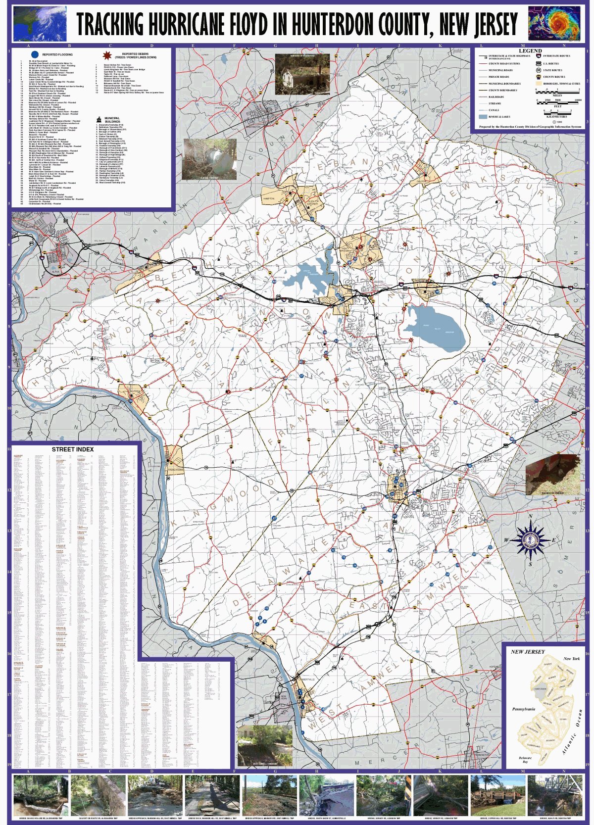
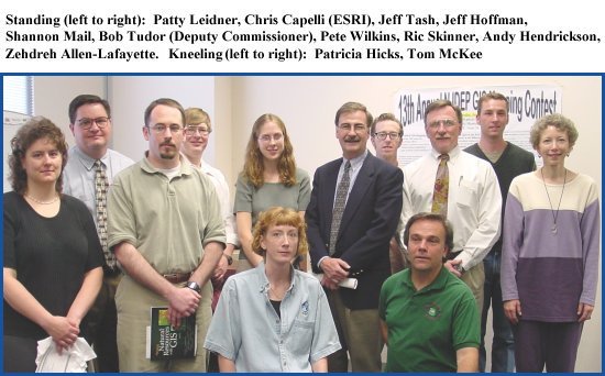
13th ANNUAL NJDEP GIS MAPPING CONTEST WINNERS
2000 MAPPING CONTEST AWARDS
June 8, 2000
|
Category |
Winner |
Map Title |
Thumbnail |
|
BEST |
1st Jeff Hoffman |
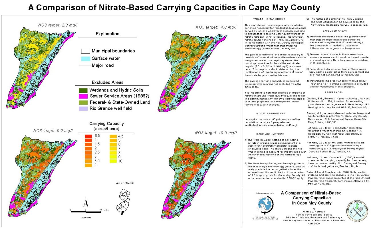
A Comparison of Nitrate-Based |
|
|
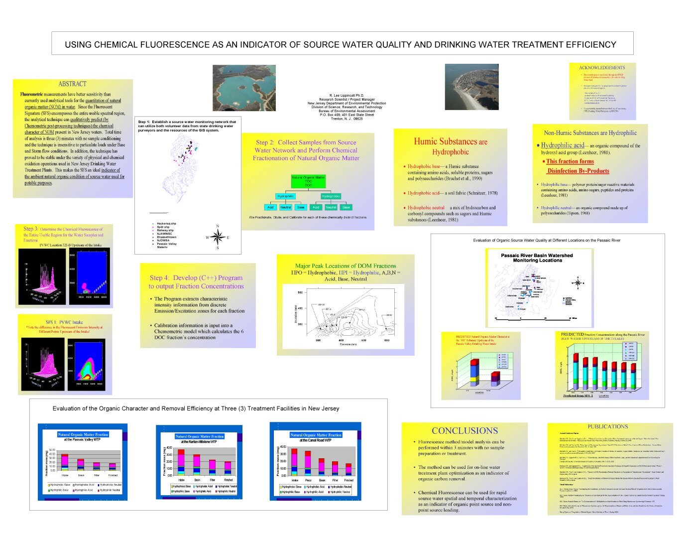
2nd Lee Lippincott |
|
||
|
BEST USE |
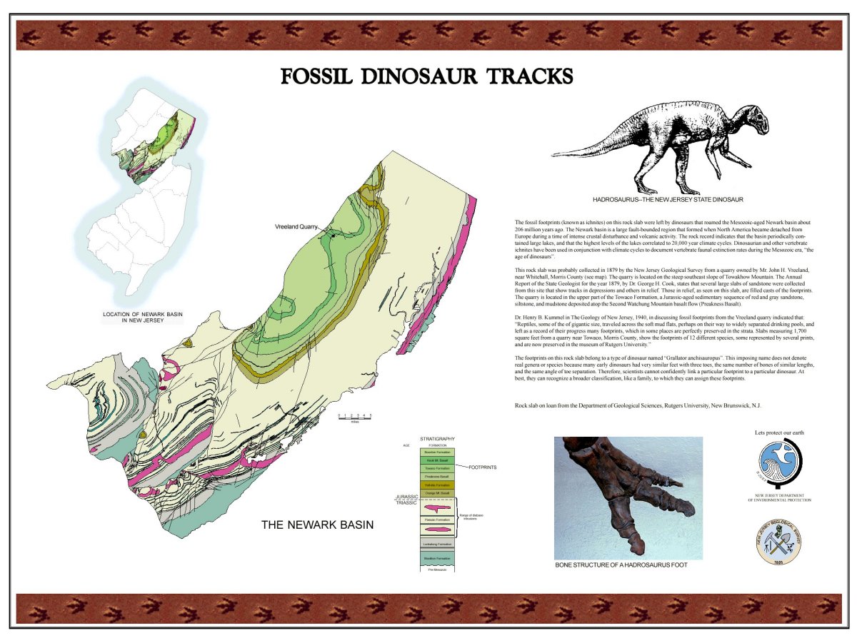
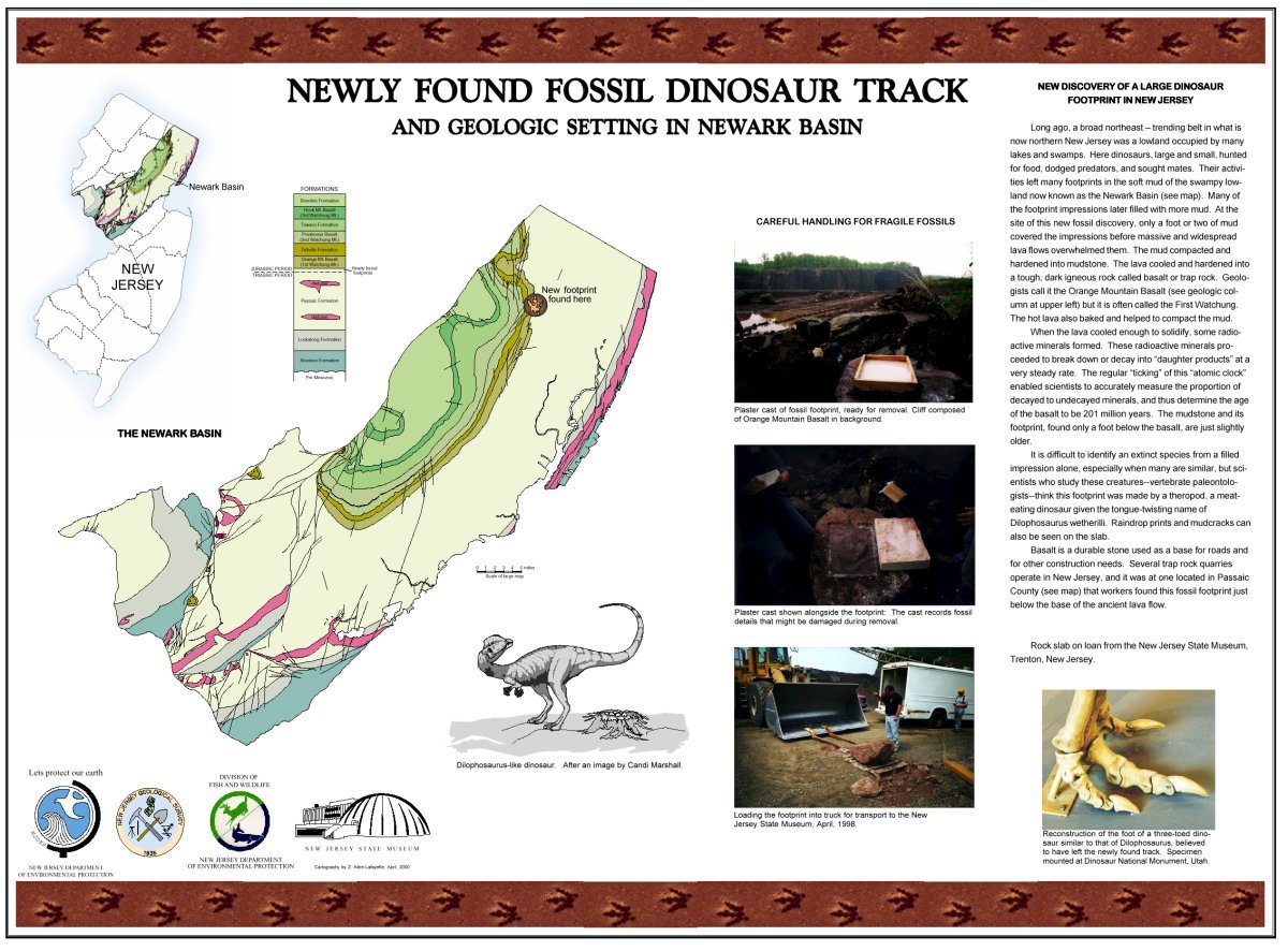
1st Zehdreh Allen-Lafayette |
and Newly Found Fossil Dinosaur Track and Geologic Setting in Newark Basin |
|
|
2nd Paul Bowers, |
|
||
|
BEST USE |
1st Jeff Tash, |
Using Land Use/Land Cover Data for |
Not Available |
|
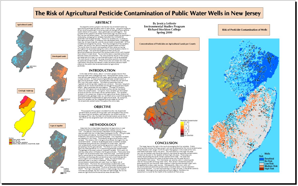
2nd Jessica Leifeste |
Risk of Agricultural Pesticide |
|
|
|
MOST |
1st Ric Skinner |
|
|
|
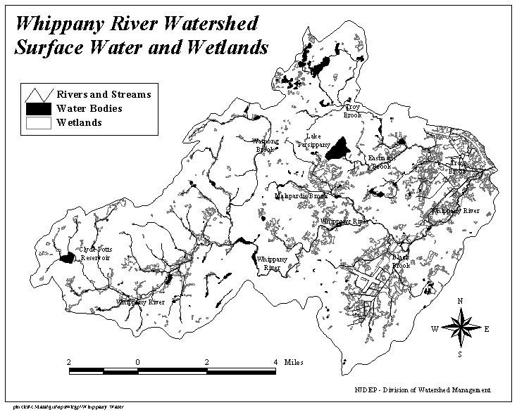
2nd Tom McKee |
Exploring New Jersey’s Watersheds with Watershed View |
Not Available |
|
|
BLACK & |
Patricia Hicks |
|
|
|
BEST |
Andy Hendrickson |
|
|
|
“MINE’S NOT |
1st Shannon Mail |
|
|
|
2nd John Sell |
WMA3 |
Not Available |
|
|
MOST |
1st Zehdreh Allen-Lafayette |
and Newly Found Fossil Dinosaur Track and Geologic Setting in Newark Basin |
|
|
ROOKIE |
1st Jeff Tash, |
Using Land Use/Land Cover Data for |
Not Available |
|
2nd Paul Bowers, |
|
||
|
BEST |
1st (tie) Jeff Tash, |
Using Land Use/Land Cover Data for |
Not Available |
|
1st (tie) Zehdreh Allen-Lafayette |
and Newly Found Fossil Dinosaur Track and Geologic Setting in Newark Basin |
|
|
|
2nd Paul Bowers, |
|
||
|
BEST |
Shannon Mail |
|
|
|
BEST |
Jessica Leifeste |
Risk of Agricultural Pesticide |
|
|
BEST |
Patty Leidner |
|