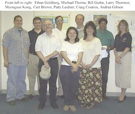
12th ANNUAL NJDEP GIS MAPPING CONTEST WINNERS
1999 MAPPING CONTEST AWARDS
June 8, 1999
|
Category |
Winner |
Map Title |
Thumbnail |
|
BEST |
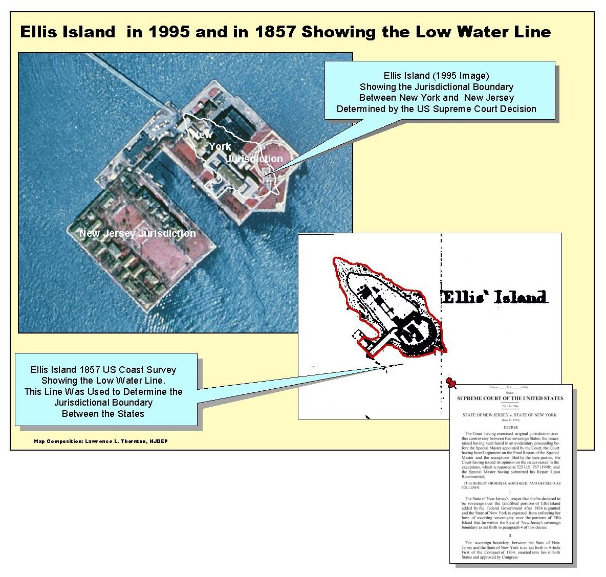
Larry Thornton |
|
|
|
BEST USE
|
Zehdreh Allen-Lafayette |
Radon Potential of NJ Coastal Plain |
Not Available |
|
BEST USE
|
Myongsun Kong Gail Carter |
|
|
|
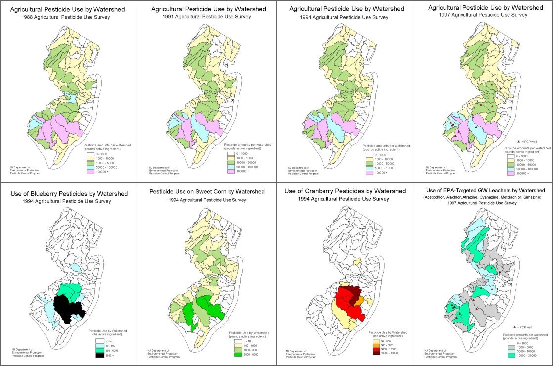
MOST |
1st Bill Guthe |
|
|
|
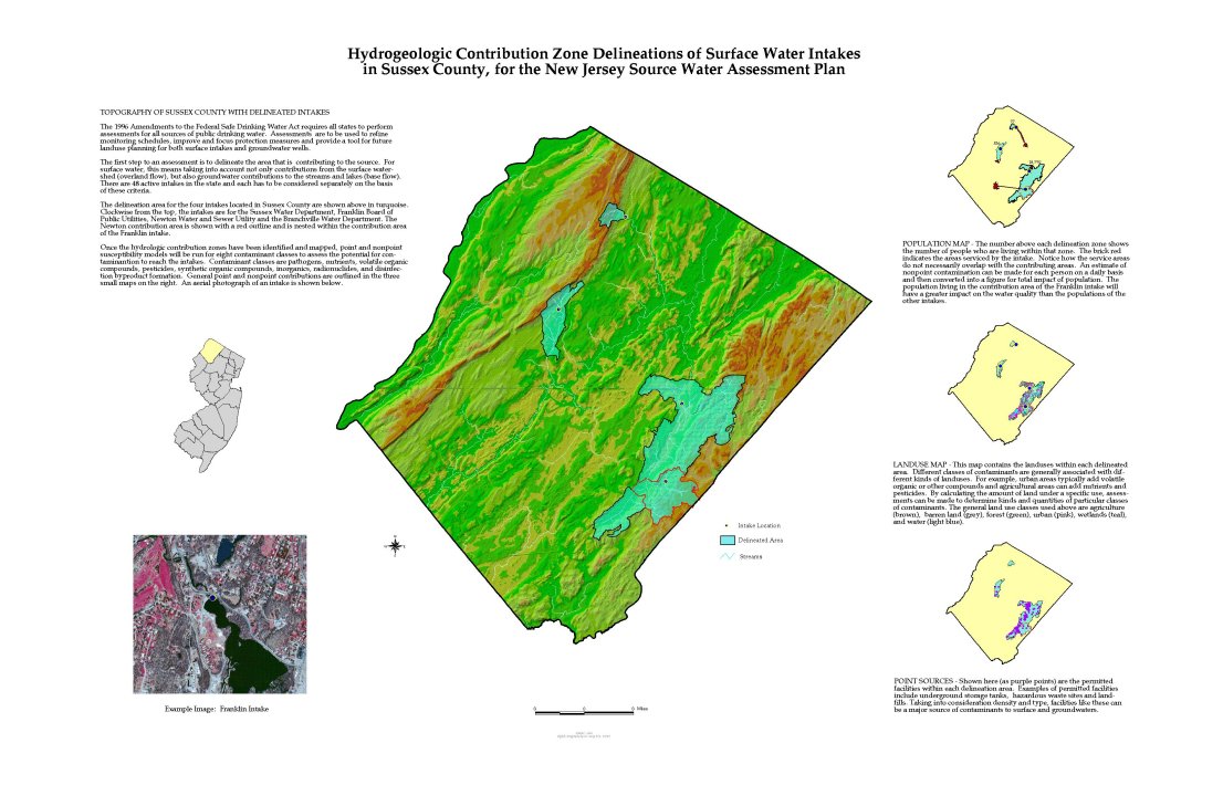
2nd Michael Thorne |
|
||
|
BLACK &
|
No Entries |
||
|
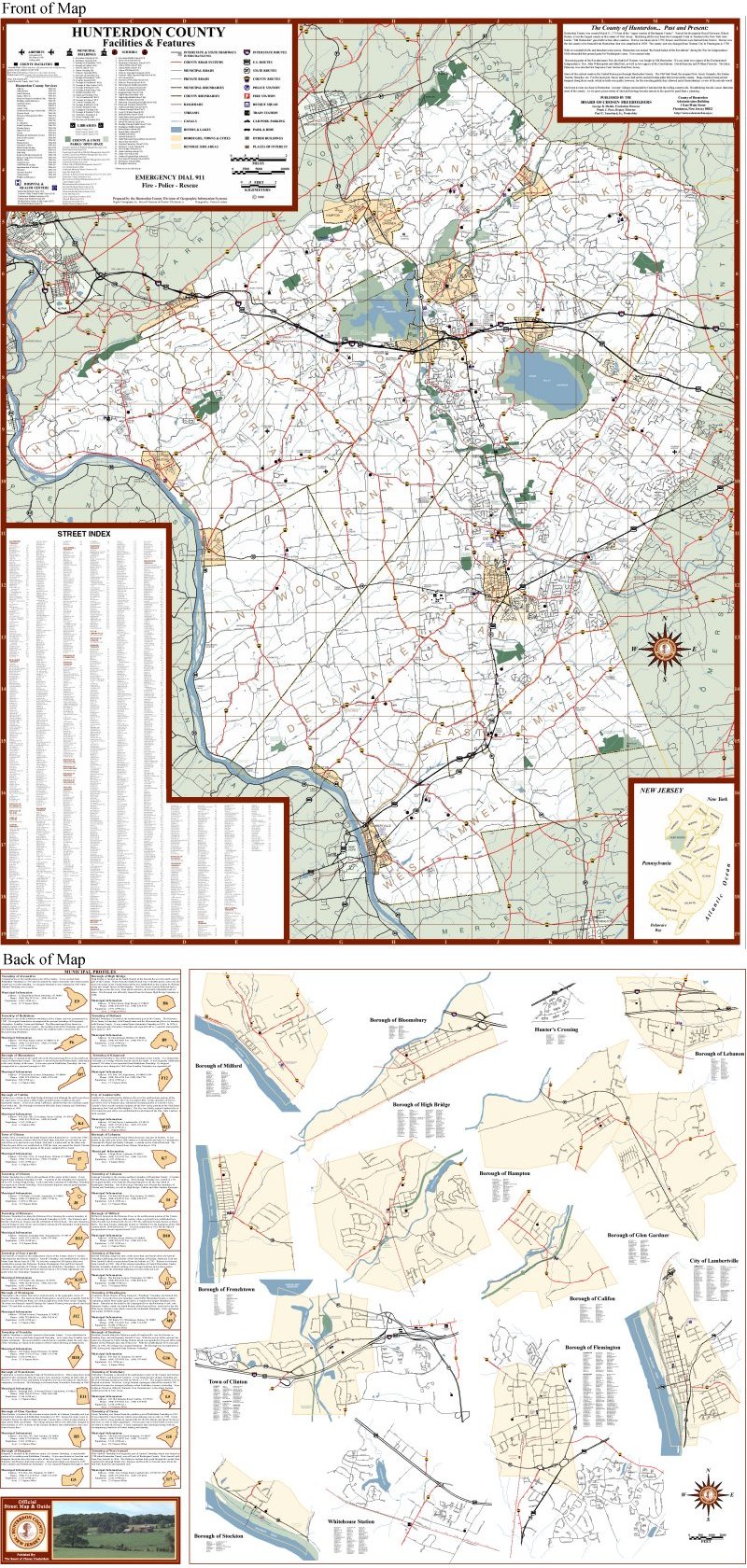
BEST |
1st Curt Brown |
|
|
|
2nd Bob Berrardo Ethan Goldberg |
Sea Girt Reef Tract/Shark River |
Not Available |
|
|
MOST |
1st (tie) Patty Leidner |
|
|
|
1st (tie) Craig Coutros Jim Dunn |
|
||
|
ROOKIE |
Myongsun Kong Gail Carter |
|
|
|
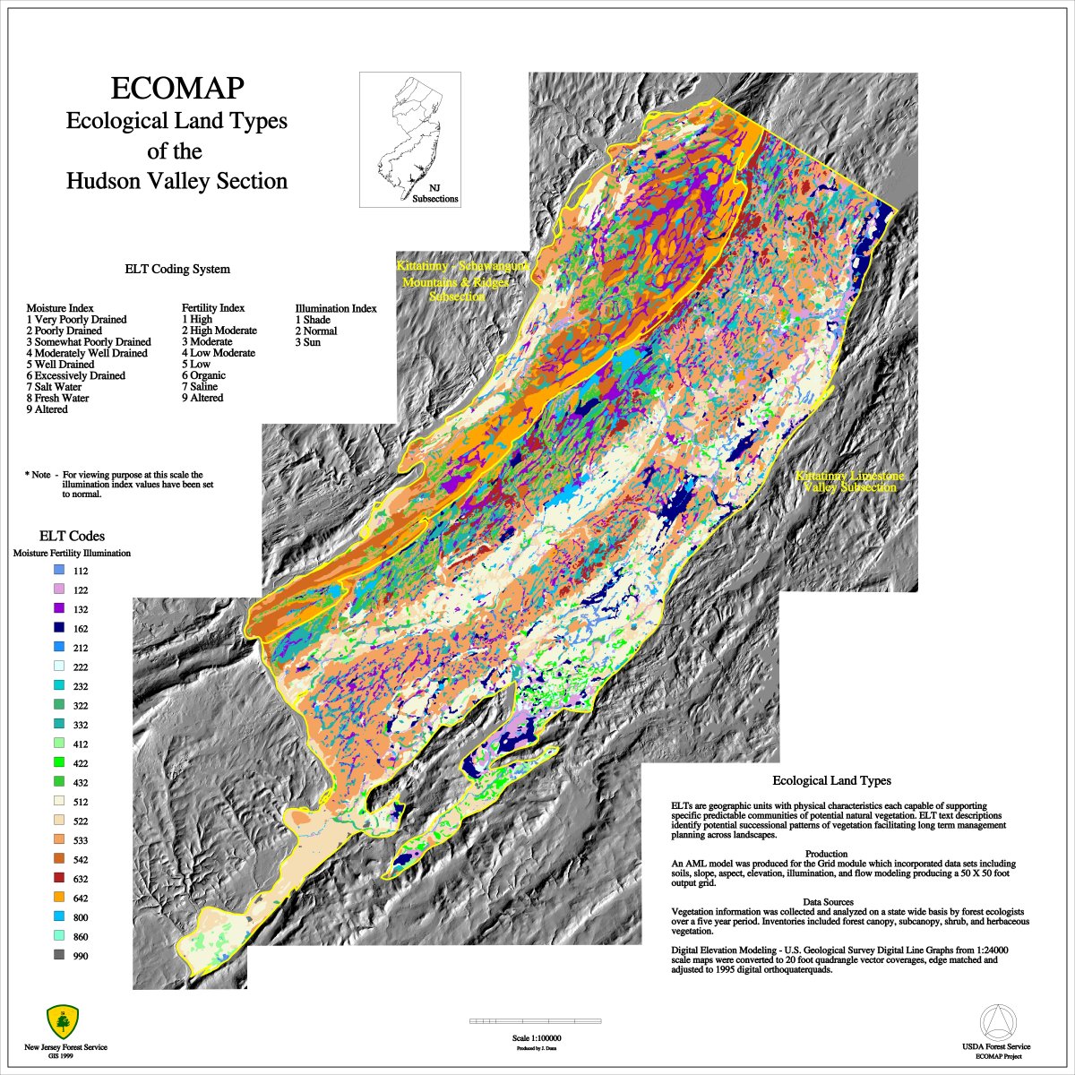
BEST |
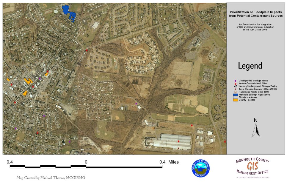
Craig Coutros Jim Dunn |
|
|
|
BEST
|
No Entries |
||
|
BEST |
Patty Leidner |
|