New Jersey Salt Marsh Ponds as Harmful Algae Reservoirs

Contact Us:

Mihaela D. Enache, Ph.D., Project Manager & Co-PI, Research Scientist I, Division of Science and Research, NJDEP (mihaela.enache@njdepwptest.net)

Ling Ren, Ph.D., PI, Research Assistant Professor, College of Science, George Mason University (lren2@gmu.edu)

Study Area

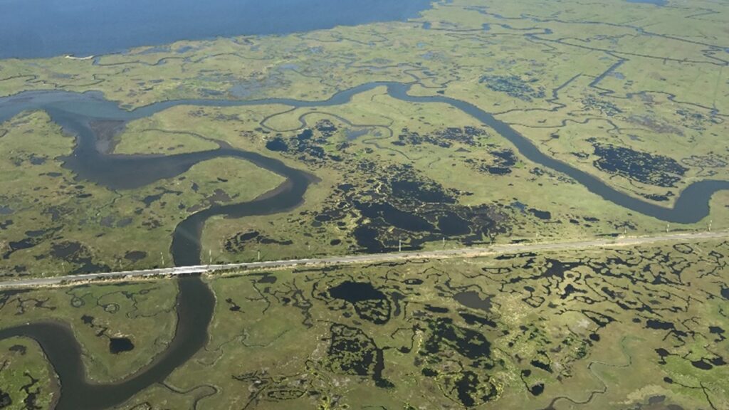
Tuckerton peninsula, a NOAA’s designated sentinel site of the JC NERR, offers a large expanse of unaltered salt marsh along the southern New Jersey coast. Salt marsh ponds (SMPs) on the Tuckerton peninsula show a variety of sizes and connections with adjacent water. (picture credit: Dr. Thomas Grothues, Rutgers University).
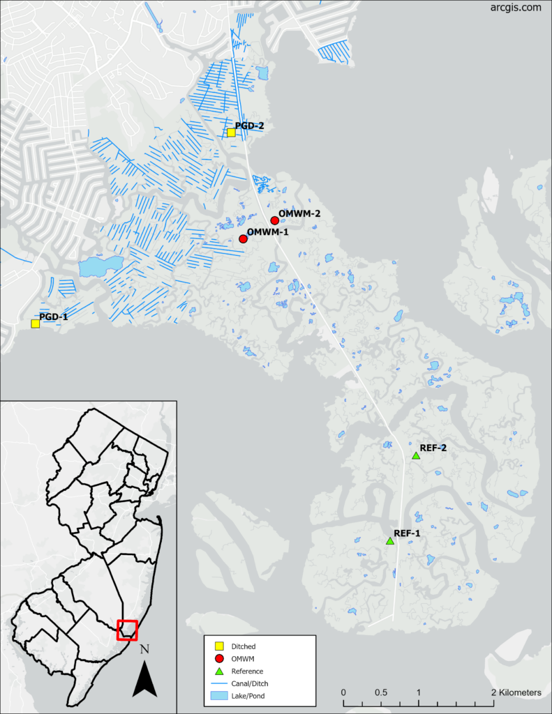
Two ponds were sampled for algal assemblages in each of the three sections:
Parallel Grid Ditching (PGD) | Open Marsh Water Management (OMWM) | Reference Area (REF)

PGD-1

PGD-1

Latitude: 39°32’43.69″N
Longitude: 74°22’30.76″W
Dimensions (m): 8.5 x 12

PGD-2

PGD-2

Latitude: 39°34’6.09″N
Longitude: 74°20’41.47″W
Dimensions (m): 14 x 24

OMWM-1

OMWM-1

Latitude: 39°33’20.12″N
Longitude: 74°20’34.94″W
Dimensions (m): 20 x 25

OMWM-2

OMWM-2

Latitude: 39°33’28.07″N
Longitude: 74°20’17.31″W
Dimensions (m): 18 x 20

REF-1

REF-1

Latitude: 39°31’10.00″N
Longitude: 74°19’13.37″W
Dimensions (m): 12 x 15

REF-2

REF-2

Latitude: 39°31’46.83″N
Longitude: 74°18’58.81″W
Dimensions (m): 12 x 19