
Maps & Tools
Maps & Tools
The Bureau of Climate Change & Clean Energy utilizes Geographic Information System (GIS) applications to support, evaluate, and promote clean energy technologies and policy development. The Bureau has created and published a number of GIS datasets and online web-mapping applications that stakeholders can utilize for geospatial analyses and planning purposes. These GIS data downloads and web-mapping applications/story maps can be found by clicking the appropriate tiles below and cover topics such as solar PV siting and development, electricity and natural gas usage in New Jersey, public electric vehicle charging station locations, power plants and associated emissions, and State-based climate investments utilizing proceeds from auctions of the Regional Greenhouse Gas Initiative.
Data Downloads
View the full collection of data downloads for the NJDEP Bureau of Climate Change and Clean Energy, or browse each individual dataset below.
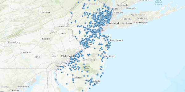
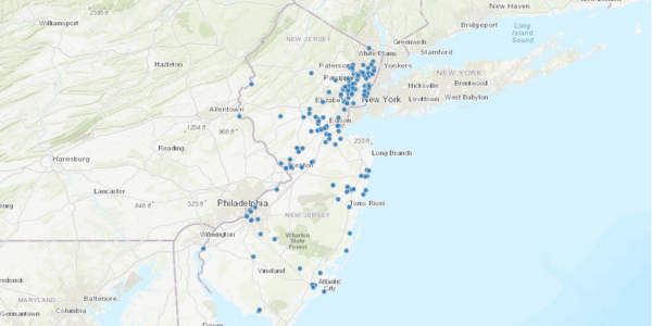
Alternative Fueled Vehicle Fueling Stations
The purpose of this data is to identify the locations of publicly accessible Alternative Fueled Vehicle (AFV) Fueling Stations. The data can be used by Alternative Fueled Vehicle owners, government entities and other stakeholders to identify existing fueling locations and plan for future infrastructure build-out.
Public Solar Facilities
The purpose of this dataset is to identify solar PV installations at public facilities in New Jersey. Public facilities include: Government Facilities, Public Schools, Public Colleges/Universities, and other public school facilities.
Community Solar PV Projects
This dataset was developed to support the New Jersey Board of Public Utilities and their Community Solar Pilot Program. Providing this geospatial dataset will enable users to view the spatial distribution of projects, as well as relevant information specific to each awarded project. It will also assist with tracking of the program’s growth from year to year.
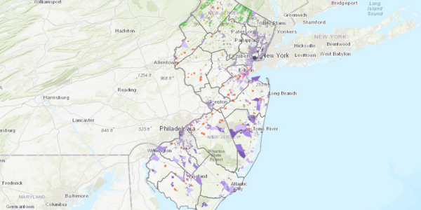
Solar PV Installations by County
The purpose of this data is to provide data and information on the current status of installed solar PV quantity and capacity within each of New Jersey’s counties.
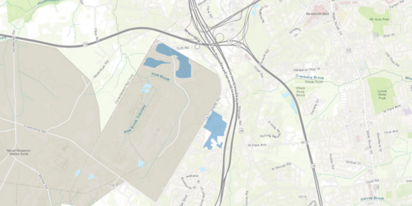
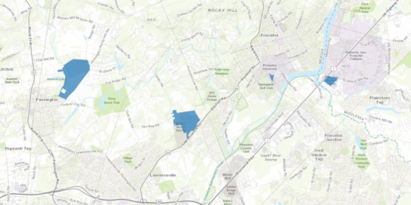
Solar PV Behind the Meter Greater than 1MW
The purpose of this data is to identify the boundaries of behind the meter (not grid supplied) solar PV installations in New Jersey that are greater than 1 megawatt (MW) in size. The data can be used by project managers, government entities and other stakeholders to understand the spatial extent of current photo voltaic installations and plan for future projects.
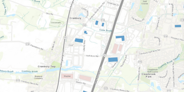
Solar PV Grid Supply Installations
The purpose of this data is to identify the boundaries of Solar PV Grid Supply Installations in New Jersey. The data can be used by project managers, government entities and other stakeholders to understand the spatial extent of current photo voltaic installations and plan for future projects.
RGGI Climate Investments
The purpose of this dataset is to assist with tracking projects that have been awarded funds from RGGI auction proceeds and provide public transparency on these projects.
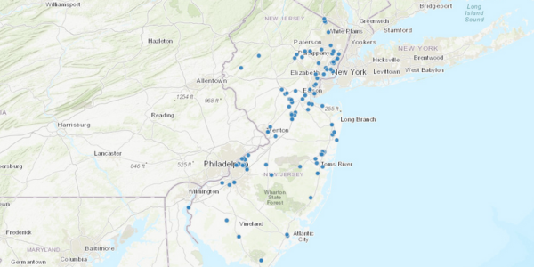
Power Plant Locations
The purpose of this data is to show the spatial distribution of Power Plants in New Jersey. This dataset shows all of the electric generation stations, power plants, above 1 Megawatt capacity in New Jersey, which includes both fossil and renewable energy sources other than solar PV.
Power Plant Parcels
The purpose of this data is to show the spatial distribution and parcel boundaries of Power Plants in New Jersey.
Power Plants (RGGI EGU)
The purpose of this data is to describe the location of electric generating units (EGUs) that are subject to the Regional Greenhouse Gas Initiative (RGGI).
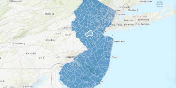
Municipal Energy Use
This GIS dataset was created to geospatially link the municipal energy use data to the NJ Municipalities dataset so that users can spatially view the electricity and natural use statewide, in each of the specified sectors, as well as overall.
Historic Municipal Energy Use in New Jersey (Table)
This GIS table dataset was created so that users can spatially view the electricity and natural use statewide, in each of the specified sectors, in each year starting in 2015. This dataset represents years 2015 through 2021 at the time of initial publication and will be updated over time when the subsequent year is made available.
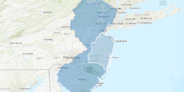
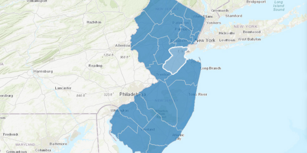
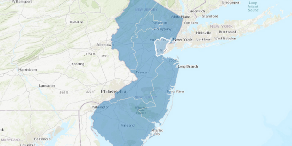
Electric Utilities Territory Map
This data provides graphic representation of electric company territories of New Jersey. Data was compiled using Electric Utility paper maps, all greater than 1:500,000. It is anticipated that electric company territorial boundaries will remain stable.
Gas Utilities Territory Map
The data was created to identify the territories served by New Jersey Natural Gas Suppliers. The data can be used by suppliers, consumers, government entities, etc. to determine Natural Gas Supplier service areas throughout the State of New Jersey.
Tools and Web Apps
View the full collection of tools and web applications for the NJDEP Bureau of Climate Change and Clean Energy, or browse each individual application below.
NJ Community Solar PV Siting Tool
This tool was developed by the New Jersey Department of Environmental Protection’s Bureau of Climate Change & Clean Energy to support and inform the siting of solar projects under the New Jersey Board of Public Utilities’ Community Solar Energy Pilot Program.
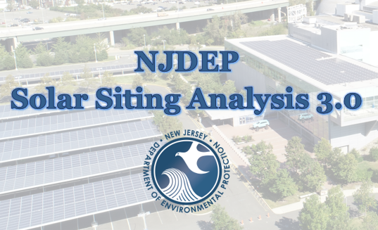
Solar Siting Analysis Version 3.0 Story Experience
This tool was developed to aid local communities and potential solar developers in planning for solar installations by distinguishing between lands where the department encourages solar development from those where the department discourages solar development.
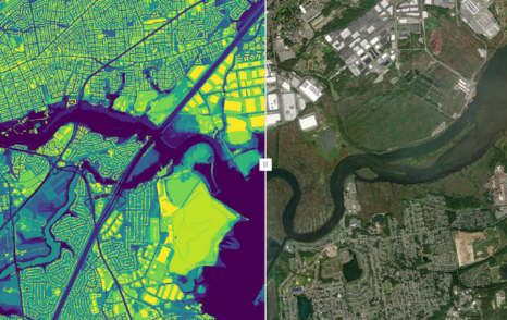
Solar Siting Analysis Version 3.0 Web Application
This tool is an interactive web mapping application that illustrates the Department’s preference for siting solar PV projects in the state based on the Solar Siting Analysis Version 3.0.
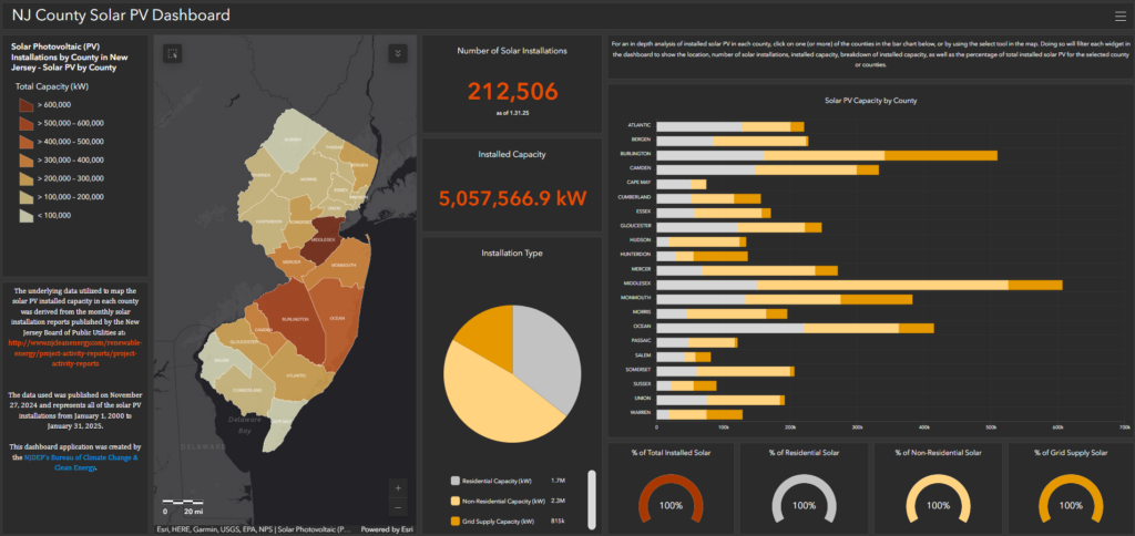
NJ County Solar PV Dashboard
The purpose of this dashboard is to provide a high level analysis of solar PV installations in New Jersey’s by county.
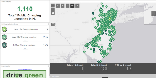
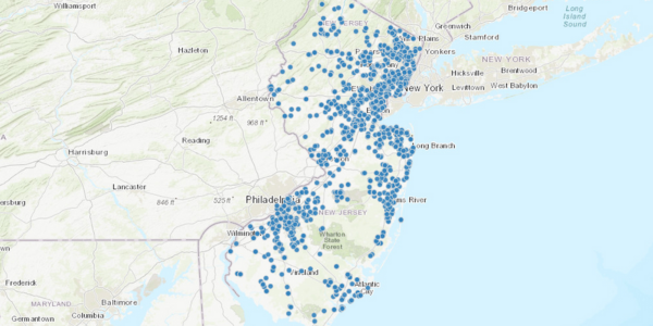
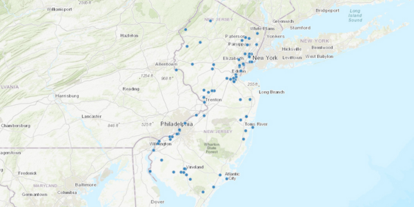
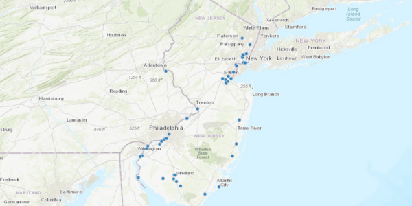
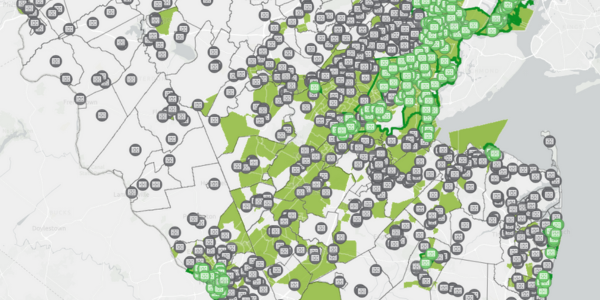
Public Electric Vehicle (EV) Charging Locator
This interactive map shows and overview of the current available public charging locations across New Jersey. Users of this map can click on each individual location for details on the charger types, address, and pricing if available.
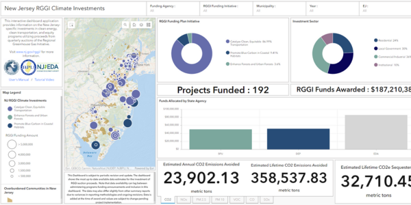
RGGI Climate Investments
This dashboard contains a number of different interactive charts and widgets with information about the climate investments being made by the NJDEP, NJBPU, and NJEDA utilizing funds obtained through quarterly auctions of the Regional Greenhouse Gas Initiative.
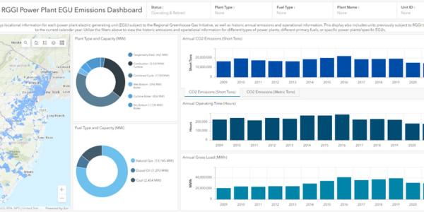
RGGI Power Plant Electric Generating Unit (EGU) Emissions
This dashboard displays locational information for each power plant electric generating unit (EGU) subject to the Regional Greenhouse Gas Initiative, as well as historic annual emissions and operational information.
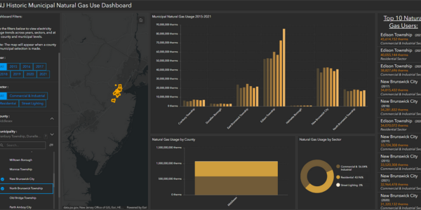
Municipal Natural Gas Usage
The purpose of this dashboard is to provide an overview of natural gas usage trends across years, sectors, and at the county and municipal levels.
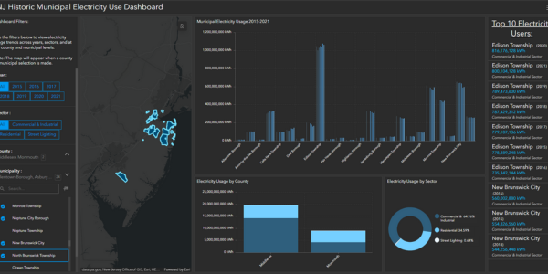
Municipal Electricity Usage
The purpose of this dashboard is to provide an overview of electricity usage trends across years, sectors, and at the county and municipal levels.

Offshore Wind Energy | Story Map
This story map was developed to provide background on the history of offshore wind in New Jersey.
Trees for Schools: Tree Planting Grant Assistance Tool
This web application was developed to support the “Trees for Schools: Tree Planting Grants for New Jersey Public Schools, Colleges & Universities” program, and the identification of public school locations that best meet the criteria for grant funds.
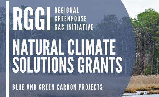
Natural Climate Solutions Grant Round 1 Recipients
This story map provides an overview of the projects and awardees of Round 1 of the Natural Climate Solutions Grant Program.