Fires and Air Toxics
EPA’s annual Air Toxics Screening Assessment (AirToxScreen) includes fire as an emission source category, in addition to point, nonpoint, mobile, secondary, background, and biogenic sources. Fires considered in AirToxScreen include wildfires, prescribed burns, and agricultural fires.
While air toxics from fires contribute to a small percentage of total emissions in AirToxScreen, smoke can cause an increase in particulate matter in the air. Particulate matter from smoke often contains air toxics in addition to other pollutants. As the climate warms and wildfire risk increases, it is important to know how wildfire smoke can impact the air and public health.
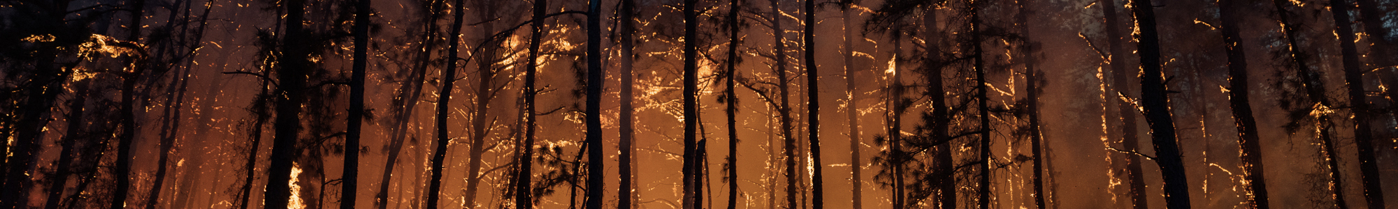
Wildfire Smoke
Wildfire smoke is generally a mixture of gaseous pollutants (like carbon monoxide), hazardous air pollutants (HAPs), water vapor, and particle pollution. Several air toxics found in smoke are VOCs, or volatile organic compounds. Some HAPs, or air toxics, found in wildfire smoke include:
- Benzene (VOC)
- Polycyclic Aromatic Hydrocarbons (or PAHs)
- Polychlorinated biphenyls
- Toluene (VOC)
- Xylenes (VOCs)
- Ethylbenzene (VOC)
- Phenol (VOC)
Short term exposure to air toxics found in wildfire smoke can cause noncancer health effects such as respiratory and eye irritation, drowsiness, dizziness, headaches, and difficulty breathing.
Particle pollution, also known as particulate matter or PM, is considered to be the primary public health threat caused by wildfire smoke. Particulate matter can include acids (like sulfuric acid), inorganic compounds (like ammonium sulfate, ammonium nitrate, and sodium chloride), organic chemicals, soot, metals, and particles from soil and dust.
While particle pollution is always present in the ambient air, wildfire events can cause a substantial increase in particulate matter, including large particles that are visible to the naked eye. Because particle pollution is the primary component of wildfire smoke, most of EPA’s research regarding the health impacts of wildfire smoke are derived from knowledge about the effects of particle pollution inhalation. Note that the types of particle pollution listed above can include a variety of air toxics and pollutants that may interact in the atmosphere to form air toxics, such as formaldehyde.
Wildfires vs. Prescribed Burns: What’s the Difference?
A wildfire is an unplanned and unwanted fire event in a natural area. Most wildfires in the United States are caused by humans, although natural events like lightning also have the potential to start wildfires.
Prescribed burns are controlled fires that serve a specific purpose, either to restore an ecosystem or prevent future wildfires. New Jersey Forest Fire Service defines prescribed burns as the skillful application of fire under exacting conditions of weather and fuel in a predetermined area, for a specific purpose to achieve specific results. Prescribed burns can help prevent wildfires by removing natural fire fuels that would accelerate the spread of wildfires, make them more difficult to contain, and increase the amount of land burned. They are also performed to minimize pest insects, plant disease, and invasive plant life. Additionally, prescribed burns can improve habitat for endangered species and promote plant growth by recycling nutrients back into the soil. In New Jersey, prescribed burns are only performed between October 1ˢᵗ and March 31ˢᵗ. NJ Forest Fire Service works with the Air Quality program at DEP to ensure that prescribed burns do not occur on poor air quality days. Prescribed fire notifications can be tracked through the Forest Fire Service website.
Agricultural burns are a type of prescribed burn performed in New Jersey. They are only allowed when a permit is issued by NJDEP Forest Fire Service and when no other methods of disposal are available. These burns are conducted to control infested plant life, herbaceous plant life and hedgerows, orchard prunings and cullings, and agricultural land clearing. Burning agricultural land within a municipality that bans open burning is never permitted.

The Pinelands
The New Jersey State Park Service manages over 452,000 acres of land, including 11 State Forests. Brendan T. Byrne, Wharton, Bass River, and Belleplain State Forests make up the Pinelands, a vast and unique forest ecosystem that relies on fire to maintain health. Prescribed burns are conducted within the Pinelands in order to prevent buildup of natural fire fuels and protect wildlife habitat from wildfires.
However, development in the region has caused a need to suppress fire in the area. This creates greater risk of human-caused wildfires that could spread rapidly and negatively affect both people and wildlife in the Pinelands. New Jersey Forest Fire Service has the difficult task of performing necessary controlled burns while minimizing hazard to the people who live in and around this unique forest ecosystem.
As many climates become increasingly warm and dry, the frequency and severity of wildfires is expected to increase. New Jersey landscapes, like the Pinelands, are already experiencing this. 2023 was New Jersey’s most active fire year in over ten years, with fourteen major wildfires. NJ Forest Fire Service reduces wildfire risk through the use of fire towers and prescribed burns. The New Jersey Wildfire Risk Assessment Portal, or NJWRAP, allows community members to explore wildfire risk in their area. The portal contains a variety of resources for fire prevention, home protection, community involvement in wildfire awareness, and more.

EPA Fire and Smoke Map
The AirNow Fire and Smoke Map allows users to visualize air quality, active wildfires, and smoke plumes across the United States. This interactive mapping tool provides air quality data for Fine Particulate Matter (PM2.5), the primary component of wildfire smoke, from three different types of air monitors. Users can track fire and smoke events happening across the country and check air quality as it updates in real time. Click on the image below to open the AirNow Fire and Smoke Map.
